
Land Survey Costs in 2026: Factors Driving Increases and How to Budget Smartly

Understanding Land Survey Costs in 2026: Factors Driving Increases and How to Budget Smartly has become essential for property owners, developers, and homebuyers navigating today's real estate landscape. With national average costs now sitting at $2,300 and ranges spanning from $475 to $25,000, the financial commitment required for professional land surveys demands careful planning and […]
Reality Capture Goes Mainstream: 3D Laser Scanning and Mobile Mapping for Surveyors

The surveying profession stands at a transformative crossroads in 2026. Reality capture technologies—once reserved for high-budget projects and specialized applications—have now become essential tools in the everyday toolkit of professional surveyors. The conversation around Reality Capture Goes Mainstream: 3D Laser Scanning and Mobile Mapping for Surveyors reflects a fundamental shift: these technologies are no longer […]
AI-Driven Precision in Land Surveying: Revolutionizing Workflows in 2026

The land surveying profession stands at a pivotal moment in 2026. What once required weeks of manual data processing, multiple site visits, and extensive quality control checks now happens in hours—sometimes minutes. AI-Driven Precision in Land Surveying: Revolutionizing Workflows in 2026 represents more than incremental improvement; it marks a fundamental transformation in how spatial data […]
Cloud-Based Platforms for Interactive Land Survey Collaboration in 2026

The land surveying profession stands at a pivotal transformation point. Gone are the days when surveyors delivered static PDF documents that clients struggled to interpret and stakeholders found difficult to collaborate on. In 2026, Cloud-Based Platforms for Interactive Land Survey Collaboration have fundamentally changed how surveying data is captured, processed, shared, and utilized across multi-stakeholder […]
Autonomous Drones in Property Surveying: From Flight Planning to Multi-Sensor Data Capture
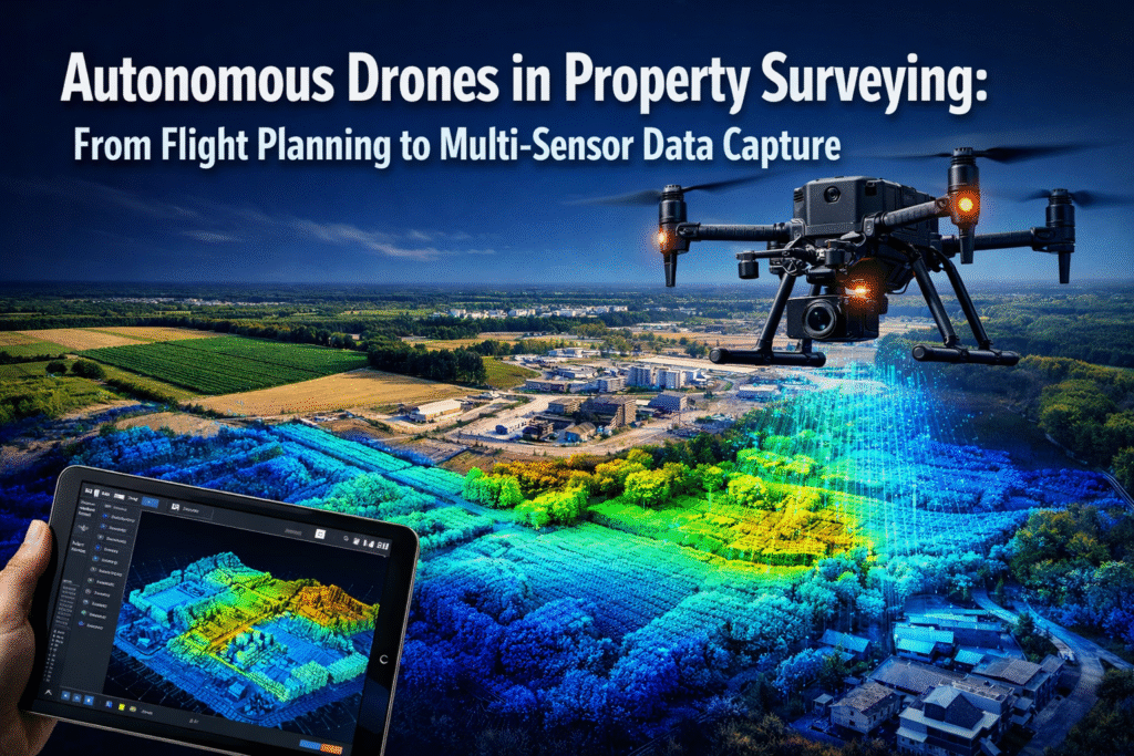
The property surveying industry is experiencing a transformation unlike anything seen in the past century. Where surveyors once spent weeks traversing large parcels with measuring equipment, autonomous drones now complete the same tasks in hours—with unprecedented accuracy and detail. In 2026, the integration of self-adjusting unmanned aerial vehicles (UAVs) equipped with multi-sensor arrays has fundamentally […]


