
BIM Integration for Land Surveyors: Seamless Collaboration in Construction Projects

The construction industry stands at a pivotal moment in 2026. A land surveyor arrives at a development site in London, captures precise geospatial data with advanced scanning equipment, and within hours, that information flows seamlessly into a Building Information Modeling (BIM) platform where architects, engineers, and contractors simultaneously access, analyze, and integrate it into their […]
Cloud-Based Platforms for Surveyors: Instant Sharing and Real-Time Collaboration

The surveying profession stands at a pivotal crossroads in 2026. Gone are the days when clients patiently awaited static PDF reports delivered weeks after fieldwork completion. Today's construction projects demand instant access, interactive visualization, and seamless collaboration across entire project teams. Cloud-based platforms for surveyors: instant sharing and real-time collaboration represent not merely a technological […]
Real-Time 3D Digital Twins for Land Surveyors: Building Interactive Property Models
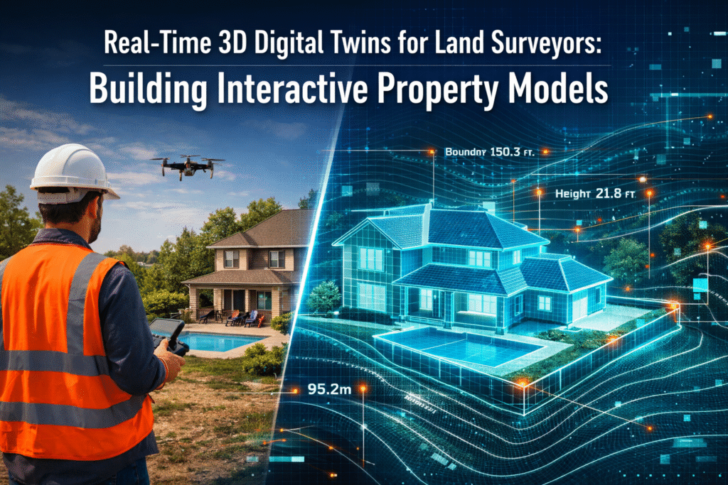
In 2026, the surveying profession stands at a transformative crossroads. Gone are the days when land surveyors delivered static PDF reports and 2D CAD drawings that quickly became outdated. Today's property stakeholders demand something far more powerful: Real-Time 3D Digital Twins for Land Surveyors: Building Interactive Property Models that update continuously, simulate environmental conditions, and […]
Sustainability in Property Surveying: Tools for Ecological Impact Assessment
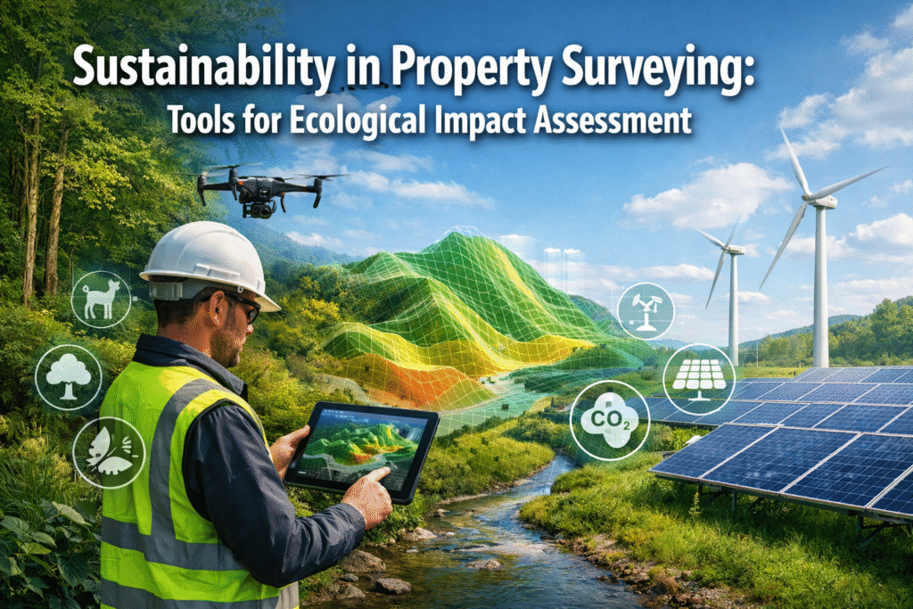
The property surveying profession stands at a critical crossroads in 2026. As climate change accelerates and biodiversity loss intensifies, the traditional role of surveyors has evolved dramatically. No longer limited to measuring boundaries and assessing structural integrity, today's chartered surveyors must navigate complex environmental regulations while deploying cutting-edge technology to forecast ecological impacts before development […]
Reality Capture Goes Mainstream: Tools Every Property Surveyor Needs in 2026
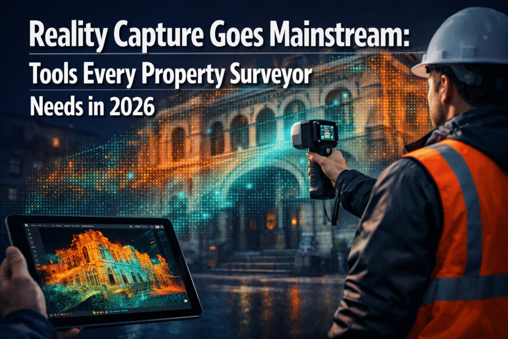
The property surveying industry is experiencing a technological revolution that seemed impossible just a few years ago. Reality capture technology, once reserved for large firms with substantial budgets, has now become accessible to surveyors of all sizes. As we navigate 2026, the democratization of reality capture goes mainstream, with tools every property surveyor needs becoming […]


