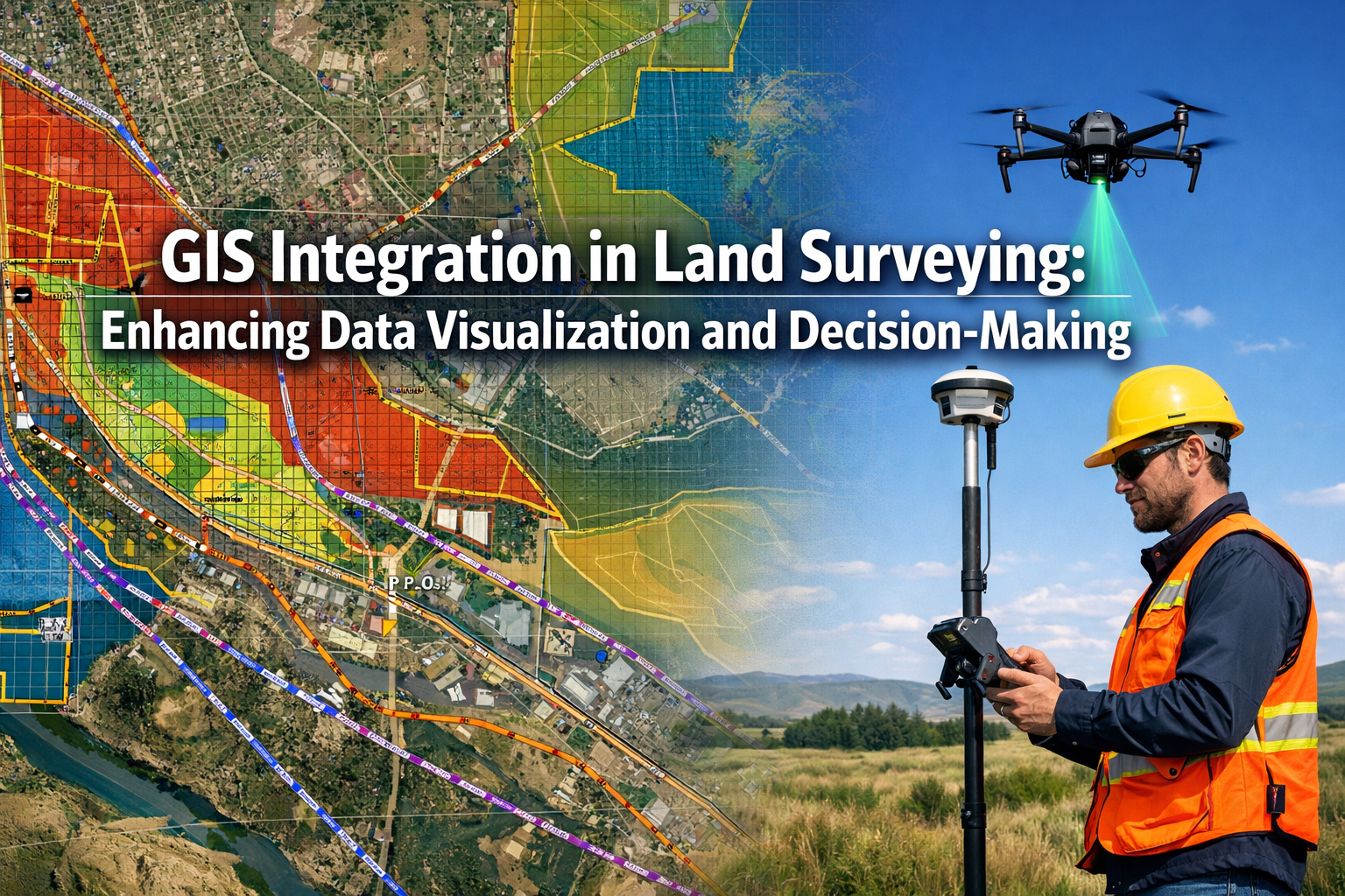
In 2026, the surveying profession stands at a transformative crossroads. As cities expand, infrastructure ages, and development pressures intensify, land surveyors face an unprecedented challenge: how to manage, analyze, and communicate increasingly complex spatial data to stakeholders who demand faster, more accurate insights. The answer lies in GIS Integration in Land Surveying: Enhancing Data Visualization and Decision-Making—a technological convergence that is fundamentally reshaping how professionals approach land use analysis, boundary determination, and infrastructure planning.
Traditional surveying methods, while precise, often produced isolated datasets that existed in silos. A boundary survey might be stored separately from utility maps, zoning regulations lived in planning department filing cabinets, and topographic data remained disconnected from environmental constraints. This fragmented approach made comprehensive land use analysis time-consuming and prone to oversight. Today, Geographic Information Systems (GIS) integration transforms these disconnected pieces into a cohesive, interactive framework that empowers surveyors to overlay zoning information, property boundaries, utility locations, and countless other datasets into unified, actionable intelligence.
The timing couldn't be more critical. Infrastructure demands are rising globally, with aging water systems, expanding electrical grids, and new transportation networks requiring careful spatial planning. In January 2026, major surveying firms like KPM Franklin announced dedicated Geospatial & Land Surveying Departments that explicitly bridge traditional surveying with modern GIS integration, combining LiDAR, 3D modeling, GNSS positioning, and spatial analysis.[1] This industry-wide shift reflects a fundamental recognition: effective decision-making in land development requires not just accurate measurements, but comprehensive spatial understanding.
Key Takeaways
✅ GIS integration transforms isolated survey data into comprehensive spatial intelligence by overlaying multiple datasets—including zoning, boundaries, utilities, and environmental constraints—enabling surveyors to identify conflicts, optimize designs, and support better land use decisions.
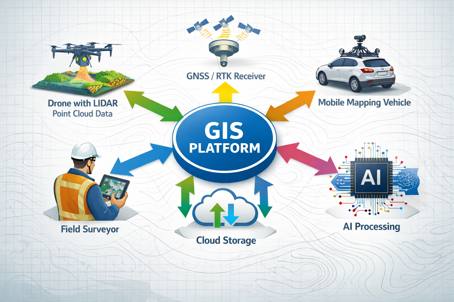
✅ Modern surveying workflows combine traditional precision with advanced technologies such as drone-based LiDAR, Real-Time Kinematics (RTK) positioning, mobile 3D mapping, and AI-powered analysis to deliver faster, more accurate results across larger project areas.
✅ Enhanced data visualization through GIS platforms converts complex technical information into intuitive maps, 3D models, and interactive dashboards that stakeholders can easily understand, improving communication and accelerating approval processes.
✅ Infrastructure planning benefits significantly from integrated geospatial approaches that reveal spatial relationships between existing utilities, proposed developments, regulatory constraints, and environmental factors—reducing costly conflicts and design revisions.
✅ The surveying profession is evolving toward fully integrated digital workflows that leverage cloud platforms, real-time collaboration, and automated analysis, positioning surveyors as strategic advisors rather than just data collectors in the development process.
Understanding GIS Integration in Modern Land Surveying
What Is GIS Integration in Land Surveying?
Geographic Information Systems (GIS) represent far more than digital mapping software. At their core, these platforms provide a sophisticated framework for capturing, storing, analyzing, and visualizing spatial data in ways that reveal relationships, patterns, and insights invisible in traditional survey deliverables. When integrated with land surveying practices, GIS transforms raw field measurements into dynamic, queryable databases that answer complex spatial questions.
GIS Integration in Land Surveying: Enhancing Data Visualization and Decision-Making occurs when surveyors move beyond simply collecting coordinates and elevations to creating comprehensive spatial datasets that connect with broader information ecosystems. This integration enables professionals to:
- Layer multiple data sources within a single coordinate system
- Perform spatial analysis to identify patterns, conflicts, and opportunities
- Generate automated reports based on spatial relationships
- Share interactive maps with stakeholders in real-time
- Update information dynamically as conditions change
The fundamental advantage lies in context. A property boundary measured to millimeter precision gains exponentially more value when displayed alongside zoning classifications, flood zones, utility easements, soil conditions, and adjacent development plans. This contextual richness enables surveyors to anticipate challenges, identify opportunities, and provide strategic guidance that extends well beyond traditional scope.
The Evolution from Traditional to Integrated Surveying
The surveying profession has undergone remarkable technological evolution over the past decades. Traditional methods relied on:
- Manual instruments like theodolites and measuring chains
- Paper-based deliverables including hand-drafted plats and written descriptions
- Isolated data storage with limited accessibility or cross-referencing
- Linear workflows where data collection, processing, and delivery occurred sequentially
Modern integrated approaches leverage:
- GNSS/RTK positioning systems providing centimeter-level accuracy in real-time[3]
- Drone-based LiDAR and photogrammetry capturing millions of data points across extensive areas[3]
- Mobile mapping systems creating detailed 3D models of indoor and outdoor environments[3]
- Cloud-based GIS platforms enabling simultaneous access and collaboration
- AI and machine learning algorithms automating data processing and pattern recognition[3]
This evolution represents more than incremental improvement—it constitutes a fundamental shift in professional identity. Surveyors increasingly function as spatial data scientists who not only measure the physical world but interpret spatial relationships to inform critical decisions. When conducting structural surveys, for instance, professionals can now integrate building condition data with historical GIS layers showing settlement patterns, soil conditions, and nearby construction activity to provide comprehensive risk assessments.
Key Components of an Integrated GIS-Surveying Workflow
Successful GIS Integration in Land Surveying: Enhancing Data Visualization and Decision-Making requires several interconnected components working in harmony:
| Component | Function | Technology Examples |
|---|---|---|
| Data Collection | Gathering accurate spatial measurements | GNSS receivers, total stations, drones, LiDAR scanners, mobile mapping systems |
| Data Processing | Converting raw measurements into usable formats | Point cloud processing software, photogrammetry platforms, coordinate transformation tools |
| Data Storage | Organizing spatial information in accessible databases | Geodatabases, cloud storage, spatial data infrastructure |
| Data Analysis | Performing spatial queries and calculations | GIS analysis tools, spatial statistics, overlay operations, buffer analysis |
| Data Visualization | Creating maps, models, and dashboards | Web mapping platforms, 3D visualization software, interactive dashboards |
| Data Sharing | Distributing information to stakeholders | Web services, mobile apps, PDF maps, interactive portals |
The power emerges when these components function as an integrated ecosystem rather than isolated steps. Field crews collect data using GNSS equipment that automatically uploads to cloud-based GIS platforms, where AI algorithms perform initial quality control. Office staff access the same data simultaneously, conducting analysis and generating visualizations while fieldwork continues. Stakeholders view progress through web dashboards that update in real-time, enabling immediate feedback and course corrections.
Enhancing Data Visualization Through GIS Integration
The Power of Layered Spatial Data
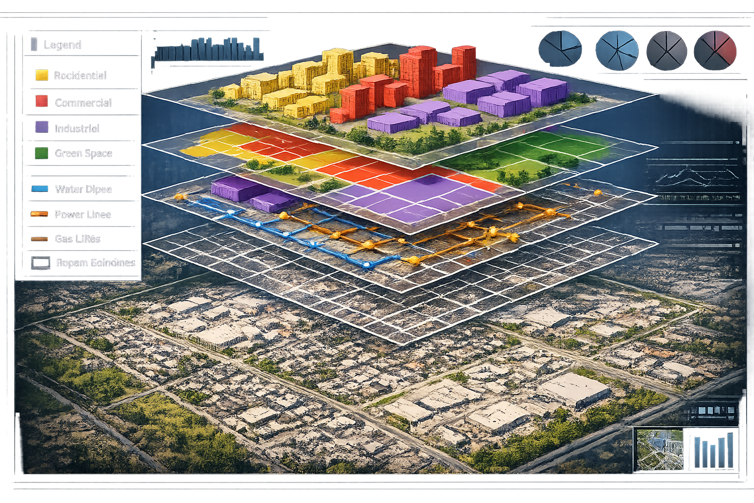
One of the most transformative aspects of GIS Integration in Land Surveying: Enhancing Data Visualization and Decision-Making is the ability to overlay multiple datasets within a unified spatial framework. This layering approach reveals relationships and conflicts that remain hidden when examining individual datasets in isolation.
Consider a typical urban development scenario. A surveyor working on a proposed commercial site might need to evaluate:
🗺️ Parcel boundaries and property ownership
🏗️ Zoning classifications and permitted uses
💧 Water, sewer, and stormwater infrastructure
⚡ Electrical and telecommunications utilities
🌳 Environmental constraints including wetlands, floodplains, and protected habitats
🚗 Transportation networks and access points
📏 Easements and rights-of-way
🏛️ Historical district designations and archaeological sensitivity
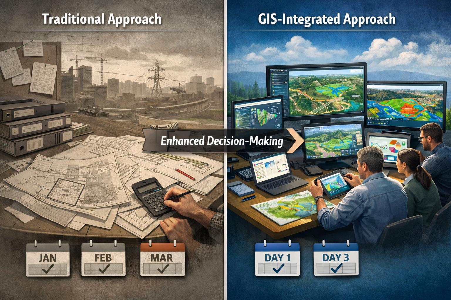
In traditional workflows, gathering this information required contacting multiple agencies, reviewing separate maps with different scales and coordinate systems, and manually comparing documents. The process consumed days or weeks, and subtle conflicts often went unnoticed until construction began.
GIS integration enables surveyors to compile all these layers into a single, georeferenced environment. The platform automatically identifies where proposed building footprints conflict with utility easements, where parking areas encroach on wetland buffers, or where access drives violate setback requirements. Color-coded overlays make complex regulatory frameworks visually intuitive, transforming pages of zoning text into clear spatial constraints that designers can immediately understand and address.
From Numbers to Narratives: Communicating Complex Information
Raw survey data—coordinates, elevations, distances, and bearings—holds little meaning for most stakeholders. Property owners, planners, attorneys, and elected officials need visual narratives that translate technical measurements into understandable insights. This is where GIS visualization capabilities become invaluable.
Modern GIS platforms enable surveyors to create:
Interactive Web Maps that stakeholders can explore using familiar interfaces similar to consumer mapping applications. Users can toggle layers on and off, query features for detailed information, measure distances, and even perform simple analyses without specialized software.
3D Terrain Models that combine survey-grade topography with building models, vegetation, and proposed improvements. These visualizations help stakeholders understand how developments will appear in context, how drainage will function, and how sight lines and shadows will affect adjacent properties.
Temporal Visualizations showing how conditions have changed over time or how phased construction will progress. Historical aerial imagery overlaid with current survey data can document coastal erosion, urban sprawl, or vegetation encroachment with compelling visual evidence.
Dashboard Presentations that consolidate key metrics, compliance indicators, and decision points into executive-level summaries. Rather than reviewing 50-page technical reports, decision-makers can view interactive dashboards that highlight critical issues and allow drill-down into supporting details.
These visualization approaches transform the surveyor's role from data provider to strategic communicator. When presenting findings to planning boards or community meetings, professionals can demonstrate impacts, compare alternatives, and address concerns through visual evidence that resonates far more effectively than technical descriptions. For professionals conducting boundary surveys, the ability to show property lines overlaid on current aerial imagery with adjacent ownership clearly labeled eliminates confusion and facilitates productive discussions.
Real-Time Data Access and Collaborative Decision-Making
The integration of cloud-based GIS platforms with modern surveying workflows enables real-time collaboration that accelerates project timelines and improves outcomes. Field crews, office staff, clients, and regulatory reviewers can access the same spatial data simultaneously, eliminating version control issues and communication delays.
This collaborative environment proves particularly valuable during:
Design Development: Engineers and architects can access current survey data while designing, ensuring their plans reflect actual site conditions. When they propose changes, surveyors can immediately evaluate impacts on property boundaries, utilities, or regulatory constraints.
Permitting Reviews: Regulatory agencies can access project GIS data directly through web portals, conducting preliminary reviews before formal submissions. This early feedback identifies issues when corrections remain inexpensive and schedule impacts minimal.
Construction Administration: Contractors can view survey control points, utility locations, and design limits through mobile devices in the field. When conflicts arise, project teams can collaboratively evaluate alternatives using shared spatial data rather than scheduling meetings and waiting for updated drawings.
Public Engagement: Community stakeholders can explore proposed projects through public web maps, understanding impacts on their neighborhoods and providing informed feedback. This transparency builds trust and often identifies local knowledge that improves designs.
The U.S. Department of Transportation's GIS Strategic Plan 2026-2030 emphasizes this collaborative approach, noting that modern geospatial infrastructure must support "data sharing and integration across organizational boundaries" to maximize value and avoid duplication.[5]
Applications in Infrastructure Planning and Land Use Analysis
Utility Mapping and Conflict Avoidance
Perhaps no application demonstrates the value of GIS Integration in Land Surveying: Enhancing Data Visualization and Decision-Making more clearly than utility mapping and conflict detection. Underground infrastructure—water mains, sewer lines, electrical conduits, telecommunications cables, and gas pipes—represents billions in investment and critical community services. Yet this infrastructure often remains poorly documented, creating risks during excavation and obstacles during development.
Traditional utility mapping relied on:
- As-built drawings of varying accuracy and completeness
- Utility company records maintained in different formats and coordinate systems
- Physical locating services that mark approximate locations with spray paint
- Manual compilation of information from multiple sources
This fragmented approach frequently resulted in costly conflicts. Contractors encounter unexpected utilities during excavation, causing project delays, emergency repairs, and occasionally catastrophic failures. Design teams discover utility conflicts late in the process, requiring expensive redesigns and permit modifications.
GIS integration transforms utility management by:
✅ Consolidating utility data from multiple providers into unified spatial databases
✅ Standardizing coordinate systems so all information aligns accurately
✅ Documenting confidence levels indicating where utilities are precisely surveyed versus approximately located
✅ Enabling automated conflict detection that identifies where proposed work intersects existing infrastructure
✅ Supporting subsurface utility engineering (SUE) workflows that progressively improve utility mapping accuracy
Modern surveying firms increasingly employ ground-penetrating radar, electromagnetic locators, and vacuum excavation to verify utility locations, then integrate this information into GIS platforms. When planning new development or infrastructure improvements, designers can query the GIS to identify all utilities within specified distances of proposed work, automatically generating conflict reports that drive proactive coordination.
For professionals conducting commercial building surveys, comprehensive utility mapping proves essential for evaluating development potential, estimating connection costs, and identifying constraints that affect property value.
Zoning Analysis and Regulatory Compliance
Land use regulations—zoning codes, overlay districts, subdivision ordinances, and environmental protections—create complex spatial frameworks that govern development. Understanding how these regulations apply to specific properties requires analyzing multiple layers of rules, each with geographic boundaries and specific requirements.
GIS Integration in Land Surveying: Enhancing Data Visualization and Decision-Making enables surveyors to:
📋 Overlay zoning boundaries with parcel data to automatically determine applicable regulations
📐 Calculate setbacks, height limits, and density based on zoning requirements
🌊 Identify environmental constraints including floodplains, wetlands, steep slopes, and critical habitats
🏛️ Map historic districts and archaeological sensitivity zones
🚫 Highlight deed restrictions and conservation easements that limit development
This automated analysis accelerates due diligence and improves accuracy. Rather than manually reviewing zoning maps and calculating compliance, surveyors can generate comprehensive regulatory reports in minutes. The GIS platform identifies all applicable regulations, calculates allowable building envelopes, and flags potential conflicts requiring variance or special permits.
Massachusetts recently demonstrated this approach's power when MassGIS updated boundaries for 3,900 protected land polygons across 160 municipalities, resulting in a net gain of 6,600 acres through improved accuracy.[2] This enhanced spatial data enables more accurate conservation planning, better regulatory compliance, and reduced boundary disputes.
For clients evaluating property acquisitions, this regulatory clarity proves invaluable. Surveyors can quickly assess whether proposed uses comply with zoning, whether environmental constraints limit buildable area, and whether special approvals will be required—information that directly affects property value and development feasibility.
Infrastructure Asset Management and Maintenance Planning
Public agencies and private utilities face growing challenges managing aging infrastructure with limited budgets. GIS-integrated surveying provides the spatial foundation for effective asset management programs that optimize maintenance, predict failures, and prioritize capital investments.
Modern asset management workflows integrate:
🔧 Condition assessment data documenting current state of infrastructure components
📅 Installation dates and expected service life enabling age-based replacement planning
💰 Maintenance history showing repair frequency and costs
📊 Performance metrics including failure rates, service interruptions, and customer complaints
🗺️ Spatial relationships revealing how infrastructure components interact
By combining survey-accurate locations with condition and performance data, GIS platforms enable sophisticated analyses:
Failure Prediction Models use machine learning to identify infrastructure segments at high risk of failure based on age, material, soil conditions, and historical performance. Maintenance crews can proactively address problems before failures occur, reducing emergency repairs and service disruptions.[3]
Network Analysis evaluates how infrastructure components depend on each other. When planning maintenance that requires shutdowns, GIS platforms can identify all affected customers, calculate service impacts, and optimize work sequencing to minimize disruptions.
Capital Planning Optimization helps agencies prioritize limited budgets by identifying projects that address the most critical needs, serve the most customers, or enable other beneficial improvements. Spatial analysis reveals opportunities to coordinate multiple projects in the same area, reducing mobilization costs and community disruption.
The 3D Hydrography Program funding recently approved for Massachusetts and six neighboring states exemplifies this integrated approach, modernizing surface water mapping by combining elevation-derived hydrography with LiDAR data as part of the 3D National Topography Model.[2] This enhanced spatial data supports better flood risk management, water resource planning, and environmental protection.
Environmental Impact Assessment and Conservation Planning
Environmental regulations increasingly require comprehensive spatial analysis demonstrating how proposed developments affect natural resources, wildlife habitats, and ecosystem services. GIS Integration in Land Surveying: Enhancing Data Visualization and Decision-Making provides the analytical framework for rigorous environmental assessment.
Surveyors working on projects subject to environmental review can integrate:
🌿 Wetland delineations precisely surveyed and georeferenced
🦅 Habitat mapping showing critical areas for protected species
💧 Watershed boundaries and stormwater flow paths
🌡️ Climate data including temperature, precipitation, and projected changes
🏞️ Land cover classifications derived from aerial imagery and field verification
Texas A&M researcher Shanna Gleason's work exemplifies this integration, combining high-accuracy GNSS field data with drone imagery to validate invasive species identification in coastal prairie conservation.[4] This approach demonstrates how ground-truthed survey data enhances remote sensing accuracy, enabling large-scale environmental monitoring at practical costs.
GIS analysis enables environmental professionals to:
✅ Calculate impact areas showing how much habitat will be disturbed
✅ Model stormwater runoff and evaluate best management practices
✅ Assess viewshed impacts from proposed structures
✅ Identify mitigation opportunities through spatial optimization
✅ Monitor compliance by comparing permitted impacts with actual construction
For projects requiring dilapidation surveys to document pre-construction conditions, integrating environmental baseline data creates comprehensive records that protect both developers and natural resources.
Advanced Technologies Driving GIS Integration
LiDAR and Point Cloud Integration
Light Detection and Ranging (LiDAR) technology has revolutionized surveying by enabling rapid collection of millions of precise elevation points across extensive areas. When integrated with GIS platforms, LiDAR point clouds provide unprecedented detail for terrain modeling, vegetation analysis, and infrastructure documentation.
Modern surveying workflows employ LiDAR in multiple configurations:
Aerial LiDAR mounted on aircraft or drones captures large areas rapidly, penetrating vegetation canopy to measure ground surface beneath. This technology proves invaluable for corridor mapping, flood modeling, and forestry management.
Mobile LiDAR mounted on vehicles scans roadways and adjacent infrastructure while driving at normal speeds. Transportation agencies use this approach to inventory assets, measure pavement conditions, and document encroachments.
Terrestrial LiDAR employs stationary scanners to capture detailed 3D models of buildings, structures, and complex sites. This approach supports renovation planning, historic preservation, and as-built documentation.
KPM Franklin's new Geospatial & Land Surveying Department explicitly integrates "terrestrial and aerial drone-based LiDAR" with GIS data and spatial analysis, enabling clients to "visualize and navigate a complex world with unprecedented clarity."[1] This integration transforms raw point clouds into actionable intelligence by:
- Classifying points automatically into ground, vegetation, buildings, and other categories
- Extracting features like building footprints, utility poles, and pavement edges
- Generating terrain models with centimeter-level accuracy
- Measuring volumes for earthwork and stockpile calculations
- Detecting changes by comparing scans from different dates
The resulting datasets integrate seamlessly with other GIS layers, enabling comprehensive spatial analysis that combines LiDAR-derived terrain with property boundaries, utilities, and regulatory constraints.
Drone Technology and Aerial Data Collection
Unmanned Aerial Vehicles (UAVs) equipped with high-resolution cameras and sensors have become essential tools for modern surveyors. These platforms provide cost-effective aerial data collection that complements traditional surveying methods and enhances GIS integration.[3]
Drone applications in surveying include:
📸 Orthophotography creating geometrically corrected aerial imagery suitable for measurement and mapping
📊 Digital Surface Models showing terrain and above-ground features
🏗️ Construction Progress Monitoring documenting site conditions at regular intervals
🔍 Inspection Services examining roofs, towers, and other difficult-to-access structures
🌾 Agricultural Mapping assessing crop health and irrigation effectiveness
The key advantage lies in data density and timeliness. A drone can capture thousands of images across a large site in hours, providing current conditions for GIS analysis. Photogrammetry software processes these images into 3D models, point clouds, and orthophotos that integrate directly into GIS platforms.
When combined with ground control points surveyed using GNSS equipment, drone-derived datasets achieve accuracy suitable for design and construction applications. This integration of aerial and terrestrial surveying creates comprehensive spatial databases that support better decision-making throughout project lifecycles.
For professionals conducting subsidence surveys, repeat drone surveys provide cost-effective monitoring of ground movement, with GIS analysis revealing patterns and trends that inform remediation strategies.
Real-Time Positioning and GNSS Technology
Global Navigation Satellite Systems (GNSS) including GPS, GLONASS, Galileo, and BeiDou provide the positioning foundation for modern surveying. Recent advances in Real-Time Kinematic (RTK) and Post-Processing Kinematic (PPK) positioning enable surveyors to achieve centimeter-level accuracy in real-time, dramatically improving field productivity.[3]
RTK positioning works by:
- Reference station at known location receives satellite signals
- Corrections calculated by comparing received positions with known coordinates
- Radio or cellular link transmits corrections to field receivers
- Field receivers apply corrections to achieve centimeter accuracy instantly
This real-time accuracy enables field crews to stake construction layouts, locate utilities, and collect topographic data with immediate quality assurance. Data flows directly from field receivers to GIS platforms through cellular connections, eliminating office processing delays and enabling real-time project monitoring.
The U.S. Department of Transportation recently announced replacement of legacy datums (NAVD88) with new coordinate frames and geopotential datum in 2026, creating "a more accurate model of Earth's shape while aligning U.S. mapping with international standards and accounting for tectonic plate movement."[5] This modernization ensures GNSS-derived survey data maintains accuracy as Earth's surface shifts, critical for long-term infrastructure management.
Artificial Intelligence and Machine Learning Applications
Artificial Intelligence (AI) and machine learning are transforming how surveyors process and analyze spatial data. These technologies automate time-consuming tasks, identify patterns humans might miss, and generate predictive insights that enhance decision-making.[3]
AI applications in GIS-integrated surveying include:
🤖 Automated Feature Extraction identifying buildings, roads, vegetation, and other features from imagery and point clouds
🔍 Change Detection comparing datasets from different dates to identify modifications
📈 Predictive Modeling forecasting infrastructure failures, flood risks, or development patterns
✅ Quality Control automatically identifying measurement errors or data inconsistencies
🎯 Classification categorizing land cover, building types, or other features from remote sensing data
Machine learning algorithms excel at processing massive datasets that would overwhelm manual analysis. A LiDAR scan containing billions of points can be automatically classified into ground, vegetation, buildings, and other categories in minutes. Aerial imagery covering hundreds of square kilometers can be analyzed to detect unauthorized construction, encroachments, or environmental violations.
These AI capabilities integrate with GIS platforms to provide intelligent spatial analysis. Rather than simply storing and displaying data, modern systems actively analyze information to generate insights, flag anomalies, and recommend actions. This evolution positions surveyors as strategic advisors who leverage technology to deliver intelligence rather than just measurements.
Overcoming Implementation Challenges
Data Quality and Standardization Issues
Successful GIS Integration in Land Surveying: Enhancing Data Visualization and Decision-Making depends fundamentally on data quality. The principle "garbage in, garbage out" applies with particular force to spatial analysis—inaccurate or inconsistent input data produces misleading results that can drive poor decisions and create legal liabilities.
Common data quality challenges include:
❌ Coordinate system inconsistencies where different datasets use incompatible projections or datums
❌ Accuracy variations mixing survey-grade data with approximate digitized information
❌ Temporal mismatches combining current surveys with outdated regulatory boundaries
❌ Attribute errors including misspellings, missing values, or incorrect classifications
❌ Geometric problems such as gaps, overlaps, or invalid polygons
Addressing these challenges requires:
✅ Metadata documentation clearly describing data sources, accuracy, collection dates, and coordinate systems
✅ Standardized workflows ensuring consistent data collection and processing procedures
✅ Quality control protocols including automated validation and manual review
✅ Data dictionaries defining attributes, allowable values, and coding conventions
✅ Version control tracking data updates and maintaining historical records
Professional organizations increasingly recognize these needs. The Geospatial Professional Network is actively surveying GIS management practices across sectors to document current approaches and identify best practices.[2] This industry-wide focus on standardization will improve data interoperability and enable more sophisticated integrated analyses.
Technology Costs and Return on Investment
Implementing comprehensive GIS integration requires significant investments in software, hardware, training, and data development. Organizations must carefully evaluate costs against benefits to justify these expenditures and ensure sustainable programs.
Typical implementation costs include:
| Cost Category | Examples | Considerations |
|---|---|---|
| Software | GIS platforms, analysis tools, mobile apps | Subscription vs. perpetual licenses, cloud vs. on-premise |
| Hardware | Servers, workstations, field devices | Performance requirements, replacement cycles |
| Data | Base maps, aerial imagery, LiDAR | Coverage area, update frequency, accuracy needs |
| Training | Staff education, certification programs | Initial and ongoing skill development |
| Personnel | GIS specialists, database administrators | In-house vs. outsourced expertise |
| Integration | Custom development, API connections | Connecting with existing systems |
Benefits that offset these costs include:
💰 Reduced project timelines through faster data collection and analysis
💰 Avoided conflicts by identifying utility and regulatory issues early
💰 Improved accuracy reducing errors and associated liabilities
💰 Enhanced services enabling new offerings and competitive advantages
💰 Better decisions through comprehensive spatial analysis
💰 Regulatory compliance meeting increasing digital submission requirements
Organizations should approach GIS integration incrementally, starting with high-value applications that demonstrate clear returns before expanding to comprehensive enterprise systems. This phased approach manages costs, allows staff to develop skills progressively, and builds organizational support through early successes.
Workforce Skills and Training Requirements
The convergence of traditional surveying with GIS technology creates workforce development challenges. Professionals must master both disciplines—understanding surveying fundamentals while developing sophisticated GIS analytical capabilities.
Essential competencies for modern surveyors include:
📚 Traditional surveying including boundary law, geodesy, and measurement principles
💻 GIS software proficiency with industry-standard platforms
📊 Spatial analysis understanding overlay operations, network analysis, and geostatistics
🗄️ Database management including data modeling and SQL queries
📱 Mobile technology deploying field data collection applications
🎨 Cartography creating effective maps and visualizations
🤝 Communication translating technical information for diverse audiences
Educational programs are adapting to these needs, with surveying curricula increasingly incorporating GIS components. However, many practicing professionals trained before this integration must upskill through continuing education. Professional organizations offer workshops, webinars, and certification programs that help bridge knowledge gaps.
Firms implementing GIS integration should invest in:
✅ Formal training programs providing structured skill development
✅ Mentoring relationships pairing experienced GIS users with those learning
✅ Practice projects allowing staff to develop skills on internal initiatives before client work
✅ External expertise engaging consultants for complex implementations
✅ Knowledge sharing through internal documentation and regular team discussions
The investment in workforce development pays dividends through improved service quality, enhanced efficiency, and stronger competitive positioning. Organizations that successfully develop integrated surveying-GIS capabilities position themselves as strategic partners rather than commodity service providers.
Future Trends and Opportunities
Cloud-Based Platforms and Real-Time Collaboration
The migration of GIS platforms to cloud-based architectures represents one of the most significant trends shaping GIS Integration in Land Surveying: Enhancing Data Visualization and Decision-Making. Cloud platforms eliminate infrastructure management burdens, enable global collaboration, and provide scalable computing power for demanding analyses.[3]
Cloud-based GIS offers:
☁️ Accessibility from any device with internet connectivity
☁️ Automatic updates ensuring users always access current software versions
☁️ Scalability expanding storage and processing capacity as needs grow
☁️ Collaboration enabling simultaneous access by distributed teams
☁️ Integration connecting with other cloud services and data sources
☁️ Cost efficiency converting capital expenses to operational subscriptions
This architecture enables real-time workflows where field data immediately becomes available for office analysis, stakeholder review, and decision-making. Construction inspectors can photograph site conditions, attach photos to specific locations in the GIS, and trigger automated notifications to project managers—all from mobile devices in the field.
The trend toward cloud platforms aligns with broader digital transformation initiatives across industries. Organizations increasingly expect information systems to provide instant access, support remote work, and integrate seamlessly with other business applications. Surveying firms that embrace cloud-based GIS position themselves to meet these expectations while improving internal efficiency.
Digital Twins and 4D Modeling
Digital twins—dynamic virtual replicas of physical assets that update in real-time—represent an emerging application of GIS integration with profound implications for infrastructure management. These models combine survey-accurate geometry with sensor data, performance metrics, and predictive analytics to enable proactive management.[7]
In surveying contexts, digital twins integrate:
🏗️ As-built surveys providing precise geometry
📡 IoT sensors monitoring conditions, usage, and performance
📊 Operational data including maintenance history and costs
🔮 Predictive models forecasting failures and optimizing interventions
📅 Temporal data showing how conditions evolve over time (4D modeling)
Transportation agencies are developing digital twins of road networks that integrate pavement condition surveys, traffic volumes, weather data, and maintenance records. These systems predict where failures will occur, optimize maintenance schedules, and evaluate how different investment scenarios affect network performance over time.
Building owners are creating digital twins that combine architectural surveys with building systems data, enabling facility managers to optimize energy use, predict equipment failures, and plan renovations with comprehensive understanding of existing conditions. When conducting structural surveys, professionals can contribute to digital twins by providing accurate geometric data and condition assessments that inform long-term asset management.
Autonomous Data Collection Systems
The future of surveying increasingly involves autonomous systems that collect spatial data with minimal human intervention. These technologies promise to reduce costs, improve safety, and enable continuous monitoring applications.[3]
Emerging autonomous capabilities include:
🤖 Autonomous drones flying pre-programmed missions to capture regular site imagery
🚗 Self-driving mapping vehicles continuously scanning road networks
🛰️ Satellite constellations providing frequent high-resolution imagery
📡 Permanent GNSS stations monitoring ground movement and atmospheric conditions
🔍 Robotic total stations tracking construction progress automatically
These systems generate massive datasets that require sophisticated GIS integration and AI analysis to extract meaningful insights. The surveyor's role evolves from data collector to system manager and analyst—designing monitoring programs, ensuring data quality, and interpreting results to support decisions.
For applications requiring continuous monitoring—such as landslide detection, subsidence tracking, or construction deformation surveys—autonomous systems provide cost-effective solutions that would be impractical with traditional manual methods. The GIS platform becomes the central repository where autonomous data streams converge, enabling real-time analysis and automated alerting when conditions exceed thresholds.
Integration with Building Information Modeling (BIM)
The convergence of GIS and Building Information Modeling (BIM) creates powerful opportunities for comprehensive project lifecycle management. While BIM excels at detailed building design and construction coordination, GIS provides broader spatial context including site conditions, utilities, and regulatory constraints.[7]
Integrated GIS-BIM workflows enable:
🏗️ Site selection evaluating multiple locations against spatial criteria
📐 Design optimization ensuring buildings fit site constraints and regulations
🚧 Construction planning coordinating site logistics with surrounding infrastructure
🏢 Facility management operating buildings with understanding of external context
♻️ Renovation and expansion evaluating options within spatial constraints
Survey data provides the critical link between GIS and BIM, establishing accurate site geometry and existing conditions that inform design. Surveyors who understand both GIS and BIM can serve as integration specialists, ensuring these complementary technologies work together effectively rather than creating conflicting information silos.
Professional organizations are developing standards for GIS-BIM integration, recognizing that comprehensive digital project delivery requires both detailed building models and broader spatial context. Surveying firms that develop expertise in this integration position themselves as essential partners throughout project lifecycles.
Conclusion: Embracing the Future of Surveying
GIS Integration in Land Surveying: Enhancing Data Visualization and Decision-Making represents far more than a technological upgrade—it constitutes a fundamental transformation in how surveying professionals create value. By combining traditional precision measurement with sophisticated spatial analysis and compelling visualization, surveyors evolve from data collectors to strategic advisors who guide critical land use and infrastructure decisions.
The benefits are clear and compelling:
✨ Comprehensive spatial intelligence through integrated datasets that reveal relationships invisible in isolated surveys
✨ Enhanced communication converting technical measurements into intuitive visualizations that stakeholders understand
✨ Faster project delivery through real-time collaboration and automated analysis
✨ Better decisions informed by comprehensive spatial understanding rather than fragmented information
✨ Competitive advantage for firms that master integrated workflows and deliver enhanced services
The infrastructure challenges facing communities in 2026 and beyond—aging utilities, climate adaptation, sustainable development, and equitable resource allocation—all require sophisticated spatial analysis that GIS integration enables. Surveyors who embrace these capabilities position themselves as essential partners in addressing society's most pressing challenges.
Actionable Next Steps
For surveying professionals and organizations ready to advance their GIS integration capabilities:
1. Assess Current Capabilities
Evaluate existing technology, data, and skills to identify gaps and opportunities. Determine which applications would deliver the highest value for your clients and practice areas.
2. Develop an Implementation Roadmap
Create a phased plan that starts with high-value applications, builds staff capabilities progressively, and expands toward comprehensive integration. Set realistic timelines and budgets that ensure sustainable progress.
3. Invest in Training and Development
Provide staff with formal education, hands-on practice opportunities, and ongoing support to develop integrated surveying-GIS competencies. Consider partnering with educational institutions or professional organizations for structured programs.
4. Start with Pilot Projects
Select representative projects to test integrated workflows, refine procedures, and demonstrate value before full-scale deployment. Document lessons learned and use successes to build organizational support.
5. Establish Data Standards and Quality Protocols
Develop clear procedures for data collection, processing, documentation, and quality control. Ensure consistency across projects and staff members to build reliable spatial databases.
6. Build Strategic Partnerships
Connect with GIS specialists, software vendors, and technology providers who can provide expertise and support. Collaborate with clients and stakeholders to understand their spatial data needs and decision-making processes.
7. Stay Informed About Emerging Technologies
Monitor developments in AI, autonomous systems, cloud platforms, and digital twins that will shape future capabilities. Participate in professional organizations and industry events to learn from peers and thought leaders.
The surveying profession stands at an exciting inflection point. Those who successfully integrate GIS capabilities with traditional surveying excellence will thrive in an increasingly complex, data-driven world. The tools, technologies, and knowledge required are available today—the question is whether professionals will embrace the opportunity to transform their practices and expand their impact.
For organizations seeking expert guidance on implementing modern surveying approaches, professional chartered surveyors can provide valuable consultation on technology selection, workflow development, and best practices tailored to specific needs and objectives.
The future of surveying is integrated, intelligent, and indispensable. By embracing GIS Integration in Land Surveying: Enhancing Data Visualization and Decision-Making, professionals ensure they remain at the forefront of their profession, delivering the comprehensive spatial intelligence that modern infrastructure planning and land use decision-making demands.
References
[1] Kpm Franklin Unveils New Geospatial Land Surveying Department – https://amerisurv.com/2026/01/30/kpm-franklin-unveils-new-geospatial-land-surveying-department/
[2] Massgis Gisette Newsletter January 2026 – https://www.mass.gov/info-details/massgis-gisette-newsletter-january-2026
[3] The Future Of Land Surveying Technology And Upcoming Trends In 2026 – https://metricop.com/blogs/land-surveying/the-future-of-land-surveying-technology-and-upcoming-trends-in-2026
[4] 2026 01 January – https://eos-gnss.com/newsletters/2026-01-january
[5] Us Dot Gis Strategic Plan 2026 30 – https://www.transportation.gov/sites/dot.gov/files/2025-12/US-DOT-GIS-Strategic-Plan-2026-30.pdf
[7] How Ai Is Changing The Role Of The Surveyor In Aec – https://www.gim-international.com/content/article/how-ai-is-changing-the-role-of-the-surveyor-in-aec