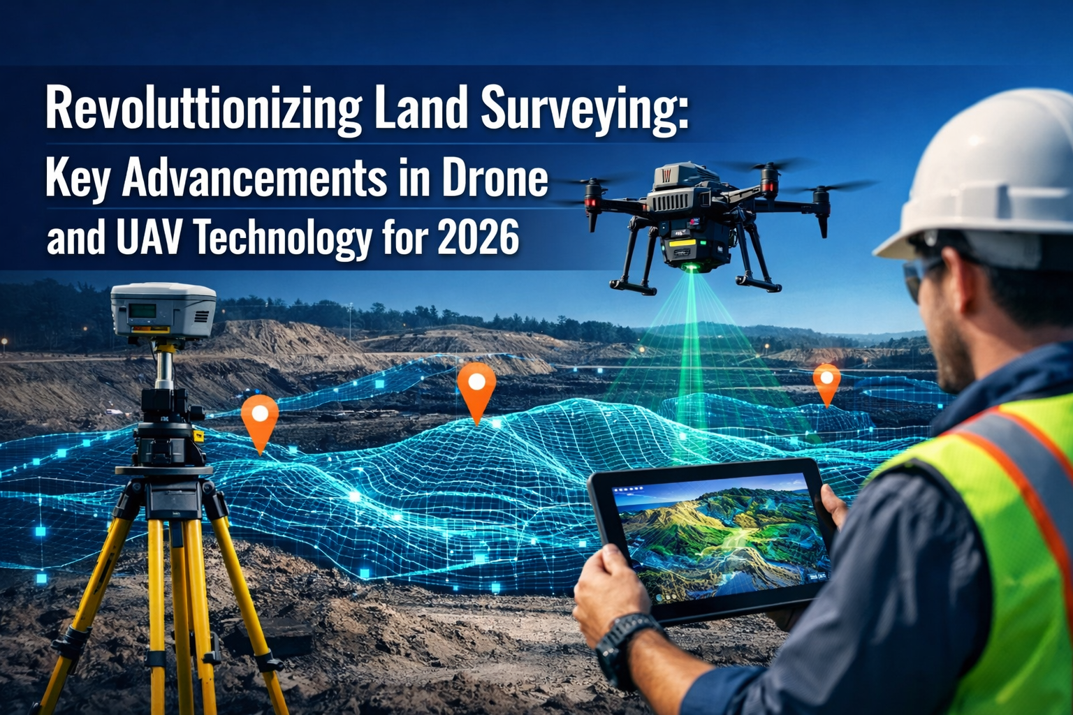
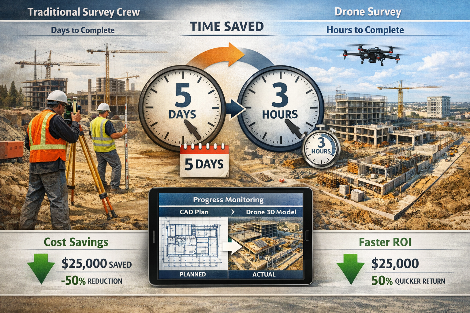
The land surveying industry stands at a pivotal moment in 2026, where traditional surveying methods that once required weeks of labor-intensive fieldwork are being transformed by cutting-edge drone technology. Imagine completing a comprehensive topographic survey of 500 acres in just three hours instead of two weeks—this isn't science fiction, but the reality that Revolutionizing Land Surveying: Key Advancements in Drone and UAV Technology for 2026 has brought to surveying professionals worldwide. With accessible, affordable drones now equipped with high-resolution cameras and LiDAR sensors delivering centimeter-level accuracy, the barriers to advanced surveying capabilities have dramatically lowered, opening unprecedented opportunities for construction firms, engineering companies, and surveying professionals.
This transformation extends far beyond simple time savings. Environmental engineering firms have documented cost reductions exceeding $80,000 annually by integrating drone technology into their workflows[5]. Construction managers now monitor project progress in real-time, detecting deviations from plans before they become costly errors. Archaeologists discover hidden sites beneath dense vegetation that would have remained invisible using traditional methods. The convergence of autonomous flight systems, artificial intelligence, and advanced sensor technology is fundamentally reshaping how professionals approach land surveying challenges.
Key Takeaways
- Centimeter-level accuracy is now achievable with modern drone surveying systems, matching or exceeding traditional ground-based methods while reducing survey time from weeks to hours[4]
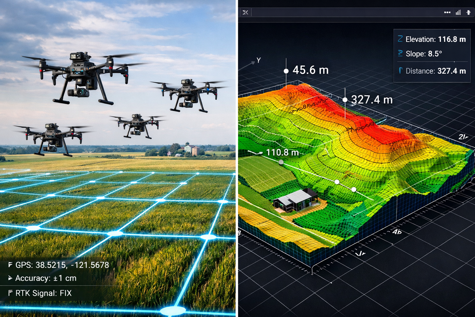
- Autonomous drone swarms work together with minimal human intervention, covering large areas efficiently through coordinated flight paths and dramatically reducing resource requirements[2]
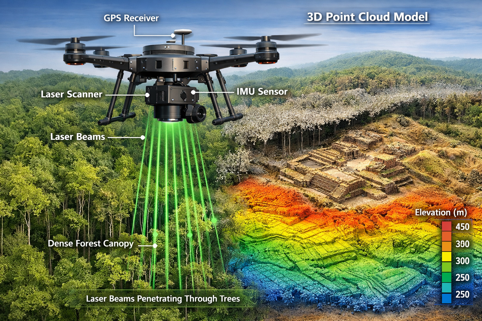
- LiDAR-equipped drones penetrate dense vegetation to create highly accurate 3D terrain models, revealing features invisible to traditional surveying methods[3]
- Real-time data processing powered by AI enables instant visualization of topographic information, construction progress, and project deviations integrated directly into GIS platforms[1][5]
- Documented cost savings demonstrate ROI, with firms reporting reductions exceeding $80,000 annually through drone technology adoption and workflow optimization[5]
Understanding the Drone Surveying Revolution in 2026
What Makes Modern Drone Surveying Different
The landscape of land surveying has undergone a fundamental transformation that extends well beyond simply mounting cameras on flying platforms. Revolutionizing Land Surveying: Key Advancements in Drone and UAV Technology for 2026 represents a complete reimagining of data collection, processing, and application in surveying workflows.
Modern drone surveying systems integrate multiple advanced technologies working in concert:
Multi-Sensor Data Collection: Today's surveying drones typically fly with downward-facing RGB cameras, multispectral sensors, or LiDAR systems, capturing massive datasets that are processed through Geographic Information Systems (GIS) to produce actionable intelligence[4]. This multi-modal approach allows surveyors to gather different types of data simultaneously—visual imagery for asset identification, thermal data for infrastructure inspection, and precise elevation measurements for topographic modeling.
Autonomous Operation Capabilities: Unlike early drone systems requiring constant pilot attention, 2026's autonomous platforms execute pre-programmed flight paths with remarkable precision. These systems automatically adjust for wind conditions, maintain consistent altitude and overlap parameters, and even coordinate with other drones in swarm configurations[2]. The reduction in required human intervention translates directly to lower operational costs and increased consistency across survey missions.
Real-Time Processing Integration: Perhaps the most significant advancement lies in AI-powered real-time data processing. Modern systems process high-resolution imagery and generate preliminary 3D models while the drone is still in flight, with integration into GIS platforms enabling near real-time visualization of project data including topographic information and easements[1][5]. This immediate feedback allows surveyors to identify gaps in coverage or data quality issues before leaving the field, eliminating costly return visits.
The Accuracy Revolution: Centimeter-Level Precision
One of the most compelling aspects of Revolutionizing Land Surveying: Key Advancements in Drone and UAV Technology for 2026 is the achievement of centimeter-level accuracy in drone-based surveys[4]. This precision level, once exclusive to traditional ground-based surveying methods, now comes with the speed and efficiency advantages of aerial data collection.
Several factors contribute to this accuracy achievement:
- High-resolution sensor technology: Modern cameras capture imagery at resolutions exceeding 20 megapixels, enabling identification of features as small as individual survey markers
- RTK/PPK GPS integration: Real-Time Kinematic (RTK) and Post-Processed Kinematic (PPK) GPS systems provide precise positioning data for each image capture point
- Ground control point optimization: Strategic placement of surveyed ground control points enables photogrammetric processing software to achieve sub-centimeter accuracy
- Advanced processing algorithms: Machine learning-enhanced photogrammetry software identifies and corrects systematic errors in data collection
The accuracy achieved depends on several variables including sensor quality, flight altitude, and ground conditions[4]. For typical surveying applications at 100-meter flight altitude, horizontal accuracy of 2-3 centimeters and vertical accuracy of 5-7 centimeters is routinely achievable—more than sufficient for most construction, engineering, and planning applications.
For professionals seeking comprehensive property assessments, understanding how drone technology complements traditional methods is essential. Our structural survey services combine advanced drone data collection with expert analysis to provide complete property evaluations.
Key Technological Advancements Driving the Revolution
LiDAR Technology: Seeing Through the Canopy
Light Detection and Ranging (LiDAR) represents one of the most transformative technologies in Revolutionizing Land Surveying: Key Advancements in Drone and UAV Technology for 2026. This laser-based sensing technology has fundamentally changed what surveyors can accomplish, particularly in challenging environments.
LiDAR drones emit rapid laser pulses—often hundreds of thousands per second—and measure the time it takes for each pulse to return after reflecting off surfaces. This creates incredibly dense point clouds containing millions of precisely positioned three-dimensional points that represent the surveyed terrain and features.
The Vegetation Penetration Advantage: Unlike traditional photogrammetry that captures only visible surfaces, LiDAR's laser pulses can penetrate gaps in vegetation canopy, with multiple returns from a single pulse capturing both canopy height and ground elevation beneath[3]. This capability has proven revolutionary for:
- Forestry applications: Accurate terrain modeling beneath dense tree coverage for timber volume estimation and harvest planning
- Archaeological discovery: Revealing ancient structures and settlement patterns hidden beneath jungle canopy—archaeologists have discovered previously unknown sites using LiDAR that were completely invisible using traditional survey methods[3]
- Flood modeling: Creating accurate bare-earth digital elevation models in vegetated floodplains for hydraulic analysis
- Infrastructure planning: Identifying ground conditions beneath vegetation for pipeline routing, transmission line planning, and road design
Accuracy and Density: Modern drone-mounted LiDAR systems achieve point densities exceeding 200 points per square meter, with vertical accuracy of 5-10 centimeters depending on flight altitude and system specifications. This density enables identification of subtle terrain features including drainage patterns, archaeological features, and geological formations that would be extremely difficult or impossible to detect using traditional methods.
The cost of LiDAR technology has decreased dramatically over the past five years, with systems that once cost $200,000+ now available for under $50,000, making this advanced capability accessible to mid-sized surveying firms and specialized contractors.
Autonomous Drone Swarms: Multiplying Efficiency
One of the most exciting developments in Revolutionizing Land Surveying: Key Advancements in Drone and UAV Technology for 2026 is the emergence of autonomous drone swarms capable of working together with minimal human intervention[2]. This technology multiplies the efficiency advantages of drone surveying by enabling multiple aircraft to survey large areas simultaneously while maintaining precise coordination.
How Swarm Technology Works: Advanced flight control algorithms enable multiple drones to:
- Execute coordinated flight paths that optimize coverage while avoiding conflicts
- Communicate position and status information in real-time
- Automatically adjust individual flight plans based on swarm performance
- Return sequentially for battery changes to maintain continuous coverage
- Merge collected data into unified datasets during post-processing
Practical Applications: Swarm surveying proves particularly valuable for:
- Large-scale construction projects: Monitoring multiple active work areas simultaneously across sprawling development sites
- Linear infrastructure: Surveying pipelines, transmission corridors, or transportation routes where traditional single-drone coverage would require excessive flight time
- Emergency response: Rapidly assessing damage across wide areas following natural disasters
- Agricultural monitoring: Covering thousands of acres of farmland in single survey missions
The efficiency gains are substantial. A coordinated swarm of four drones can complete surveys in roughly one-quarter the time of a single aircraft, while requiring only marginally more human oversight. This translates to dramatic reductions in project timelines and enables more frequent monitoring intervals for construction progress tracking and change detection applications.
For property professionals working across multiple locations, our chartered surveyors covering South East London utilize advanced drone technology to provide efficient, accurate assessments across the region.
AI-Powered Real-Time Data Processing
The integration of artificial intelligence into drone surveying workflows represents a quantum leap in operational efficiency. Revolutionizing Land Surveying: Key Advancements in Drone and UAV Technology for 2026 is characterized not just by better data collection, but by intelligent, automated data processing that delivers actionable insights in near real-time.
Onboard Processing Capabilities: Modern surveying drones equipped with edge computing processors can:
- Perform preliminary photogrammetric processing during flight
- Identify coverage gaps or image quality issues requiring additional passes
- Generate low-resolution preview models for immediate field validation
- Detect changes compared to previous surveys using automated comparison algorithms
- Flag potential safety hazards or construction deviations for immediate attention
Cloud-Based AI Analysis: Once data is uploaded, cloud-based AI systems provide advanced analysis including:
- Automated feature extraction: AI algorithms identify and classify objects including buildings, vehicles, vegetation, water bodies, and infrastructure elements without manual digitization
- Change detection: Machine learning models compare current surveys to baseline data, automatically highlighting modifications, construction progress, or unauthorized changes
- Volumetric calculations: Automated stockpile volume measurements, cut-fill calculations, and material quantity estimates
- Defect identification: AI-trained models detect cracks, surface degradation, or structural issues in infrastructure inspections
GIS Integration: The integration of drone data with GIS platforms enables near real-time visualization of project information including topographic data, easements, utilities, and design overlays[1][5]. This integration creates a digital twin of the project site that serves as a central information hub for all stakeholders.
The time savings are remarkable. Tasks that once required days or weeks of manual processing—digitizing features, calculating volumes, identifying changes—now complete automatically in hours or even minutes, allowing surveyors to focus on analysis, interpretation, and decision support rather than data processing.
Practical Applications and Real-World Case Studies
Construction Monitoring and Progress Tracking
Construction project management has been fundamentally transformed by Revolutionizing Land Surveying: Key Advancements in Drone and UAV Technology for 2026, with AI-enabled drones providing unprecedented visibility into project status, progress, and potential issues.
Real-Time Progress Assessment: Modern drone systems enable construction managers to:
- Conduct weekly or even daily surveys of entire project sites
- Generate 3D models showing current conditions
- Overlay actual construction against original design plans to identify deviations[1][3]
- Calculate earthwork volumes to verify contractor quantities
- Document site conditions for progress billing and dispute resolution
Error Detection and Prevention: By comparing drone-captured reality models against Building Information Modeling (BIM) designs, AI systems automatically detect deviations from plans, reducing errors and rework[1][3]. This early detection capability prevents small discrepancies from becoming major problems, saving substantial time and money.
Case Study: Large-Scale Development Project: A major residential development in the UK implemented weekly drone surveys throughout the two-year construction timeline. The project team reported:
- 60% reduction in survey costs compared to traditional ground-based monitoring
- Early detection of a foundation placement error that would have cost £150,000 to correct if discovered later
- Improved stakeholder communication through visual progress documentation
- Faster dispute resolution with objective documentation of site conditions
The ability to capture complete site conditions in hours rather than days means construction teams can make informed decisions based on current data rather than outdated information, improving project outcomes and reducing costly delays.
For comprehensive property assessments that incorporate drone technology, our drone roof survey services provide detailed analysis of building conditions with minimal disruption.
Topographic Surveying and Large-Area Mapping
Traditional topographic surveying of large areas represented one of the most time-consuming and expensive surveying tasks. Revolutionizing Land Surveying: Key Advancements in Drone and UAV Technology for 2026 has completely transformed this application, with drone surveys reducing surveying time from days or even weeks to hours of detailed data capture[3].
The Efficiency Transformation: Consider a typical 200-acre site survey:
| Method | Time Required | Personnel | Typical Cost | Accuracy |
|---|---|---|---|---|
| Traditional Ground Survey | 10-15 days | 3-person crew | £15,000-£25,000 | ±2-3 cm |
| Drone Survey (Photogrammetry) | 4-6 hours flight + processing | 1-2 person crew | £3,000-£6,000 | ±3-5 cm |
| Drone Survey (LiDAR) | 3-4 hours flight + processing | 1-2 person crew | £5,000-£8,000 | ±5-8 cm |
The time and cost advantages are undeniable, while accuracy remains comparable for most applications. This efficiency enables more frequent surveys, better change detection, and broader application of topographic data in project planning and design.
Fixed-Wing vs. Multirotor Platforms: Both platform types serve important roles in large-area surveying. Fixed-wing drones are favored for very large area coverage due to longer endurance—capable of surveying 1,000+ acres in a single flight[4]. Multirotor platforms offer advantages for smaller areas requiring detailed coverage, vertical infrastructure inspection, and operation in confined spaces.
Deliverable Products: Modern drone topographic surveys produce comprehensive deliverables including:
- Digital Elevation Models (DEMs): Bare-earth terrain representations
- Digital Surface Models (DSMs): Models including vegetation and structures
- Orthomosaic imagery: Geometrically corrected aerial photographs
- Contour maps: Traditional contour line representations at user-specified intervals
- 3D point clouds: Dense three-dimensional datasets for detailed analysis
- CAD-ready data: Survey data formatted for direct import into design software
Asset Management and Infrastructure Inspection
High-resolution aerial imagery from drone surveys can distinctly identify features like signage, curbs, road indicators, hydrants, and drainage systems, making drones valuable tools for asset management and urban planning[3]. This capability has opened new applications in municipal management, utility operations, and facility maintenance.
Municipal Asset Inventories: Local governments utilize drone surveys to:
- Create comprehensive inventories of street furniture, signage, and pavement markings
- Document drainage infrastructure and stormwater management systems
- Monitor pavement conditions and prioritize maintenance investments
- Update GIS databases with current asset locations and conditions
Utility Infrastructure Management: Energy and utility companies employ drone technology for:
- Transmission line inspection: Identifying damaged insulators, vegetation encroachment, and structural issues
- Pipeline corridor monitoring: Detecting unauthorized construction, erosion, or vegetation management needs
- Solar farm assessment: Identifying underperforming panels through thermal imaging
- Wind turbine inspection: Close-range blade inspection without requiring shutdown or climber access
Thermal Imaging Applications: Drones equipped with thermal cameras provide unique capabilities including:
- Identifying heat loss in building envelopes
- Detecting moisture intrusion in roofing systems
- Locating electrical hotspots indicating potential failures
- Assessing solar panel performance across large installations
The combination of visual and thermal data creates comprehensive condition assessments that would be impractical or impossible using traditional inspection methods. For properties requiring detailed condition documentation, our dilapidation survey services provide thorough assessments incorporating advanced inspection technologies.
Environmental and Archaeological Applications
Revolutionizing Land Surveying: Key Advancements in Drone and UAV Technology for 2026 has expanded applications far beyond traditional surveying into environmental science and archaeological research, where the technology's unique capabilities unlock new discoveries and insights.
Archaeological Discovery: LiDAR's ability to penetrate vegetation has enabled archaeologists to discover new sites that were completely hidden beneath forest canopy[3]. Recent discoveries include:
- Previously unknown Mayan cities in Central American jungles
- Roman road networks beneath European forests
- Ancient agricultural terracing systems in Southeast Asia
- Prehistoric earthworks in North American woodlands
These discoveries would have been nearly impossible using traditional survey methods, demonstrating how technology expands the realm of what's possible in surveying by allowing greater access to difficult terrain[3].
Environmental Monitoring: Environmental scientists and resource managers employ drone surveys for:
- Wetland delineation: Mapping wetland boundaries and vegetation communities
- Erosion monitoring: Tracking coastal erosion, streambank retreat, and landslide movement
- Habitat assessment: Quantifying wildlife habitat characteristics and changes over time
- Vegetation health analysis: Using multispectral imagery to assess plant stress and disease
Case Study: Environmental Engineering Firm Success: Environmental engineering firm Dudek documented remarkable results from drone technology adoption. By integrating drone surveys with ArcGIS technology for land surveying operations, the firm saved over $80,000 in one year[5]. The efficiency gains enabled the company to take on additional projects while reducing field time and improving data quality.
The firm's workflow improvements included:
- Reducing field survey time by 70% for typical projects
- Eliminating return visits through comprehensive single-flight data capture
- Improving client deliverables with visual 3D models and orthoimagery
- Expanding service offerings to include specialized applications like wetland monitoring
Cost-Benefit Analysis: Understanding the ROI
Initial Investment vs. Long-Term Savings
Understanding the financial implications of Revolutionizing Land Surveying: Key Advancements in Drone and UAV Technology for 2026 requires examining both upfront costs and ongoing operational savings. While initial drone technology investment is substantial, operational costs are significantly lower than traditional ground-based surveying methods[3].
Initial Investment Components:
| Component | Entry Level | Professional | Advanced |
|---|---|---|---|
| Drone Platform | £3,000-£8,000 | £8,000-£20,000 | £20,000-£50,000 |
| Sensors (Camera/LiDAR) | Included | £5,000-£15,000 | £30,000-£80,000 |
| Processing Software | £500-£2,000/year | £3,000-£8,000/year | £8,000-£15,000/year |
| Training & Certification | £1,000-£3,000 | £3,000-£6,000 | £6,000-£10,000 |
| Insurance | £1,500-£3,000/year | £3,000-£6,000/year | £6,000-£12,000/year |
| Total First Year | £6,000-£16,000 | £22,000-£55,000 | £70,000-£167,000 |
Operational Cost Advantages: Once the initial investment is made, ongoing operational costs prove substantially lower than traditional methods:
- Reduced field time: Surveys completed in hours instead of days dramatically reduce labor costs
- Smaller crew requirements: One or two operators replace three to five-person traditional survey crews
- Lower equipment costs: Minimal consumables and maintenance compared to traditional surveying equipment
- Reduced travel expenses: Faster surveys mean less time on site and lower accommodation costs for distant projects
Documented ROI Examples: Real-world implementations demonstrate compelling returns:
- Mid-sized surveying firm: £35,000 drone system investment recovered in 8 months through reduced field time and crew size
- Construction company: £50,000 investment in drone monitoring system prevented a single £150,000 construction error, paying for itself multiple times over
- Environmental consulting firm: £80,000+ annual savings documented from workflow improvements[5]
For most surveying firms conducting regular topographic surveys, construction monitoring, or infrastructure inspections, the investment typically pays for itself within 12-18 months through operational efficiencies and expanded service capabilities.
Efficiency Gains and Time Savings
The time savings enabled by Revolutionizing Land Surveying: Key Advancements in Drone and UAV Technology for 2026 represent one of the most compelling value propositions. Drone surveys reduce surveying time from traditional methods requiring days or even weeks to cover large areas down to hours of detailed data capture[3].
Quantified Time Comparisons:
100-Acre Topographic Survey:
- Traditional ground survey: 5-7 days field work + 2-3 days processing = 7-10 days total
- Drone photogrammetry survey: 3-4 hours flight + 6-8 hours processing = 1-2 days total
- Time savings: 80-85%
Construction Progress Documentation:
- Traditional survey: 1-2 days field work + 1 day processing = 2-3 days total
- Drone survey: 1-2 hours flight + 3-4 hours processing = 4-6 hours total
- Time savings: 75-80%
Linear Infrastructure Inspection (10 km pipeline corridor):
- Traditional ground inspection: 3-5 days = 3-5 days total
- Drone inspection: 2-3 hours flight + 4-6 hours analysis = 6-9 hours total
- Time savings: 85-90%
Multiplier Effects: Time savings create cascading benefits:
- Faster project delivery: Clients receive results in days instead of weeks
- More frequent monitoring: Projects can be surveyed weekly or monthly instead of quarterly
- Competitive advantage: Faster turnaround enables firms to win time-sensitive projects
- Capacity expansion: Same staff can complete 3-5x more projects annually
These efficiency gains fundamentally change business models, enabling surveying firms to expand services, reduce prices, or improve profitability—often all three simultaneously.
Expanding Service Capabilities and Market Reach
Beyond direct cost savings, Revolutionizing Land Surveying: Key Advancements in Drone and UAV Technology for 2026 enables surveying professionals to expand service offerings and access new markets previously unavailable with traditional methods.
New Service Offerings:
- Difficult terrain access: Survey steep slopes, wetlands, and hazardous areas without physical access
- Thermal inspections: Offer building envelope and solar panel assessments using thermal cameras
- Volumetric analysis: Provide rapid stockpile measurements for mining and aggregate operations
- Marketing deliverables: Create compelling 3D visualizations and fly-through videos for clients
- Specialized applications: Serve niche markets like archaeological surveys, environmental monitoring, and precision agriculture
Geographic Expansion: Drone technology enables firms to efficiently serve larger geographic territories. Projects that were previously unprofitable due to travel time and accommodation costs become viable when field time reduces from days to hours. Our network of chartered surveyors across Hampshire demonstrates how technology enables efficient service delivery across broad regions.
Competitive Positioning: Firms adopting advanced drone technology gain significant competitive advantages:
- Technical differentiation: Offering capabilities competitors lack
- Quality improvements: Delivering more comprehensive data and better visualizations
- Client attraction: Appealing to technology-forward clients seeking innovation
- Media opportunities: Generating publicity through innovative project applications
The technology has expanded the realm of what's possible in surveying by allowing greater access to difficult terrain and enabling collection of diverse data types including precise locational data, topographical models, orthomosaics, and thermal imagery[3].
Implementing Drone Technology in Your Surveying Practice
Selecting the Right Equipment for Your Applications
Choosing appropriate equipment represents a critical decision when adopting Revolutionizing Land Surveying: Key Advancements in Drone and UAV Technology for 2026 technologies. The right system depends on your specific applications, budget, and operational requirements.
Platform Selection Considerations:
Multirotor Drones (Quadcopters, Hexacopters, Octocopters):
- ✅ Advantages: Vertical takeoff/landing, hover capability, easier operation, better for confined areas
- ❌ Limitations: Shorter flight times (20-45 minutes), smaller coverage areas, higher per-acre costs
- Best for: Construction sites, small to medium properties, infrastructure inspection, urban environments
Fixed-Wing Drones:
- ✅ Advantages: Long endurance (45-90+ minutes), large area coverage, lower per-acre costs, better wind resistance
- ❌ Limitations: Require launch/landing space, cannot hover, more complex operation, less maneuverable
- Best for: Large-scale topographic surveys, agricultural mapping, linear infrastructure, corridor mapping[4]
Hybrid VTOL (Vertical Takeoff and Landing):
- ✅ Advantages: Combine multirotor convenience with fixed-wing efficiency
- ❌ Limitations: Higher cost, increased complexity, heavier weight
- Best for: Diverse applications requiring both large-area coverage and confined-space operation
Sensor Selection:
RGB Cameras (Standard Photography):
- Applications: General mapping, orthomosaics, visual inspection, asset documentation
- Cost: £500-£5,000 (often included with platform)
- Accuracy: 2-5 cm with proper ground control
Multispectral Cameras:
- Applications: Agricultural monitoring, vegetation health, environmental assessment
- Cost: £3,000-£15,000
- Accuracy: 3-8 cm
LiDAR Systems:
- Applications: Terrain modeling under vegetation, high-accuracy elevation data, forestry
- Cost: £30,000-£100,000+
- Accuracy: 5-10 cm vertical, exceptional point density
Thermal Cameras:
- Applications: Building inspection, solar panel assessment, infrastructure monitoring
- Cost: £3,000-£20,000
- Accuracy: Temperature measurement ±2-5°C
Recommendation Framework: For most surveying firms starting with drone technology, a professional-grade multirotor platform with a high-quality RGB camera represents the optimal entry point. This configuration handles 80% of typical surveying applications while remaining manageable in terms of cost, training requirements, and operational complexity. Specialized sensors can be added as specific project demands justify the investment.
Training, Certification, and Regulatory Compliance
Successfully implementing Revolutionizing Land Surveying: Key Advancements in Drone and UAV Technology for 2026 requires not just equipment investment but also proper training, certification, and ongoing regulatory compliance.
Pilot Certification Requirements (UK):
The Civil Aviation Authority (CAA) regulates commercial drone operations in the UK. Requirements include:
- Flyer ID: Basic online test demonstrating understanding of drone regulations (free)
- Operator ID: Registration for anyone flying drones 250g or heavier (£10.33 annually)
- A2 Certificate of Competency: Required for commercial operations in most scenarios (£200-£300 training + examination)
- General Visual Line of Sight Certificate (GVC): For more complex commercial operations (£1,000-£2,000 training)
- Specific operational authorization: May be required for certain high-risk operations
Insurance Requirements: Commercial drone operations require specialized insurance coverage:
- Public liability insurance: Minimum £1 million coverage (typically £5-10 million recommended)
- Equipment insurance: Coverage for drone and sensor damage or loss
- Professional indemnity: Coverage for errors in survey data or deliverables
- Annual costs: £1,500-£12,000 depending on coverage levels and operations
Operational Compliance:
Commercial drone operators must:
- Maintain flight logs documenting all operations
- Conduct pre-flight safety checks and equipment inspections
- Respect airspace restrictions and no-fly zones
- Maintain visual line of sight (or obtain specific authorization for beyond visual line of sight operations)
- Avoid flying over crowds or congested areas without authorization
- Respect privacy regulations and data protection requirements
Ongoing Training: Technology evolves rapidly, requiring continuous learning:
- Software updates and new processing techniques
- Emerging sensor technologies and applications
- Regulatory changes and compliance requirements
- Industry best practices and quality standards
Many surveying firms find that designating a dedicated drone specialist or small team produces better results than expecting all surveyors to maintain drone proficiency alongside traditional skills.
Integration with Existing Workflows and Software
Successful adoption of Revolutionizing Land Surveying: Key Advancements in Drone and UAV Technology for 2026 requires thoughtful integration with existing surveying workflows, software systems, and client deliverable expectations.
Processing Software Ecosystem:
Photogrammetry Processing:
- Pix4D: Industry-leading photogrammetry software with specialized modules for surveying, agriculture, and inspection (£2,500-£7,000 annually)
- Agisoft Metashape: Professional photogrammetry with excellent accuracy and flexibility (£2,500-£5,000 perpetual license)
- DroneDeploy: Cloud-based processing with simplified workflows (£2,400-£6,000 annually)
LiDAR Processing:
- LP360: Specialized LiDAR processing and feature extraction (£3,000-£8,000 annually)
- TerraSolid: Comprehensive LiDAR and point cloud processing suite (£5,000-£12,000)
- Global Mapper: Affordable option for basic LiDAR processing (£400-£800)
GIS Integration: Integration with GIS platforms enables near real-time visualization of project data including topographic information and easements[1][5]. Popular integration approaches include:
- ArcGIS Pro: Industry-standard GIS with robust drone data integration capabilities
- QGIS: Open-source alternative with growing drone data support
- Direct CAD export: Generating AutoCAD-compatible files for engineering workflows
Workflow Integration Steps:
- Field data collection: Execute drone flights with appropriate overlap and ground control
- Quality assurance: Review imagery and coverage immediately after flight
- Processing: Generate point clouds, orthomosaics, and elevation models
- Feature extraction: Digitize required features or use automated extraction tools
- Quality control: Verify accuracy against ground control points and check points
- Deliverable generation: Create client-specific outputs (CAD files, PDFs, 3D models)
- Archive: Store raw data and processed outputs for future reference
Client Communication: Educating clients about drone survey capabilities, limitations, and deliverables proves essential for satisfaction and repeat business. Many firms create sample deliverables and case studies demonstrating the value proposition.
For professionals seeking to understand how different survey types complement each other, our guide on what survey you need provides comprehensive information on selecting appropriate assessment methods.
Future Trends and Emerging Technologies
Beyond 2026: What's Coming Next
While Revolutionizing Land Surveying: Key Advancements in Drone and UAV Technology for 2026 represents remarkable progress, the technology continues evolving rapidly with several emerging trends poised to further transform the industry.
Extended Autonomous Capabilities: Future systems will feature:
- Fully autonomous operations: Drones that plan their own flight paths based on objectives, conduct missions without human intervention, and automatically process and deliver results
- Adaptive intelligence: Systems that recognize data quality issues mid-flight and automatically adjust parameters or flight paths to correct problems
- Automated obstacle avoidance: Enhanced sensors and AI enabling safe operation in complex environments including urban areas and around structures
- Self-managing fleets: Drone systems that autonomously handle battery management, equipment maintenance scheduling, and operational logistics
Sensor Technology Advancements:
- Miniaturized LiDAR: Smaller, lighter, more affordable LiDAR sensors expanding accessibility
- Hyperspectral imaging: Advanced spectral sensors providing detailed material identification capabilities
- Quantum sensors: Emerging quantum technology enabling unprecedented measurement precision
- Integrated sensor suites: Single platforms carrying multiple sensor types for comprehensive data collection in single flights
AI and Machine Learning Integration:
- Automated feature recognition: AI systems that automatically identify and classify all objects in survey data
- Predictive analytics: Machine learning models that predict infrastructure deterioration, construction delays, or environmental changes
- Intelligent anomaly detection: Automated identification of unusual conditions requiring human attention
- Natural language interfaces: Systems that accept survey objectives in plain language and autonomously execute appropriate data collection and analysis
Regulatory Evolution: Aviation authorities worldwide continue adapting regulations to enable expanded drone operations:
- Beyond visual line of sight (BVLOS): Regulations enabling long-distance autonomous operations
- Urban air mobility: Integration of drones into controlled airspace for operations in cities
- Automated traffic management: Systems enabling safe coordination of multiple drone operators in shared airspace
Integration with Other Emerging Technologies
Revolutionizing Land Surveying: Key Advancements in Drone and UAV Technology for 2026 represents just one component of a broader digital transformation in construction and surveying. Integration with complementary technologies creates synergistic capabilities exceeding what any single technology provides.
Building Information Modeling (BIM) Integration:
Drone surveys increasingly integrate directly with BIM workflows:
- As-built verification: Automated comparison of constructed conditions against BIM models
- Progress tracking: Linking construction progress to BIM schedules and milestones
- Clash detection: Identifying conflicts between design intent and actual construction
- Facility management: Updating BIM models with current conditions for ongoing building operations
Digital Twin Technology:
Combining drone surveys with IoT sensors and real-time data creates digital twins—virtual replicas of physical assets that update continuously:
- Infrastructure monitoring: Real-time tracking of bridge deflection, building settlement, or dam performance
- Predictive maintenance: Identifying maintenance needs before failures occur
- Operational optimization: Improving efficiency of facilities, construction sites, or industrial operations
- Scenario modeling: Testing proposed changes in virtual environment before physical implementation
Augmented Reality (AR) Applications:
Drone survey data enables powerful AR applications:
- Field visualization: Overlaying design models onto real-world views through AR glasses or tablets
- Utility location: Visualizing underground utilities based on survey data
- Construction guidance: Providing workers with visual guides for precise placement of elements
- Client presentations: Creating immersive experiences for stakeholder engagement
Blockchain for Data Verification:
Emerging applications of blockchain technology provide:
- Immutable survey records: Tamper-proof documentation of survey data and timestamps
- Chain of custody: Verified tracking of data from collection through processing to delivery
- Smart contracts: Automated triggering of payments or approvals based on verified survey milestones
The convergence of these technologies creates capabilities that fundamentally transform how built environment professionals design, construct, operate, and maintain infrastructure and buildings.
Common Challenges and Solutions
Addressing Data Quality and Accuracy Concerns
While Revolutionizing Land Surveying: Key Advancements in Drone and UAV Technology for 2026 delivers impressive results, achieving optimal data quality requires understanding and addressing common challenges.
Challenge: Insufficient Ground Control
Many drone surveys fail to achieve expected accuracy due to inadequate ground control point (GCP) distribution or measurement.
Solution:
- Establish GCPs in a distributed pattern covering the entire survey area
- Use high-precision GNSS equipment to measure GCP coordinates (±2-3 cm accuracy minimum)
- Include checkpoints (measured points not used in processing) to verify final accuracy
- For RTK/PPK-equipped drones, GCP requirements reduce but verification points remain essential
Challenge: Poor Image Quality
Blurry images from excessive speed, incorrect camera settings, or poor lighting degrade final accuracy.
Solution:
- Fly during optimal lighting conditions (avoid harsh midday shadows or low-angle morning/evening light)
- Adjust flight speed to prevent motion blur (typically 5-10 m/s maximum depending on altitude)
- Use appropriate camera settings (shutter speed fast enough to prevent blur, ISO low enough to minimize noise)
- Maintain consistent altitude and overlap parameters throughout flight
Challenge: Processing Errors
Incorrect processing parameters or software limitations can produce inaccurate results despite good field data.
Solution:
- Verify processing software settings match project requirements (coordinate systems, accuracy expectations)
- Review processing reports for warnings or quality indicators
- Validate results against independent measurements before delivery
- Maintain consistent processing workflows to ensure repeatability
Challenge: Vegetation Interference
Dense vegetation obscures ground surface in photogrammetric surveys, creating inaccurate terrain models.
Solution:
- Use LiDAR sensors for vegetated areas requiring accurate ground modeling[3]
- Conduct surveys during leaf-off conditions when possible for deciduous vegetation
- Apply vegetation classification algorithms to filter non-ground points
- Supplement drone surveys with traditional ground surveys in critical areas
Weather, Regulatory, and Operational Obstacles
Weather Limitations:
Drone operations face weather constraints that can delay projects:
Challenge: Wind, rain, and temperature extremes prevent safe operations
Solution:
- Monitor weather forecasts and maintain flexible scheduling
- Invest in more weather-resistant platforms for critical time-sensitive projects
- Establish backup survey methods for weather-sensitive deadlines
- Communicate weather limitations clearly to clients during project planning
Regulatory Restrictions:
Airspace regulations, privacy concerns, and operational limitations create compliance challenges.
Challenge: Restricted airspace, permission requirements, and regulatory complexity
Solution:
- Research airspace restrictions during project planning using CAA-approved tools
- Obtain necessary permissions well in advance of scheduled flights
- Maintain current knowledge of regulatory changes through industry associations
- Work with experienced aviation law consultants for complex situations
- Consider commercial dilapidation survey alternatives when drone operations prove impractical
Data Management Challenges:
Drone surveys generate massive datasets requiring substantial storage and processing resources.
Challenge: Terabytes of data overwhelming storage systems and processing capabilities
Solution:
- Implement tiered storage strategies (high-speed for active projects, archive for completed work)
- Invest in adequate processing hardware (powerful workstations or cloud processing services)
- Establish data retention policies defining how long raw data must be preserved
- Use compression and efficient file formats to minimize storage requirements
Skill Development and Staffing:
Finding or developing staff with appropriate skills combines surveying knowledge with drone operation expertise.
Challenge: Shortage of personnel with both surveying expertise and drone proficiency
Solution:
- Invest in training existing surveying staff in drone operations
- Hire drone specialists and train them in surveying principles
- Partner with specialized drone service providers for overflow or specialized projects
- Develop mentorship programs pairing experienced surveyors with drone operators
Conclusion: Embracing the Future of Land Surveying
Revolutionizing Land Surveying: Key Advancements in Drone and UAV Technology for 2026 represents far more than incremental improvement—it fundamentally transforms what surveying professionals can accomplish, how quickly they deliver results, and the value they provide to clients. The convergence of autonomous flight systems, centimeter-level accuracy, LiDAR penetration capabilities, AI-powered real-time processing, and dramatically reduced costs creates unprecedented opportunities for surveying firms willing to embrace these technologies.
The evidence is compelling: surveys that once required weeks now complete in hours[3], firms document annual savings exceeding $80,000[5], and applications previously impossible—like discovering archaeological sites beneath dense jungle canopy—become routine[3]. The technology has expanded the realm of what's possible in surveying by allowing greater access to difficult terrain and enabling collection of diverse data types[3].
Actionable Next Steps for Surveying Professionals
For firms just beginning their drone journey:
- Start with a needs assessment: Identify which current projects would benefit most from drone technology
- Invest in entry-level equipment: Begin with a professional-grade multirotor and RGB camera system (£10,000-£25,000 investment)
- Obtain proper training and certification: Complete required pilot certifications and specialized surveying training
- Execute pilot projects: Test workflows on internal or friendly client projects before broad deployment
- Document results: Carefully track time savings, cost reductions, and quality improvements to build the business case for expansion
For firms with existing drone capabilities:
- Evaluate specialized sensors: Assess whether LiDAR, thermal, or multispectral sensors would expand service offerings
- Implement advanced processing: Invest in AI-powered processing tools for automated feature extraction and analysis
- Develop autonomous workflows: Transition from manual flight planning to autonomous mission execution
- Integrate with existing systems: Connect drone data pipelines with GIS, CAD, and BIM workflows
- Expand applications: Explore new markets like construction monitoring, environmental assessment, or infrastructure inspection
For all surveying professionals:
The transformation enabled by drone technology isn't optional—it's inevitable. Firms that embrace these advancements position themselves for growth, competitive advantage, and expanded capabilities. Those that resist risk obsolescence as clients increasingly expect the speed, accuracy, and value that modern drone surveying delivers.
The future of land surveying combines the precision and expertise of traditional surveying with the efficiency, accessibility, and capabilities of advanced drone technology. By understanding these advancements, investing appropriately, and implementing thoughtfully, surveying professionals can thrive in this transformed landscape while delivering unprecedented value to the clients and projects they serve.
Whether you're conducting structural surveys, managing construction projects, or planning infrastructure development, the drone revolution offers tools and capabilities that make your work faster, more accurate, and more comprehensive than ever before possible.
The revolution in land surveying is here. The question isn't whether to participate, but how quickly you'll embrace the opportunities it creates. 🚁
References
[1] Ai Drones For Surveying Enhancing Land Mapping Precision And Efficiency – https://www.arcsurveyors.com/ai-drones-for-surveying-enhancing-land-mapping-precision-and-efficiency/
[2] How Technology Is Revolutionizing Land Surveys – https://www.firstchoicesurveying.com/blog/how-technology-is-revolutionizing-land-surveys
[3] Drone Surveying – https://uavcoach.com/drone-surveying/
[4] Advancing Surveying With Drone Technology – https://www.unmannedsystemstechnology.com/feature/advancing-surveying-with-drone-technology/
[5] With Gis Technology Drone Industry Alights In Reality – https://www.esri.com/about/newsroom/arcnews/with-gis-technology-drone-industry-alights-in-reality