"

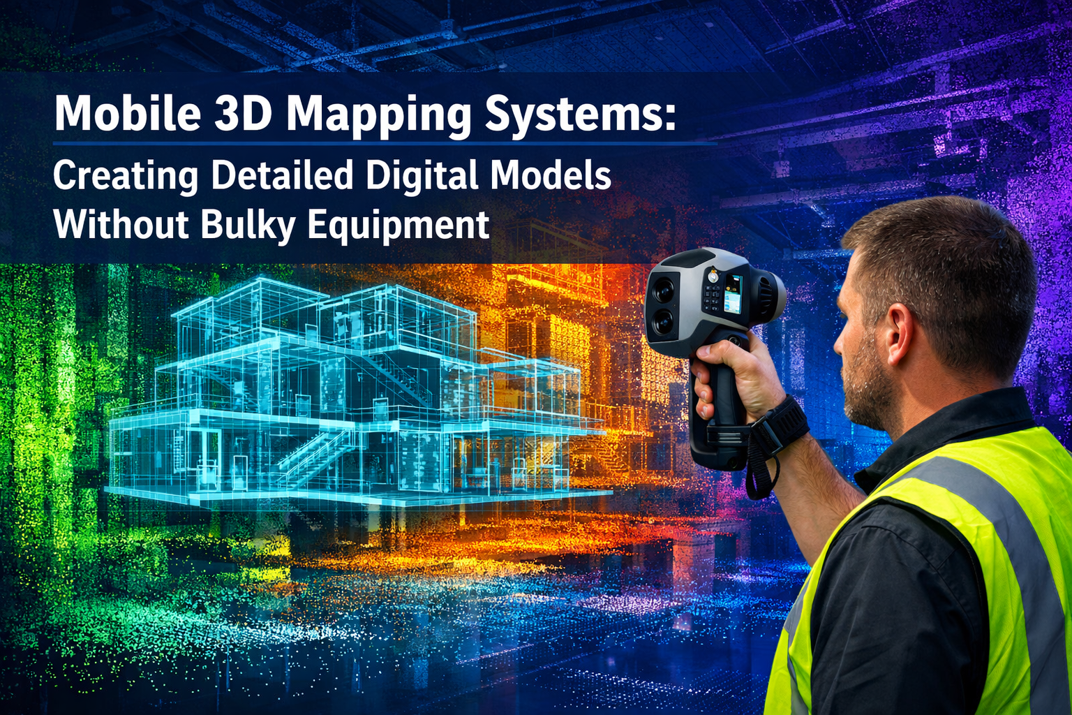
Imagine transforming a sprawling construction site, a historic building's intricate facade, or an entire city block into a precise digital twin—all without hauling heavy tripods, bulky laser scanners, or expensive specialized vehicles. This isn't science fiction; it's the reality of modern mobile 3D mapping systems that are revolutionizing how surveyors, architects, and engineers capture spatial data in 2026. 🚀
Mobile 3D mapping systems: creating detailed digital models without bulky equipment represents a fundamental shift in surveying technology. These portable solutions enable professionals to gather high-precision spatial data rapidly, whether documenting interior spaces for structural surveys or conducting comprehensive drone roof surveys. The technology has matured from experimental to essential, with the global mobile mapping system market valued at USD 51.19 billion in 2026 and projected to reach USD 116.86 billion by 2031[3].
This transformation matters because traditional surveying methods often require substantial equipment investment, multiple site visits, and weeks of post-processing time. Mobile mapping solutions compress these timelines dramatically while reducing physical strain on field crews and expanding access to organizations that previously couldn't justify the capital expenditure.
Key Takeaways
- Mobile 3D mapping systems eliminate bulky equipment by leveraging handheld scanners, smartphone LiDAR, and vehicle-mounted sensors that capture millimeter-accurate spatial data at walking or driving speeds
- Processing times have dropped by 60% thanks to AI-powered neural networks that automatically identify features like lane markings, pavement defects, and structural elements without manual editing
- Market growth reflects rapid adoption, with the mobile mapping sector expanding at 17.95% annually as organizations recognize the efficiency gains and cost savings
- Flexible deployment options range from handheld iOS devices with LiDAR to vehicle-independent systems capturing highway-speed data, enabling surveyors to match tools to project requirements
- Real-time digital reconstruction capabilities now extend beyond outdoor mapping to complete interior cabin and building environments, supporting comprehensive digital twin creation
Understanding Mobile 3D Mapping Technology and Its Evolution
Mobile 3D mapping systems represent a technological convergence of multiple sensing technologies, positioning systems, and processing algorithms designed to capture spatial information while the sensor platform moves through an environment. Unlike traditional static laser scanning that requires setting up equipment at fixed positions, mobile systems continuously collect data as operators walk, drive, or fly through spaces.
Core Components of Modern Mobile Mapping Systems
At their foundation, these systems integrate several critical technologies:
LiDAR (Light Detection and Ranging) sensors emit laser pulses that bounce off surfaces and return to the sensor, measuring distances with millimeter precision. Modern mobile systems use multi-beam scanners capable of capturing hundreds of thousands of points per second, creating dense point clouds that represent physical surfaces[3].
GNSS (Global Navigation Satellite Systems) receivers determine the sensor's position in global coordinates, while IMU (Inertial Measurement Units) track orientation and movement. Together, these positioning technologies ensure that every captured point receives accurate geospatial coordinates.
High-resolution cameras capture imagery synchronized with laser data, providing photorealistic textures and enabling feature recognition through computer vision algorithms. This visual context makes the resulting 3D models immediately interpretable by stakeholders who may not be familiar with raw point cloud data.
Processing software stitches together millions of individual measurements into coherent 3D models, applying algorithms that filter noise, align overlapping scans, and extract meaningful features from raw data.
The Shift Toward Portable Solutions
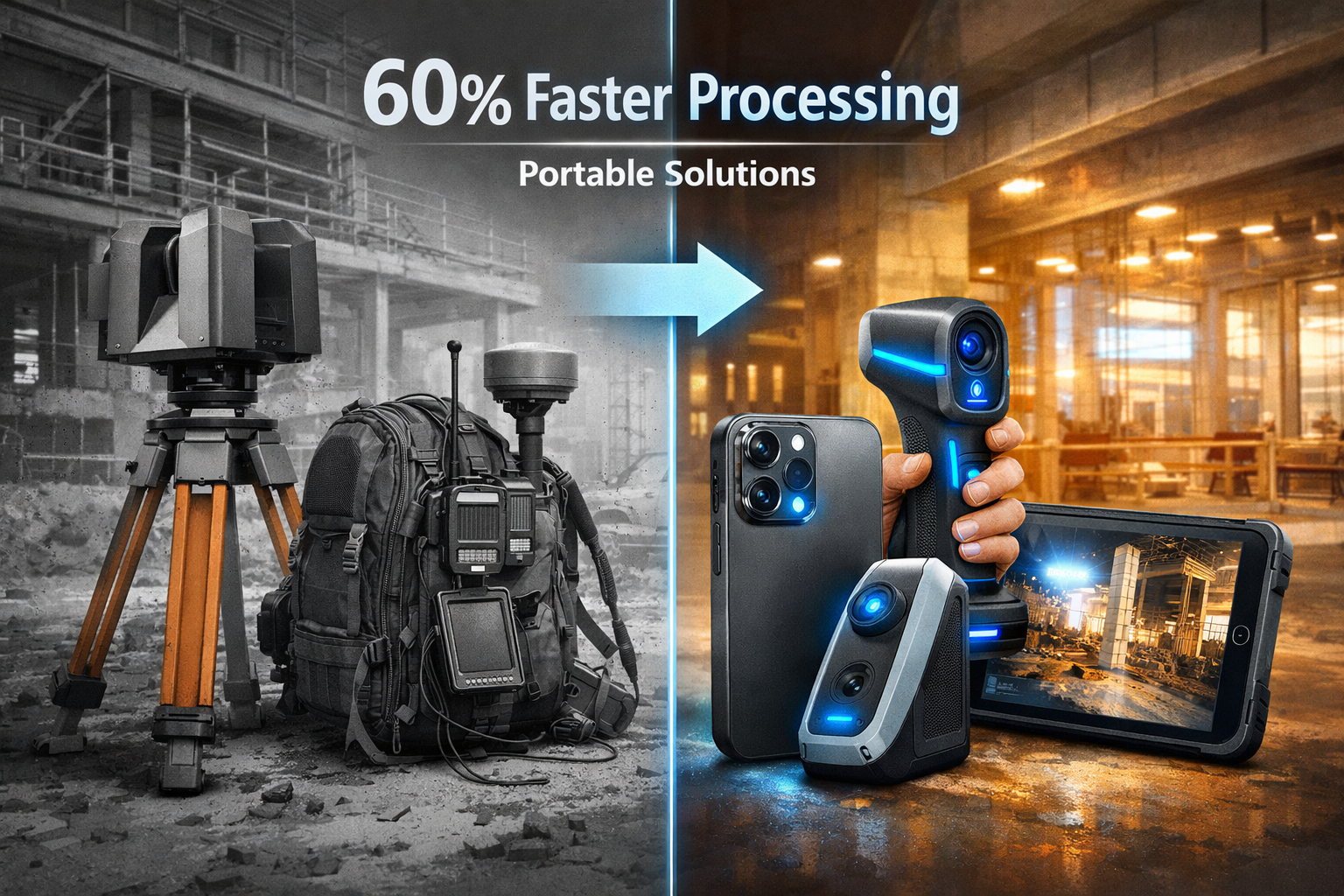
The evolution from bulky to portable represents more than miniaturization—it reflects fundamental advances in sensor technology, battery efficiency, and computational power. Early mobile mapping systems required specialized vehicles equipped with roof-mounted sensor arrays costing hundreds of thousands of dollars. These systems delivered exceptional results but remained accessible only to large organizations with substantial budgets.
Pix4D's addition of Topcon CR-H1 GNSS support to PIX4Dcatch in May 2025 exemplified this democratization trend, enabling precise handheld 3D scans on LiDAR-equipped iOS devices and dramatically reducing equipment bulk[3]. Surveyors can now achieve survey-grade accuracy using devices that fit in a backpack, opening mobile mapping to small firms and individual practitioners.
This portability revolution extends beyond outdoor applications. Seeing Machines' 3D Cabin Perception Mapping platform, debuted at CES 2026 in January, demonstrated how compact camera systems can create real-time digital reconstructions of complex interior environments[2]. The system showcased real-time digital reconstruction of vehicle cabins with 3 cameras covering 3 rows of seating, supporting up to 7 occupants[2], proving that comprehensive spatial mapping no longer requires extensive sensor arrays.
Market Growth Reflecting Practical Value
The 17.95% compound annual growth rate driving the mobile mapping market from USD 51.19 billion in 2026 toward USD 116.86 billion by 2031[3] reflects genuine operational value rather than speculative hype. Organizations across construction, transportation, utilities, and facilities management have validated that mobile mapping systems deliver measurable returns through:
- Reduced site visit requirements as comprehensive data capture in single passes eliminates return trips for additional measurements
- Faster project timelines enabling design teams to work from accurate as-built models within days rather than weeks
- Improved safety by minimizing time personnel spend in hazardous environments like active roadways or unstable structures
- Better stakeholder communication through immersive 3D visualizations that clients and contractors can explore interactively
The market expansion also reflects technology maturation. Early adopters who invested in 2020-2022 have now proven workflows and demonstrated ROI, encouraging broader adoption across industries. Professional services firms offering chartered surveying services increasingly incorporate mobile mapping as standard practice rather than specialized capability.
How Mobile 3D Mapping Systems Create Detailed Digital Models Without Bulky Equipment
The practical implementation of mobile 3D mapping systems: creating detailed digital models without bulky equipment involves understanding how different form factors serve specific applications and how recent technological advances have compressed professional-grade capabilities into increasingly compact packages.
Vehicle-Mounted Systems for Large-Scale Mapping
Trimble's MX90 vehicle-independent mobile mapping system, launched in February 2025, exemplifies the latest generation of vehicle-mounted solutions[3]. Unlike earlier systems requiring dedicated survey vehicles, the MX90 mounts to standard vehicles and captures laser scans and imagery at highway speeds for applications including crack detection and asset inspections.
This vehicle-independence represents a crucial practical advance. Organizations can deploy mobile mapping capabilities across their existing fleet rather than maintaining specialized survey vehicles. A transportation department can mount the system on a maintenance truck, capture corridor data during routine patrols, and redeploy the equipment to another vehicle the next day.
Leica Geosystems' Pegasus TRK300, introduced in May 2025, features an adaptable design with a dual-head multi-beam scanner offering 300-meter range for smart-city and infrastructure projects[3]. This extended range enables mapping entire street corridors in single passes, including building facades, overhead utilities, and roadway surfaces simultaneously.
Vehicle-mounted systems excel for:
- Transportation corridor mapping capturing roadway conditions, signage, and pavement markings
- Utility infrastructure documentation identifying above-ground assets and mapping underground feature locations
- Smart city initiatives creating comprehensive urban digital twins for planning and management
- Large campus or facility mapping where driving access permits efficient coverage
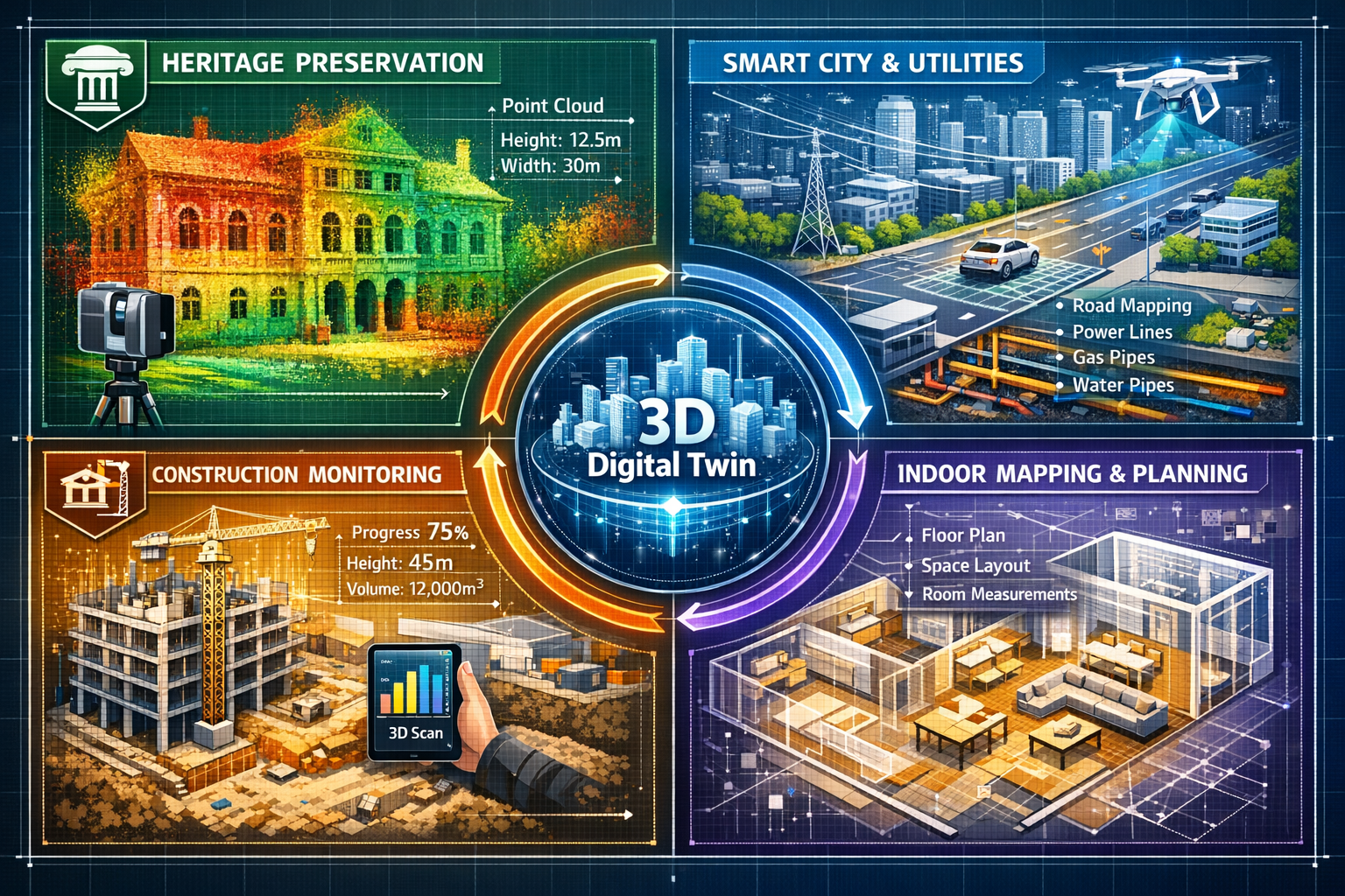
Handheld and Backpack Systems for Interior and Constrained Spaces
Where vehicles cannot access—building interiors, pedestrian areas, complex industrial facilities—handheld and backpack systems provide equivalent capability in portable form factors. These systems typically weigh 5-15 pounds and operate for 2-4 hours on battery power, enabling surveyors to map extensive interior spaces in single sessions.
The integration of LiDAR into consumer devices has created an unexpected entry point for professional applications. Modern iPhones and iPads equipped with LiDAR sensors, when paired with professional software like PIX4Dcatch with Topcon CR-H1 GNSS support, achieve accuracy suitable for many architectural and construction applications[3]. While not replacing dedicated survey equipment for all purposes, these consumer-device solutions enable rapid preliminary scans, progress documentation, and design verification at minimal equipment cost.
Professional handheld scanners offer enhanced accuracy, range, and feature sets compared to consumer devices. They typically provide:
- Survey-grade accuracy (±5-10mm) suitable for dimensional verification and as-built documentation
- Extended range (20-100 meters) enabling efficient coverage of large spaces
- Specialized features including thermal imaging, moisture detection, or structural analysis capabilities
- Professional workflows with direct integration into CAD and BIM platforms
These portable systems prove particularly valuable for building surveys and specific defect reports where documenting existing conditions accurately and comprehensively supports renovation planning and dispute resolution.
AI-Powered Processing: The Hidden Revolution
Hardware portability represents only half the equation for creating detailed digital models without bulky equipment. The processing revolution driven by artificial intelligence has proven equally transformative by compressing post-processing timelines and reducing the specialized expertise required to extract actionable information from raw scan data.
Trimble's TBC 2024.10 release in March 2025 integrated trainable neural-network models that automatically locate lane markings and pavement defects without manual point cloud editing[3]. Early adopters in state transportation departments reported 60% reductions in post-processing time, allowing field crews to redeploy within 24 hours instead of weeks[3].
This processing acceleration fundamentally changes project economics. When post-processing consumed weeks of skilled labor, the total project cost often exceeded the value delivered, limiting mobile mapping to high-value applications. With AI-automated feature extraction, the cost-benefit equation shifts dramatically, making mobile mapping economically viable for routine documentation and monitoring applications.
Competing AI advances from Mach9 and Leica reduced manual edge drafting in utility corridor mapping, broadening access for organizations with limited geomatics staff[3]. These developments address a critical adoption barrier: many organizations that would benefit from mobile mapping lack personnel with specialized point cloud processing expertise. AI-powered automation enables general surveyors and technicians to produce professional results without extensive specialized training.
Real-Time Reconstruction and Digital Twin Creation
The latest frontier in mobile mapping extends beyond data capture to real-time environmental reconstruction. Seeing Machines' 3D Cabin Perception Mapping platform demonstrated this capability at CES 2026, providing full 3D pose solutions for all occupants, including height and weight classification[2], while simultaneously detecting child seats, monitoring out-of-position conditions, and identifying random objects—all from a compact three-camera array.
The system's unified perception layer provides a powerful abstraction layer that decouples feature development from underlying camera configurations[2], allowing features to be built once and deployed seamlessly across multiple product configurations. This architectural approach reduces development effort and accelerates time to market for new capabilities.
While demonstrated in automotive contexts, this real-time reconstruction approach translates directly to building and facility mapping. Surveyors can visualize captured data immediately during collection, identifying coverage gaps or areas requiring additional detail before leaving the site. This immediate feedback loop eliminates costly return visits and ensures comprehensive documentation in single mobilizations.
Mapbox's 3D Lanes feature, unveiled at CES 2026 in January, provides true-to-life road detail to assist navigation and is now available in the Mapbox Navigation SDK for both in-vehicle and mobile use[1]. This capability extends mobile mapping from static documentation to dynamic navigation and guidance applications, creating living digital twins that support ongoing operations rather than serving merely as historical records.
Real-World Applications: Mobile 3D Mapping Systems Transforming Professional Practice
Understanding how mobile 3D mapping systems: creating detailed digital models without bulky equipment deliver practical value requires examining specific applications where the technology solves real problems and creates measurable benefits.
Construction Progress Monitoring and Quality Control
Construction projects generate constant change as work progresses from foundation to completion. Traditional documentation methods—photographs, manual measurements, and periodic surveys—capture snapshots but struggle to provide comprehensive spatial records that enable precise progress verification and quality control.
Mobile mapping systems enable weekly or even daily capture of entire project sites, creating temporal sequences of 3D models that document construction progression. Project managers can overlay current conditions against design models to identify deviations early, when corrections remain relatively inexpensive. This capability proves particularly valuable for:
Concrete placement verification comparing poured slabs and walls against design elevations and dimensions to ensure proper thickness and positioning before subsequent trades begin work. Deviations identified at this stage require minimal correction; discovered later, they may necessitate extensive rework.
MEP (mechanical, electrical, plumbing) coordination verifying that installed systems match coordinated models and identifying conflicts before concealment. A handheld scanner passed through ceiling spaces captures as-built pipe, duct, and conduit routing, enabling clash detection against planned installations.
Facade installation quality documenting panel alignment, joint widths, and overall geometry against architectural intent. Mobile mapping captures comprehensive facade conditions far more efficiently than manual measurement, enabling quality verification across entire building elevations.
Professional firms offering residential structural engineering services increasingly incorporate mobile mapping into their quality assurance protocols, providing clients with objective documentation of construction quality and compliance with specifications.
Heritage Preservation and Cultural Documentation
Historic buildings and cultural sites present unique documentation challenges. Their architectural complexity, irregular geometries, and often-fragile conditions demand non-invasive measurement methods that capture comprehensive detail without physical contact or extended access periods.
Mobile 3D mapping systems excel in these applications by capturing complete building exteriors and interiors rapidly, creating permanent digital records that support:
Conservation planning providing accurate geometric foundations for restoration designs and enabling precise material quantity estimation for repair projects. The 3D models document current conditions comprehensively, establishing baselines against which future deterioration can be measured.
Virtual access and education creating immersive digital experiences that allow remote visitors to explore sites that may be geographically distant, physically inaccessible, or too fragile to accommodate large visitor numbers. Museums and heritage organizations increasingly offer virtual tours based on mobile mapping data.
Disaster preparedness and recovery maintaining detailed pre-disaster records that support accurate reconstruction if fire, flood, or structural failure damages or destroys heritage assets. Following the 2019 Notre-Dame fire, existing laser scan data proved invaluable for restoration planning; mobile mapping makes creating such records far more practical for the thousands of heritage buildings lacking comprehensive documentation.
The portability advantage proves particularly significant for heritage applications, where access constraints often prevent bringing large equipment into historic interiors. A surveyor can capture a complex church interior with handheld scanner in hours, where traditional methods might require days of access with tripod-mounted equipment.
Infrastructure Asset Management and Inspection
Transportation agencies, utilities, and facility managers maintain vast infrastructure networks requiring regular inspection and condition assessment. Traditional inspection methods—visual observation, manual measurement, and photographic documentation—prove time-consuming, subjective, and often incomplete.
Mobile mapping transforms infrastructure management by creating comprehensive spatial inventories that support:
Roadway condition assessment automatically identifying and measuring pavement defects including cracks, potholes, rutting, and surface deterioration. AI-powered analysis of mobile mapping data produces objective condition ratings across entire road networks, supporting data-driven maintenance prioritization and budget allocation.
Bridge inspection and monitoring documenting structural geometry, identifying deterioration, and measuring deformations that may indicate structural distress. Periodic mobile mapping creates temporal datasets enabling change detection that reveals progressive deterioration requiring intervention.
Utility asset inventory locating and documenting above-ground infrastructure including poles, transformers, valves, and access points. The resulting spatial databases support outage response, maintenance planning, and regulatory compliance reporting.
Organizations conducting dilapidation surveys for commercial properties increasingly leverage mobile mapping to document property conditions comprehensively, creating defensible records that support lease negotiations and dispute resolution.
Urban Planning and Smart City Development
Cities pursuing digital transformation initiatives require comprehensive 3D models as foundations for planning, simulation, and management applications. Mobile mapping provides the efficient data collection methodology that makes city-scale 3D modeling economically feasible.
Leica's Pegasus TRK300 with its 300-meter range specifically targets smart city applications[3], enabling rapid capture of entire urban districts including building facades, street furniture, vegetation, and infrastructure. The resulting 3D city models support:
Development planning and visualization enabling planners and communities to visualize proposed developments in accurate existing context, assessing visual impact, shadow studies, and urban design compatibility before construction begins.
Infrastructure planning analyzing sight lines, clearances, and spatial relationships to optimize placement of new utilities, transportation improvements, and public amenities while avoiding conflicts with existing infrastructure.
Emergency response planning providing first responders with accurate 3D models of building layouts, access routes, and infrastructure locations to support incident planning and training exercises.
Environmental analysis modeling urban heat islands, flood risk, noise propagation, and air quality based on accurate 3D representations of built environments.
The efficiency gains from mobile mapping prove essential for maintaining current city models. Urban environments change constantly through construction, renovation, and infrastructure modifications. Annual or biennial mobile mapping updates keep digital twins synchronized with physical reality at manageable cost.
Property Survey and Valuation Applications
Professional surveyors conducting property valuations and RICS valuation services increasingly incorporate mobile 3D mapping to enhance documentation quality and reduce site time requirements.
For complex properties, particularly those with extensive grounds, multiple structures, or challenging access conditions, mobile mapping enables comprehensive documentation that would prove impractical with traditional measurement methods. Applications include:
Reinstatement cost assessment for insurance purposes, where accurate measurement of building volumes, surface areas, and architectural details supports precise reconstruction cost estimation. Reinstatement cost valuations benefit from the comprehensive documentation mobile mapping provides.
Boundary and easement documentation capturing precise property extents and identifying encroachments, setback compliance, and access route dimensions that affect property rights and values.
Lease and dilapidation surveys documenting property conditions at lease inception and termination, creating objective records that support fair assessment of tenant responsibilities and landlord obligations.
Capital gains and tax valuations providing defensible documentation of property characteristics and conditions at specific dates for capital gains tax purposes, supporting accurate basis determination and gain calculation.
The comprehensive documentation mobile mapping provides proves particularly valuable when disputes arise. A complete 3D model with photographic textures creates an objective record of conditions that can be revisited and measured repeatedly without requiring additional site access.
Selecting and Implementing Mobile 3D Mapping Solutions
Organizations considering adoption of mobile 3D mapping systems: creating detailed digital models without bulky equipment face numerous technology choices and implementation decisions. Success requires matching system capabilities to application requirements while considering budget constraints, staff capabilities, and workflow integration.
Evaluating System Specifications and Capabilities
Key technical specifications determine system suitability for specific applications:
Accuracy specifications typically range from ±5mm for high-precision architectural documentation to ±50mm for large-scale asset inventory applications. Consider both absolute accuracy (position relative to global coordinates) and relative accuracy (measurements within the scan) as different applications prioritize each differently.
Range determines maximum effective measurement distance, typically 10-100 meters for handheld systems and 100-300 meters for vehicle-mounted solutions. Longer range enables faster coverage of large spaces but may sacrifice close-range detail resolution.
Point density or measurement rate determines how many points per second the system captures, directly affecting the detail level in resulting 3D models. Higher density improves feature resolution but increases data volumes and processing requirements.
Environmental operating range specifies temperature, humidity, and lighting conditions the system tolerates. Some systems require specific lighting conditions or struggle in bright sunlight, limiting deployment flexibility.
Battery life and operating duration constrain field productivity, particularly for handheld systems. Consider whether typical projects fit within single-battery coverage or require mid-session battery swaps that interrupt data collection.
Integration with Existing Workflows and Software
Technical specifications matter less than practical workflow integration. The most capable system delivers limited value if captured data doesn't flow efficiently into design, analysis, and deliverable production workflows.
Consider compatibility with:
CAD and BIM platforms including AutoCAD, Revit, ArchiCAD, and MicroStation. Native format support or robust import/export capabilities enable efficient model integration without format conversion losses.
Point cloud processing software such as Trimble RealWorks, Leica Cyclone, or Faro Scene. Organizations with existing processing infrastructure should prioritize systems offering seamless integration.
Analysis and simulation tools including structural analysis, energy modeling, and visualization platforms. Ensure 3D models export in formats these tools consume efficiently.
Project management and collaboration platforms enabling team members to access and interact with 3D models through web browsers without specialized software installation.
Professional practices offering comprehensive services across multiple locations benefit from cloud-based workflows that enable field teams to upload data from site and office teams to begin processing immediately, compressing project timelines and improving client responsiveness.
Training and Skill Development Requirements
While modern mobile mapping systems emphasize ease of use, achieving professional results requires understanding both equipment operation and data processing workflows. Organizations should plan for:
Equipment operation training covering proper scanning techniques, quality control procedures, and troubleshooting common issues. Most manufacturers provide 1-3 day training programs; budget time for staff to practice techniques before deploying on client projects.
Processing software training teaching point cloud registration, cleaning, feature extraction, and deliverable production. This typically requires more extensive training than equipment operation, particularly for staff without prior point cloud experience.
Quality assurance protocols establishing procedures for verifying data completeness, accuracy, and deliverable quality before client delivery. Develop checklists and review processes that catch issues before they reach clients.
Ongoing skill development as software updates introduce new capabilities and AI-powered features. Budget time for staff to explore new functionality and incorporate productivity improvements into standard workflows.
Cost-Benefit Analysis and ROI Considerations
Mobile mapping system investments range from a few thousand dollars for consumer-device solutions to over $100,000 for high-end vehicle-mounted systems. Justifying these investments requires realistic assessment of:
Equipment costs including the mapping system itself plus necessary accessories (batteries, mounting hardware, protective cases) and required software licenses for processing and deliverable production.
Operational cost savings from reduced site time, fewer return visits, and compressed project timelines. Quantify these savings based on current project costs and realistic efficiency improvements.
Revenue opportunities from new service offerings enabled by mobile mapping capabilities. Can the organization offer services previously outsourced or pursue projects previously declined due to methodology limitations?
Competitive positioning benefits from offering advanced capabilities that differentiate the organization from competitors still using traditional methods. While difficult to quantify precisely, competitive advantage drives long-term business success.
Risk reduction through better documentation that supports dispute resolution and reduces professional liability exposure. Comprehensive 3D records provide objective evidence of conditions and work quality.
Many organizations find that starting with lower-cost handheld or consumer-device solutions enables capability development and workflow refinement before committing to higher-end systems. This staged approach reduces initial investment while providing practical experience that informs subsequent equipment decisions.
Future-Proofing Technology Investments
Mobile mapping technology continues evolving rapidly. The 17.95% annual market growth[3] reflects not just expanding adoption but continuous capability improvements. Organizations should consider:
Upgrade paths and expandability including whether systems support hardware upgrades (improved sensors, extended range) or primarily require complete replacement when capabilities prove insufficient.
Manufacturer stability and support evaluating whether the vendor demonstrates commitment to ongoing product development and customer support. Established manufacturers with broad product lines typically provide more reliable long-term support than startups with single products.
Software development trajectory assessing whether processing software receives regular updates introducing new capabilities, particularly AI-powered automation that improves productivity without hardware changes.
Industry standard compatibility preferring systems that support open formats and industry-standard workflows over proprietary approaches that create vendor lock-in and limit flexibility.
The rapid advancement in AI-powered processing suggests that organizations may achieve greater long-term value by investing in capable hardware with reasonable upgrade paths while expecting processing software to deliver continuous productivity improvements through algorithmic advances rather than hardware replacement.
Overcoming Common Challenges and Limitations
While mobile 3D mapping systems: creating detailed digital models without bulky equipment deliver substantial benefits, successful implementation requires understanding and addressing inherent limitations and common challenges.
Accuracy Considerations and Validation
Mobile mapping systems trade some absolute accuracy for efficiency and portability compared to static laser scanning. Understanding these tradeoffs enables appropriate technology selection and quality assurance:
GNSS dependency means outdoor mobile mapping accuracy depends on satellite visibility and positioning quality. Urban canyons, tree canopy, and building overhangs can degrade positioning, introducing errors in the resulting 3D models. Surveyors should establish ground control points and verify accuracy against known references, particularly in GNSS-challenged environments.
Accumulated drift in SLAM (Simultaneous Localization and Mapping) based systems can introduce distortions over extended scan sessions, particularly in large buildings or facilities lacking distinctive geometric features for algorithm registration. Closing loops by returning to starting locations and incorporating survey control points mitigates drift accumulation.
Surface properties affect measurement quality, with highly reflective, transparent, or dark surfaces challenging for laser-based systems. Surveyors should recognize these limitations and supplement mobile mapping with targeted traditional measurements where surface properties prevent reliable laser returns.
Movement speed influences point density and data quality. Faster movement covers ground efficiently but reduces point density and may introduce motion blur in synchronized imagery. Operators should match speed to required detail levels and application accuracy requirements.
Data Management and Storage Requirements
Mobile mapping generates substantial data volumes—often hundreds of gigabytes per project—creating storage, transfer, and management challenges:
Field data backup requires robust procedures ensuring captured data reaches secure storage before field equipment returns to service. Lost data typically cannot be recaptured without significant cost and schedule impact.
Processing hardware requirements demand substantial computational resources, particularly for AI-powered feature extraction and large-dataset processing. Organizations should budget for workstations with high-end processors, substantial RAM (64GB+), and professional graphics cards.
Long-term archiving of both raw scan data and processed deliverables requires storage infrastructure and data management protocols. Consider whether projects may require revisiting years later and establish retention policies balancing storage costs against potential future value.
Data transfer logistics for large datasets can prove challenging, particularly when field teams work remotely. Cloud upload from field locations may prove impractical with limited bandwidth; physical drive shipping may introduce delays. Develop transfer workflows appropriate to project timelines and data volumes.
Environmental and Operational Constraints
Mobile mapping systems operate effectively across wide conditions but face limitations in extreme environments:
Lighting conditions affect camera-based systems and some laser scanners. Very bright sunlight can overwhelm sensors; complete darkness prevents photographic texture capture. Plan data collection for appropriate lighting conditions or supplement with artificial lighting where necessary.
Weather limitations including rain, snow, and fog can prevent effective data capture or damage equipment. Most systems specify operating humidity and precipitation limits; respect these constraints to avoid equipment damage and data quality issues.
Access and safety constraints may limit where mobile mapping can deploy despite theoretical capability. Hazardous environments, confined spaces, and areas with access restrictions may require alternative documentation methods or specialized safety protocols.
Motion requirements mean mobile systems must move through environments to capture data. Spaces too small for operator movement or situations where movement would disturb ongoing operations may necessitate static scanning approaches.
Skill Gaps and Learning Curves
Organizations new to mobile mapping often underestimate the expertise required for professional results:
Scan planning requires understanding how to position scan paths for complete coverage, appropriate overlap, and sufficient control for accurate registration. Poor planning results in coverage gaps requiring costly return visits or incomplete deliverables.
Quality control during collection enables identifying and correcting issues before leaving the site. Operators should verify data completeness and quality systematically rather than discovering problems during office processing when site access may no longer be available.
Processing expertise separates adequate results from professional deliverables. Understanding registration algorithms, point cloud cleaning techniques, and feature extraction methods enables producing accurate, clean models efficiently.
Deliverable production matching client requirements and industry standards requires understanding appropriate formats, detail levels, and presentation methods for different applications and audiences.
Organizations should plan for 3-6 months of capability development before achieving full productivity with new mobile mapping systems. Starting with internal projects or lower-stakes applications enables skill building before deploying on critical client work.
The Future of Mobile 3D Mapping: Emerging Trends and Opportunities
The trajectory of mobile 3D mapping systems: creating detailed digital models without bulky equipment points toward continued miniaturization, automation, and integration with broader digital workflows.
AI and Machine Learning Advancements
The 60% post-processing time reduction achieved through neural network integration in Trimble TBC[3] represents early-stage AI application. Future developments will likely deliver:
Automated feature classification identifying and categorizing objects (doors, windows, furniture, equipment) without manual intervention, creating intelligent 3D models with semantic information rather than simple geometric representations.
Defect detection and analysis automatically identifying structural issues, deterioration, and maintenance requirements from scan data, transforming mobile mapping from documentation tool to diagnostic instrument.
Predictive modeling analyzing temporal scan sequences to identify deterioration trends and predict future maintenance requirements, enabling proactive intervention before failures occur.
Real-time processing eliminating the distinction between data capture and deliverable production, with final 3D models available immediately upon scan completion rather than requiring hours or days of office processing.
Integration with Augmented and Virtual Reality
Mobile mapping data provides ideal foundations for immersive AR and VR applications:
On-site AR guidance overlaying design models on physical environments through tablet or headset displays, enabling construction workers to visualize intended results and verify installation accuracy in real-time.
Remote collaboration allowing distributed teams to meet virtually within accurate 3D representations of project sites, discussing issues and making decisions without travel requirements.
Training and simulation using accurate facility models for emergency response training, equipment operation instruction, and maintenance procedure development in safe virtual environments.
Client engagement providing immersive experiences that help non-technical stakeholders understand proposed changes and make informed decisions about design alternatives.
Autonomous and Robotic Deployment
Current mobile mapping requires human operators to carry or drive equipment through environments. Emerging autonomous solutions will enable:
Robotic indoor mapping with autonomous mobile robots navigating buildings independently, capturing comprehensive interior documentation without human supervision.
Drone-based exterior capture combining aerial photogrammetry with LiDAR for rapid building and site documentation. While drone roof surveys already prove valuable for specific applications, integration with ground-based mobile mapping will enable complete property documentation from single deployments.
Continuous monitoring through permanently installed or periodically deployed autonomous systems that update digital twins continuously, maintaining synchronized representations of dynamic environments.
Democratization and Accessibility
The integration of LiDAR into consumer devices signals broader technology democratization:
Consumer-grade professional tools will continue improving, enabling small organizations and individual practitioners to access capabilities previously requiring substantial capital investment.
Cloud-based processing will shift computational requirements from local workstations to cloud infrastructure, reducing hardware barriers and enabling pay-per-use models that convert capital expenses to operational costs.
Simplified workflows through continued AI automation will reduce expertise requirements, enabling general surveyors and technicians to produce professional results without specialized training.
Open data ecosystems will emerge as municipalities and organizations share 3D city models and infrastructure data, creating public resources that support planning, development, and research applications.
These trends suggest that mobile 3D mapping will transition from specialized capability to standard practice across surveying, architecture, engineering, and construction disciplines. Organizations that develop capabilities now position themselves to lead as the technology becomes industry standard rather than competitive differentiator.
Conclusion: Embracing Mobile 3D Mapping for Competitive Advantage

Mobile 3D mapping systems: creating detailed digital models without bulky equipment represents far more than incremental improvement over traditional surveying methods. This technology fundamentally transforms how professionals capture, analyze, and communicate spatial information, delivering efficiency gains that reshape project economics while expanding the scope of what documentation can achieve.
The market trajectory—USD 51.19 billion in 2026 growing toward USD 116.86 billion by 2031[3]—reflects genuine operational value validated across diverse industries and applications. Organizations that have implemented mobile mapping report not just cost savings and timeline compression but qualitative improvements in decision-making quality, stakeholder communication, and risk management.
Actionable Next Steps for Implementation
Organizations considering mobile mapping adoption should pursue a structured approach:
1. Assess Current Workflows and Pain Points 📊
Identify specific projects or processes where traditional methods prove time-consuming, expensive, or inadequate. Mobile mapping delivers greatest value where it solves real problems rather than serving as technology for its own sake.
2. Define Requirements and Success Criteria 🎯
Establish specific accuracy, coverage, deliverable, and timeline requirements that mobile mapping must meet. Clear criteria enable objective technology evaluation and prevent pursuing capabilities that exceed actual needs.
3. Explore Entry-Level Options 📱
Consider starting with consumer-device solutions or equipment rentals to develop familiarity with workflows and validate business cases before committing to major capital investments. Many organizations discover that modest initial investments deliver substantial value.
4. Develop Expertise Systematically 🎓
Invest in training and allocate time for skill development. Plan for learning curves and start with lower-stakes applications before deploying on critical projects. Expertise development determines success more than equipment selection.
5. Establish Quality Assurance Protocols ✅
Develop systematic procedures for verifying data quality, accuracy, and completeness. Quality assurance should occur both during field collection and office processing to catch issues when correction remains practical.
6. Monitor Technology Evolution 🔍
Stay informed about AI-powered processing advances, new equipment releases, and emerging best practices. The rapid pace of development means capabilities and economics continue improving; periodic reassessment ensures organizations leverage latest advances.
For professional surveyors, architects, engineers, and construction managers, mobile 3D mapping has evolved from experimental technology to essential capability. The question is no longer whether to adopt but how quickly to develop proficiency and integrate into standard practice. Organizations that embrace these systems now position themselves to deliver superior service quality, competitive pricing, and faster project delivery—advantages that translate directly to market success.
The elimination of bulky equipment barriers means mobile mapping accessibility extends far beyond large organizations with substantial capital budgets. Small firms, individual practitioners, and specialized consultancies can now access professional-grade capabilities that were previously out of reach. This democratization creates opportunities for differentiation and competitive advantage regardless of organization size.
As AI-powered automation continues reducing processing expertise requirements and equipment costs decline through technology maturation, mobile 3D mapping will become standard practice across the built environment professions. The organizations that develop capabilities now will lead this transition; those that delay risk finding themselves at competitive disadvantage as clients come to expect comprehensive 3D documentation as standard deliverable rather than premium offering.
Whether documenting heritage buildings for preservation, monitoring construction progress, managing infrastructure assets, or conducting property valuations, mobile 3D mapping delivers measurable value through better data captured more efficiently. The technology has matured beyond early-adopter phase to proven, reliable capability ready for mainstream deployment.
The future of spatial documentation is mobile, intelligent, and accessible. Organizations that recognize this reality and act accordingly will thrive in the increasingly digital built environment industry.
References
[1] Watch – https://www.youtube.com/watch?v=918Xgc_CLjo
[2] Seeing Machines Breaks New Ground At Ces 2026 With 3d Cabin Perception Mapping 302659625 – https://www.prnewswire.com/news-releases/seeing-machines-breaks-new-ground-at-ces-2026-with-3d-cabin-perception-mapping-302659625.html
[3] Mobile Mapping System Market Industry – https://www.mordorintelligence.com/industry-reports/mobile-mapping-system-market-industry
[4] Real World Applications Of Mobile Mapping Systems – https://castlesurveys.co.uk/real-world-applications-of-mobile-mapping-systems/
[5] roboticstomorrow – https://www.roboticstomorrow.com/article/2026/01/3d-mobile-mapping-for-digital-twins-camera-features-that-ensure-accuracy/26045
[6] Mobile 3d Mapping Creating Digital Twins Without Bulky Equipment – https://nottinghillsurveyors.com/blog/mobile-3d-mapping-creating-digital-twins-without-bulky-equipment
[7] Mobile Mapping Market Insights Autonomous Vehicles 3 D Data And Industry Forecast To 2033 – https://vocal.media/futurism/mobile-mapping-market-insights-autonomous-vehicles-3-d-data-and-industry-forecast-to-2033