The construction industry has witnessed a seismic shift in how property surveys are conducted, shared, and utilized. Gone are the days when surveyors returned from the field with stacks of paper notes, only to spend hours manually transferring data into reports that quickly became outdated. In 2026, Cloud-Based Platforms for Collaborative Property Surveys: Instant Access and Real-Time Revisions have revolutionized the way professionals work, enabling browser-based 3D visualization and seamless stakeholder synchronization that dramatically reduces errors throughout construction workflows.
Imagine a scenario where a chartered surveyor conducting a structural survey discovers a critical defect during an on-site inspection. Within seconds, that information appears on the screens of architects, engineers, contractors, and property owners—all viewing the same 3D model with annotated defects, measurements, and photographic evidence. This isn't science fiction; it's the reality of modern surveying technology that's transforming how the built environment industry operates.
The integration of cloud technology with property surveying has created unprecedented opportunities for collaboration, accuracy, and efficiency. As digital transformation accelerates across the construction sector, understanding these platforms has become essential for professionals who want to deliver superior results while maintaining competitive advantage.
Key Takeaways
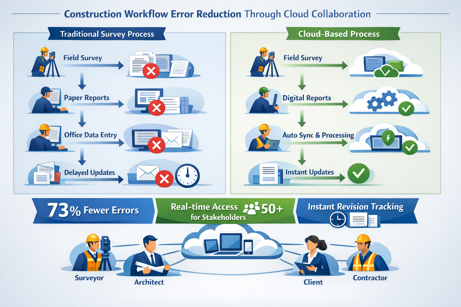
- 🌐 Cloud-based survey platforms enable instant data synchronization between field surveyors and office teams, eliminating delays and reducing transcription errors by up to 73%
- 📊 Browser-based 3D visualization allows unlimited stakeholders to view, annotate, and collaborate on property surveys simultaneously without specialized software installations
- ⚡ Real-time revision capabilities ensure all project participants work from the most current survey data, preventing costly construction mistakes and rework
- 🔄 Automated workflows streamline the survey process from data collection to final reporting, significantly reducing project timelines and administrative overhead
- 🛡️ Enhanced accuracy and accountability through version control, audit trails, and collaborative annotation tools that document every change and decision
Understanding Cloud-Based Platforms for Collaborative Property Surveys: Instant Access and Real-Time Revisions

What Makes Cloud Survey Platforms Different?
Traditional property surveying relied heavily on disconnected tools and manual processes. Surveyors would collect data in the field using various instruments, record observations in notebooks or standalone devices, return to the office, and then spend considerable time transferring that information into CAD software or report templates. Each handoff created opportunities for errors, delays, and miscommunication.
Cloud-based survey platforms fundamentally change this workflow by creating a continuous digital thread from initial data capture through final deliverable. These systems operate on several core principles:
- Centralized data storage that eliminates version confusion and ensures single-source truth
- Automatic synchronization that updates all connected devices and users instantly
- Web-based access that removes software installation barriers and enables universal participation
- Collaborative tools that allow multiple professionals to work simultaneously on the same survey
- Mobile-first design optimized for field conditions and on-site decision-making
According to industry analysis, the shift toward digital surveying workflows has accelerated significantly, with professionals recognizing that better technology directly translates to competitive advantages [5]. The ability to provide clients with instant access to survey findings while work is still in progress has become a significant differentiator in the marketplace.
Core Components of Modern Cloud Survey Systems
Effective cloud-based platforms for collaborative property surveys integrate several technological components that work together seamlessly:
| Component | Function | Benefit |
|---|---|---|
| Mobile Data Collection Apps | Field surveyors capture measurements, photos, notes, and annotations on tablets or smartphones | Eliminates paper forms and manual data entry errors |
| Cloud Storage Infrastructure | Secure servers automatically receive, store, and backup all survey data | Prevents data loss and enables access from anywhere |
| 3D Visualization Engine | Converts survey data into interactive browser-based models | Stakeholders understand complex spatial information without technical training |
| Collaboration Tools | Comment threads, markup tools, approval workflows, and notifications | Streamlines communication and decision-making processes |
| API Integrations | Connects with CAD software, project management tools, and other systems | Creates seamless workflows across the entire project ecosystem |
| Version Control System | Tracks every change, revision, and update with timestamps and user attribution | Maintains complete audit trail and accountability |
When conducting commercial building surveys, these integrated components enable surveyors to deliver comprehensive reports that stakeholders can access and interact with immediately, rather than waiting days or weeks for traditional deliverables.
The Technology Behind Instant Access
The "instant access" promise of cloud-based platforms relies on sophisticated technical architecture designed for reliability and performance. Modern survey platforms utilize:
Edge computing capabilities that allow field devices to function even without continuous internet connectivity, automatically syncing data when connections are restored. This ensures surveyors working in remote locations or buildings with poor signal can continue collecting information without interruption.
Progressive web applications (PWAs) that function like native apps but run entirely in web browsers, eliminating the need for app store downloads and ensuring all users always have the latest version. When a commercial property surveyor updates a finding, every stakeholder viewing that survey sees the change within seconds.
Content delivery networks (CDNs) that distribute survey data across multiple geographic servers, ensuring fast loading times regardless of where team members are located. A client in London and a contractor in Manchester can both access high-resolution 3D models with minimal latency.
Responsive design frameworks that automatically adapt survey visualizations to any screen size, from smartphones to large presentation displays, maintaining clarity and usability across all devices.
These technological foundations enable the seamless experiences that professionals now expect when conducting modern property surveys [1].
How Cloud-Based Platforms for Collaborative Property Surveys Enable Real-Time Collaboration
Simultaneous Multi-User Access and Editing
One of the most transformative aspects of cloud-based survey platforms is the ability for multiple professionals to work on the same survey simultaneously—a capability that fundamentally changes project dynamics.
In traditional workflows, survey data moved sequentially through various hands: the surveyor collected data, a CAD technician created drawings, an engineer reviewed findings, and an architect incorporated information into designs. Each handoff created delays and opportunities for miscommunication.
Modern cloud platforms enable parallel workflows where:
- Field surveyors capture and upload data continuously throughout site visits
- Office-based analysts begin processing information while field work continues
- Engineers review preliminary findings and request additional measurements in real-time
- Architects access survey data immediately to inform design decisions
- Clients monitor progress and provide feedback without waiting for formal presentations
Survey 123, a leading platform in this space, allows surveyors to fill out forms and collect data that automatically syncs to the cloud while still on-site, enabling immediate access for all authorized team members. This capability has proven particularly valuable when conducting drone roof surveys, where aerial imagery can be reviewed and analyzed by structural engineers while the drone operator is still in the field.
Real-Time Revision Tracking and Version Control
The construction industry has long struggled with version control issues—outdated plans leading to costly mistakes, conflicting information between documents, and uncertainty about which dataset represents current reality. Cloud-based platforms solve these problems through sophisticated revision management.
Automatic version tracking creates a complete history of every change made to survey data:
- Who made the change
- When it was made
- What specifically was modified
- Why the change was necessary (through linked comments or annotations)
This transparency creates accountability and provides invaluable documentation for resolving disputes or understanding project evolution. When multiple stakeholders review a specific defect report, they can see exactly how findings evolved from initial observation through final conclusions.
Real-time synchronization ensures that when a surveyor updates a measurement or adds a new observation, that change propagates instantly to all connected users. Visual indicators show when colleagues are viewing or editing the same sections, preventing conflicting modifications and enabling coordinated work.
Branching and merging capabilities allow teams to explore alternative scenarios or solutions without affecting the main survey dataset, then selectively incorporate approved changes back into the primary version—similar to how software developers manage code.
Stakeholder Communication and Notification Systems
Effective collaboration requires more than just shared access to data; it demands intelligent communication systems that keep relevant parties informed without creating notification overload.
Modern cloud survey platforms incorporate smart notification engines that:
✅ Alert specific stakeholders when survey sections relevant to their responsibilities are updated
✅ Notify team members when their input or approval is required
✅ Send deadline reminders for review cycles or decision points
✅ Provide daily or weekly digest summaries of survey activity
✅ Allow customizable notification preferences to match individual working styles
Integrated commenting and annotation tools create threaded discussions directly attached to specific survey elements. Rather than exchanging emails with vague references to "the crack in the south wall," team members can place comments directly on the 3D model at the exact location being discussed, attaching photos, measurements, or reference documents.
@mention functionality allows users to direct questions or requests to specific individuals, ensuring critical information reaches the right people. When a surveyor identifies a potential subsidence issue during a subsidence survey, they can immediately tag the structural engineer and geotechnical specialist for expert input.
Status workflows provide visual indicators of survey completion, review stages, and approval processes, giving project managers clear visibility into progress and bottlenecks without requiring constant status meetings.
Reducing Errors in Construction Workflows Through Cloud-Based Platforms for Collaborative Property Surveys
The Cost of Survey Errors in Traditional Workflows
Survey inaccuracies and miscommunications have historically been among the most expensive problems in construction projects. When foundation excavation begins based on incorrect site measurements, or when structural repairs target the wrong locations due to unclear defect documentation, the financial and schedule impacts cascade throughout the entire project.
Common error sources in traditional surveying include:
- Manual transcription mistakes when transferring field notes to digital formats
- Misinterpretation of handwritten observations or sketches
- Outdated information being used because newer surveys weren't distributed
- Measurement unit confusion (metric vs. imperial)
- Coordinate system inconsistencies between different survey datasets
- Lost or damaged paper records
- Ambiguous verbal descriptions of defect locations
- Time delays allowing site conditions to change before surveys are reviewed
Research into digital surveying workflows suggests that organizations doubling down on digital transformation are experiencing significant improvements in accuracy and efficiency [6]. The elimination of manual data entry alone can reduce errors by substantial margins, while real-time collaboration prevents the use of outdated information.
How Cloud Platforms Eliminate Common Error Points
Cloud-based survey platforms address traditional error sources through multiple mechanisms:
Direct digital capture eliminates transcription errors entirely. When a surveyor measures a wall thickness using a laser distance meter connected to a tablet running survey software, that measurement flows directly into the database without human interpretation or re-entry. The same applies to photographic evidence, GPS coordinates, and sensor readings.
Structured data collection through customizable forms ensures consistency and completeness. Rather than free-form note-taking that might omit critical details, surveyors work through standardized checklists that prompt for all necessary information. When conducting a schedule of dilapidations, the platform can enforce collection of specific data points for each defect type.
Automated validation rules flag potential errors immediately. If a surveyor enters a ceiling height that's physically impossible, or if GPS coordinates fall outside the expected property boundaries, the system alerts them to double-check before proceeding. This real-time quality control prevents errors from propagating through the project.
Single source of truth architecture means there's never confusion about which dataset is current. Everyone accesses the same centralized database, eliminating scenarios where different team members work from different versions of survey information.
Visual verification through 3D models and photographic documentation reduces ambiguity. Rather than relying on text descriptions like "moderate cracking in northeast corner," stakeholders can view high-resolution photos and 3D visualizations showing exact locations and severity.
Browser-Based 3D Visualization: Seeing is Understanding
Perhaps the most significant error-reduction feature of modern cloud survey platforms is browser-based 3D visualization that allows all stakeholders to literally see the same thing simultaneously.
Traditional survey deliverables—text reports, 2D floor plans, and elevation drawings—require technical expertise to interpret correctly. Clients, contractors, and even some professionals struggle to translate 2D representations into accurate mental models of 3D reality. This interpretation gap creates misunderstandings that lead to errors.
Interactive 3D models accessible through any web browser eliminate this gap:
- Spatial understanding: Stakeholders can rotate, zoom, and navigate through virtual representations of surveyed properties, understanding spatial relationships intuitively
- Defect visualization: Structural issues, dampness, or other defects appear exactly where they exist in the physical building, with color-coding for severity
- Measurement tools: Users can measure distances, areas, and volumes directly within the 3D environment, verifying dimensions independently
- Layer control: Different data types (structural elements, mechanical systems, defects, annotations) can be toggled on/off to focus attention
- Comparison views: Before/after scenarios or alternative solutions can be displayed side-by-side for informed decision-making
When conducting property valuations, the ability to provide clients with interactive 3D visualizations of surveyed properties significantly improves their understanding of factors affecting value, leading to more informed decisions and fewer disputes.
Case Study: Construction Workflow Error Reduction
Consider a typical scenario involving a commercial property renovation project:
Traditional Workflow Challenges:
- Surveyor completes site inspection over two days
- Returns to office and spends three days producing report
- Report distributed via email to 15 stakeholders
- Architect discovers ambiguity about load-bearing wall location
- Email exchange with surveyor takes two days to resolve
- Meanwhile, contractor proceeds with demolition based on preliminary information
- Load-bearing wall is damaged, requiring emergency structural repairs
- Project delayed by three weeks, £45,000 in additional costs
Cloud-Based Platform Workflow:
- Surveyor captures data continuously during site inspection, syncing to cloud in real-time
- Architect reviews preliminary findings while surveyor still on-site
- Question about load-bearing wall appears as annotation on 3D model
- Surveyor receives notification, takes additional measurements and photos immediately
- Updated information appears in architect's view within minutes
- Contractor accesses final verified survey before beginning demolition
- Work proceeds correctly on first attempt
- No delays, no additional costs, project completed on schedule
This scenario illustrates how Cloud-Based Platforms for Collaborative Property Surveys: Instant Access and Real-Time Revisions fundamentally transform project outcomes by eliminating the communication gaps and time delays that create opportunities for costly mistakes.
Advanced Features of 2026 Cloud Survey Platforms
AI-Powered Analysis and Automation
The cloud survey platforms available in 2026 incorporate sophisticated artificial intelligence capabilities that extend far beyond simple data storage and sharing. These systems actively analyze survey data to provide insights and automation that enhance surveyor productivity and accuracy.
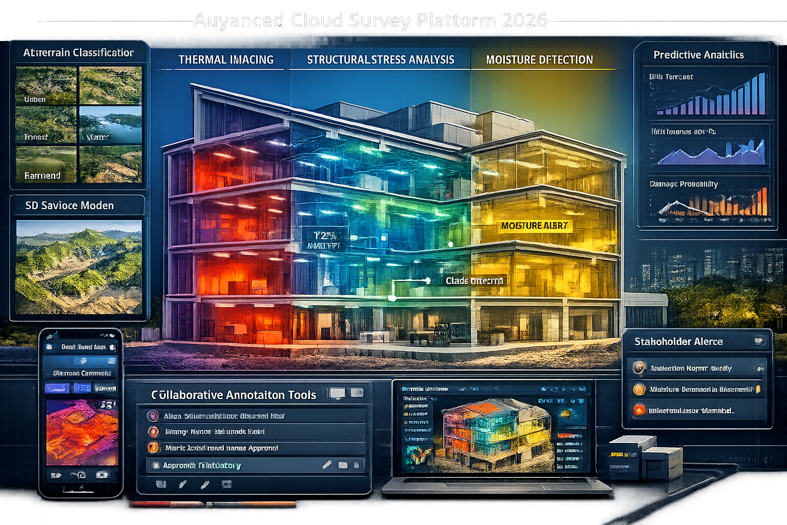
Automated terrain classification uses machine learning algorithms to instantly categorize ground surfaces, vegetation types, and built features from photographic and LiDAR data. What previously required hours of manual interpretation now happens in seconds, allowing surveyors to focus on higher-value analysis and decision-making.
Preliminary surface model generation creates initial 3D representations of surveyed properties automatically from point cloud data, providing immediate visualization while surveyors refine details. This capability proves particularly valuable when conducting roof surveys, where complex geometries can be visualized immediately.
Defect detection algorithms analyze photographic evidence to identify potential issues like cracks, moisture stains, or material deterioration, flagging areas that require closer surveyor attention. While these AI systems don't replace professional judgment, they serve as valuable quality control tools that ensure nothing is overlooked.
Predictive analytics leverage historical survey data to forecast future conditions:
- Slope erosion projections based on topography and drainage patterns
- Water flow simulations predicting flood risk or drainage issues
- Vegetation pattern changes affecting property boundaries or structures
- Infrastructure stress testing identifying potential failure points before they occur
These advanced capabilities transform surveys from static snapshots into dynamic tools for proactive property management and planning [1].
Integration with Construction Management Ecosystems
Modern cloud survey platforms don't exist in isolation—they integrate seamlessly with the broader ecosystem of construction technology tools through robust APIs (Application Programming Interfaces) and standardized data formats.
BIM (Building Information Modeling) integration allows survey data to flow directly into architectural and engineering models. When a surveyor captures as-built conditions of an existing building, that information can automatically update the BIM model, ensuring design work proceeds from accurate baseline information.
Project management platform connections link survey milestones, findings, and deliverables with overall project schedules and task management systems. When a survey identifies unexpected conditions requiring design changes, those impacts automatically flow into project timelines and resource planning.
Financial system integration connects survey findings with cost estimation and budgeting tools. Discovery of additional defects during a commercial dilapidation survey can trigger automatic cost estimate updates and budget revision workflows.
Document management system synchronization ensures survey reports, photos, and supporting documentation are automatically filed in appropriate project folders with proper metadata and version control.
Platforms like ArcGIS Online exemplify this integration approach, enabling real-time storage, management, and data sharing across teams while connecting with numerous third-party construction and engineering tools.
Mobile-First Design for Field Productivity
The effectiveness of cloud survey platforms ultimately depends on how well they function in the challenging conditions where surveyors actually work—construction sites, remote properties, and existing buildings with limited connectivity and harsh environmental conditions.
2026 platforms prioritize mobile-first design with features specifically addressing field requirements:
📱 Offline functionality: Complete survey capabilities continue working without internet connectivity, with automatic synchronization when connections are restored
🔋 Battery optimization: Efficient code and data management extend device battery life during long survey sessions
☀️ Sunlight-readable interfaces: High-contrast displays and adaptive brightness ensure usability in bright outdoor conditions
🧤 Glove-friendly controls: Large touch targets and simplified interactions accommodate work gloves and cold-weather gear
💧 Ruggedized compatibility: Support for industrial-grade tablets and smartphones designed for construction environments
🎯 GPS integration: Automatic location tagging of observations and measurements
📸 Advanced camera features: HDR photography, panoramic capture, and photogrammetry capabilities built directly into survey workflows
When using land survey apps, getting started requires understanding how mobile-first design principles translate into practical field productivity [3]. The best platforms make complex surveying tasks feel intuitive and natural on mobile devices.
Security, Compliance, and Data Governance
As survey data becomes increasingly digital and cloud-based, security and compliance considerations grow more critical. Property surveys often contain sensitive information about structural defects, property values, ownership details, and strategic development plans that require robust protection.
Enterprise-grade security features in modern cloud survey platforms include:
- End-to-end encryption for data in transit and at rest
- Multi-factor authentication preventing unauthorized access
- Role-based access controls ensuring stakeholders see only information appropriate to their responsibilities
- Audit logging tracking every data access and modification for compliance and security investigations
- Automated backup and disaster recovery protecting against data loss
- GDPR compliance for personal data protection in European jurisdictions
- SOC 2 certification demonstrating security control effectiveness
- Data residency options allowing organizations to specify geographic storage locations
Compliance automation helps surveyors meet regulatory and professional requirements:
- Automatic retention of records for required periods
- Template enforcement ensuring reports include all mandatory elements
- Professional indemnity insurance integration documenting coverage
- Chain of custody tracking for legal proceedings
- Standards compliance checking (RICS Red Book, building regulations, etc.)
These security and compliance capabilities allow organizations to embrace cloud technology confidently while meeting their professional and legal obligations.
Selecting and Implementing Cloud-Based Survey Platforms
Evaluating Platform Options for Your Organization
The cloud survey platform market has matured significantly, offering numerous options ranging from general-purpose solutions to specialized tools for specific survey types. Selecting the right platform requires careful evaluation of organizational needs and platform capabilities.
Key evaluation criteria include:
1. Survey Type Specialization
Does the platform excel at your primary survey types? Some platforms optimize for topographic surveys, others for building condition assessments, and still others for specialized applications like party wall surveys or dilapidations.
2. Integration Capabilities
How well does the platform connect with your existing tools? Evaluate compatibility with your CAD software, project management systems, accounting software, and other critical tools.
3. Scalability and Performance
Can the platform handle your largest projects? Test with realistic data volumes—large point clouds, hundreds of high-resolution photos, complex 3D models—to ensure performance remains acceptable.
4. User Experience
How quickly can team members become productive? Platforms with intuitive interfaces and minimal learning curves deliver faster ROI than those requiring extensive training.
5. Mobile Capabilities
Does the mobile experience match field requirements? Evaluate offline functionality, battery consumption, and usability in actual site conditions.
6. Customization Options
Can you adapt the platform to your workflows? Look for customizable forms, templates, and reporting tools that match your deliverable standards.
7. Support and Training
What resources are available for onboarding and troubleshooting? Evaluate documentation quality, training programs, and technical support responsiveness.
8. Pricing Structure
Does the cost model align with your business? Consider per-user subscriptions, per-project fees, data storage costs, and feature tier pricing.
When asking critical questions before hiring survey service providers, understanding their technology capabilities and platform choices has become essential [9]. The platforms they use directly impact deliverable quality, turnaround time, and collaboration effectiveness.
Implementation Best Practices
Successfully deploying cloud survey platforms requires more than simply purchasing subscriptions and distributing login credentials. Organizations that achieve the greatest benefits follow structured implementation approaches:
Phase 1: Pilot Program (Weeks 1-4)
- Select a small team of technology-comfortable surveyors
- Choose a non-critical project for initial platform testing
- Document challenges, workarounds, and lessons learned
- Refine workflows and configuration based on real-world experience
- Develop internal best practices and standard operating procedures
Phase 2: Template Development (Weeks 3-6)
- Create standardized survey forms and checklists
- Design report templates matching your brand and quality standards
- Configure data validation rules and quality controls
- Establish naming conventions and organizational structures
- Build library of reusable components and content blocks
Phase 3: Training Rollout (Weeks 5-10)
- Provide hands-on training for all surveyors and support staff
- Create quick-reference guides and video tutorials
- Establish internal champions who can provide peer support
- Schedule follow-up training sessions addressing common questions
- Develop competency assessments ensuring proficiency
Phase 4: Gradual Expansion (Weeks 8-16)
- Migrate increasing percentages of projects to the new platform
- Maintain parallel traditional workflows during transition period
- Monitor quality metrics and client satisfaction
- Gather feedback and continuously refine processes
- Celebrate wins and share success stories to build momentum
Phase 5: Full Deployment (Week 16+)
- Complete migration of all appropriate survey types to cloud platform
- Retire legacy systems and consolidate technology stack
- Optimize subscriptions and licensing based on actual usage
- Establish ongoing training for new hires
- Plan for continuous improvement and platform evolution
Organizations that rush implementation without proper planning often experience user resistance, quality issues, and failed deployments. Taking time to implement thoughtfully pays dividends in long-term adoption and effectiveness.
Training and Change Management
The technical capabilities of cloud survey platforms matter little if surveyors and stakeholders don't embrace them. Successful implementation requires addressing the human factors of technology adoption.
Common resistance points include:
- 😟 Comfort with existing methods: "We've always done it this way"
- 📚 Learning curve concerns: "I don't have time to learn new software"
- 🔒 Security worries: "Is our data safe in the cloud?"
- 💰 Cost questions: "Why spend money when current tools work?"
- 👴 Generational differences: "I'm too old to learn new technology"
Effective change management strategies:
Communicate the "why": Help team members understand how cloud platforms solve real problems they experience daily—reducing repetitive data entry, eliminating version confusion, enabling faster project completion.
Involve users in selection: When surveyors participate in platform evaluation and selection, they develop ownership and investment in success.
Provide adequate training: Invest in comprehensive, role-specific training that goes beyond basic features to address real-world workflows and scenarios.
Start with early adopters: Identify technology-enthusiastic team members who can become internal champions and peer mentors.
Celebrate quick wins: Share success stories demonstrating tangible benefits—projects completed faster, errors avoided, client praise received.
Maintain patience: Recognize that comfort with new tools develops gradually. Provide ongoing support and avoid punitive responses to early mistakes.
Lead by example: When organizational leaders actively use and advocate for cloud platforms, adoption accelerates throughout the organization.
The surveying profession is experiencing significant digital transformation, with professionals recognizing that embracing new technology is essential for remaining competitive [6]. Organizations that manage this transition thoughtfully position themselves for long-term success.
The Future of Cloud-Based Collaborative Property Surveys
Emerging Technologies on the Horizon
While 2026 cloud survey platforms represent remarkable advances over traditional methods, the technology continues evolving rapidly. Several emerging capabilities will further transform property surveying in coming years:
Augmented reality (AR) integration will overlay survey data onto real-world views through smartphone cameras or AR glasses. Surveyors will see property boundaries, underground utilities, or structural elements highlighted in their field of view, while clients can visualize proposed changes superimposed on existing conditions.
Artificial intelligence assistants will provide real-time guidance during surveys, suggesting additional measurements based on initial findings, recommending investigation techniques for specific defect types, and even drafting preliminary report sections from field observations.
Autonomous data collection through robotic platforms will handle routine measurement tasks. Drones will automatically survey roof conditions, while ground-based robots navigate building interiors capturing comprehensive photographic and dimensional data.
Blockchain verification will create immutable records of survey findings, timestamps, and professional certifications, providing enhanced credibility for legal proceedings and dispute resolution.
Digital twin integration will connect survey data with ongoing building monitoring systems, creating living models that continuously update with sensor data, maintenance records, and condition assessments.
5G connectivity will enable real-time streaming of high-resolution 3D data from field to office, supporting remote expert consultation during complex surveys and immediate quality review.
These technologies will build upon the foundation established by current cloud platforms, further enhancing collaboration, accuracy, and efficiency.
Industry Adoption Trends
The surveying profession's embrace of cloud technology continues accelerating. Looking at future land surveying trends, the industry is moving decisively toward digital workflows and cloud-based collaboration [1].
Adoption drivers include:
- Client expectations: Property owners and developers increasingly expect instant access to survey data and interactive visualizations
- Competitive pressure: Firms offering cloud-based collaboration win projects over those using traditional methods
- Regulatory evolution: Building regulations and planning authorities increasingly accept or prefer digital survey deliverables
- Generational shift: Younger surveyors entering the profession expect modern digital tools
- Remote work normalization: Cloud platforms enable distributed teams and flexible working arrangements
- Integration requirements: Modern construction projects demand seamless data flow between multiple professional disciplines
Adoption barriers decreasing:
- Platform costs declining as competition increases
- User interfaces becoming more intuitive and accessible
- Training resources and support improving
- Security concerns addressed through improved technology and track records
- Internet connectivity expanding even in remote areas
The trajectory clearly points toward cloud-based collaboration becoming the standard approach rather than an innovative exception.
Skills Development for the Modern Surveyor
As technology transforms surveying practice, the skills required for professional success evolve accordingly. Modern surveyors must combine traditional expertise with digital competencies:
Essential technical skills:
- Proficiency with mobile survey applications and cloud platforms
- Understanding of 3D modeling and visualization tools
- Familiarity with data management and quality control processes
- Ability to integrate multiple data sources (laser scanning, photogrammetry, traditional measurements)
- Knowledge of cybersecurity and data protection best practices
Enhanced communication skills:
- Ability to explain technical findings to non-technical stakeholders using visual tools
- Comfort with virtual collaboration and remote client presentations
- Digital annotation and markup techniques for clear communication
- Proficiency with project collaboration platforms and workflows
Analytical capabilities:
- Critical evaluation of AI-generated insights and recommendations
- Understanding of data quality, accuracy, and uncertainty
- Ability to synthesize information from multiple sources into coherent conclusions
- Predictive thinking about how current conditions may evolve
Adaptability and learning:
- Comfort with continuous technology evolution and regular platform updates
- Willingness to experiment with new tools and approaches
- Ability to provide feedback to platform developers for improvement
- Commitment to ongoing professional development
Professional organizations and educational institutions increasingly recognize these evolving skill requirements, updating curricula and certification programs accordingly. Surveyors who develop both traditional expertise and modern digital competencies position themselves for long-term career success.
Maximizing Value from Cloud-Based Platforms for Collaborative Property Surveys
Best Practices for Survey Execution
Owning cloud survey technology doesn't automatically deliver superior results—organizations must develop and follow best practices that leverage platform capabilities effectively:
Pre-Survey Planning:
- Configure project-specific forms and checklists before arriving on-site
- Brief all stakeholders on how they'll access and interact with survey data
- Establish clear roles, responsibilities, and approval workflows
- Set up notification preferences to keep relevant parties informed
- Prepare template structures for efficient data organization
Field Data Collection:
- Capture comprehensive photographic documentation beyond minimum requirements
- Use structured annotation and tagging for easy information retrieval
- Take advantage of GPS tagging for precise location documentation
- Record voice notes for context that supplements formal observations
- Sync data regularly to enable real-time office review and support
Quality Control:
- Review data completeness before leaving site to avoid return visits
- Use platform validation rules to catch errors immediately
- Enable peer review workflows for critical findings
- Cross-reference measurements from multiple sources
- Document uncertainty and limitations clearly
Stakeholder Engagement:
- Provide access and brief orientation as soon as initial data is available
- Encourage questions and comments through platform annotation tools
- Schedule virtual walkthrough sessions using 3D visualization features
- Set clear expectations for revision timelines and approval processes
- Maintain communication logs within the platform for accountability
Report Finalization:
- Leverage platform reporting tools for consistent, professional deliverables
- Include interactive 3D model access alongside traditional PDF reports
- Provide stakeholder training on accessing and using cloud-based deliverables
- Archive complete project data for future reference and legal requirements
- Gather client feedback for continuous improvement
Measuring ROI and Performance Improvements
Organizations investing in cloud survey platforms should track metrics demonstrating value and identifying improvement opportunities:
Efficiency Metrics:
- Survey completion time (field hours per project)
- Report production time (office hours from field completion to deliverable)
- Revision cycle time (hours from feedback to updated deliverable)
- Administrative overhead (hours spent on non-billable coordination)
Quality Metrics:
- Error rate (corrections required after initial deliverable)
- Client satisfaction scores
- Revision requests (number of clarifications or additional information needed)
- Dispute frequency (surveys challenged or questioned)
Business Metrics:
- Project win rate (proposals accepted vs. submitted)
- Client retention (repeat business percentage)
- Referral rate (new clients from recommendations)
- Premium pricing (ability to charge more for superior service)
Collaboration Metrics:
- Stakeholder engagement (platform access and interaction frequency)
- Response time (hours from query to resolution)
- Concurrent users (number of simultaneous collaborators)
- Communication efficiency (platform interactions vs. emails/calls)
Organizations typically observe significant improvements across these metrics within 6-12 months of implementation:
- 40-60% reduction in report production time
- 50-75% decrease in revision cycles
- 30-50% improvement in client satisfaction scores
- 20-40% increase in project win rates
These improvements translate directly to competitive advantage and business growth.
Integration with Professional Standards
Cloud survey platforms must support rather than compromise professional standards and regulatory compliance. Leading platforms incorporate features specifically addressing professional requirements:
RICS Standards Compliance:
- Template enforcement ensuring reports include all required elements
- Automated checks for measurement accuracy and methodology documentation
- Professional indemnity insurance integration and verification
- Conflict of interest declarations and management
- Valuation methodology documentation for Red Book compliance
Building Regulations Alignment:
- Checklist templates based on current building regulations
- Automatic flagging of potential non-compliance issues
- Reference libraries linking to relevant regulatory requirements
- Inspection record formats meeting local authority expectations
Health and Safety Documentation:
- Risk assessment templates and workflows
- Site hazard identification and communication tools
- Compliance tracking for safety equipment and procedures
- Incident reporting and documentation capabilities
Professional Development:
- CPD activity tracking and documentation
- Knowledge base integration for technical reference
- Peer learning through anonymized case study sharing
- Integration with professional body member portals
When selecting platforms, ensure they support rather than hinder compliance with professional obligations. The best platforms make it easier to meet standards than traditional methods.
Conclusion: Embracing the Cloud Survey Revolution
The transformation of property surveying through Cloud-Based Platforms for Collaborative Property Surveys: Instant Access and Real-Time Revisions represents far more than a technological upgrade—it fundamentally reimagines how professionals work, collaborate, and deliver value to clients. In 2026, the question is no longer whether to adopt cloud-based approaches, but rather how to maximize their potential for competitive advantage and professional excellence.
The benefits are clear and compelling: dramatic error reduction through elimination of manual transcription and version confusion, accelerated project timelines via real-time collaboration and instant stakeholder access, enhanced client satisfaction through interactive visualization and transparent communication, and improved profitability from increased efficiency and premium service positioning.
Organizations that embrace this transformation thoughtfully—selecting appropriate platforms, implementing systematically, training comprehensively, and continuously refining workflows—position themselves for sustained success in an increasingly digital construction industry.
Actionable Next Steps
For surveying professionals and organizations ready to harness cloud-based collaborative platforms:
1. Assess Current State
Honestly evaluate your existing workflows, identifying pain points, inefficiencies, and client frustrations that cloud platforms could address. Document specific problems to solve rather than adopting technology for its own sake.
2. Research Platform Options
Investigate platforms suited to your survey specializations, whether residential structural surveys, commercial assessments, or specialized applications. Request demonstrations, trial periods, and references from similar organizations.
3. Start Small
Launch a pilot program with a limited team and non-critical projects. Learn, adapt, and refine before organization-wide deployment. Document lessons learned and develop internal best practices.
4. Invest in Training
Provide comprehensive, role-specific training that addresses real workflows rather than just software features. Develop internal champions who can support peers and maintain momentum.
5. Engage Stakeholders
Brief clients, collaborators, and partners on your cloud capabilities and how they benefit from improved access and collaboration. Use technology as a differentiator in proposals and client communications.
6. Measure and Optimize
Track meaningful metrics demonstrating value and identifying improvement opportunities. Continuously refine workflows, templates, and processes based on real-world experience.
7. Stay Current
Monitor platform updates, emerging features, and industry trends. Participate in user communities, provide feedback to developers, and maintain commitment to continuous improvement.
The future of property surveying is collaborative, cloud-based, and client-focused. Organizations that embrace this reality today will lead the industry tomorrow, delivering superior results while building sustainable competitive advantages. The technology exists, the benefits are proven, and the pathway forward is clear—the only question is how quickly you'll begin the journey.
Whether you're conducting chartered surveying work across London or specialized assessments anywhere in the built environment, cloud-based platforms offer transformative potential. The revolution is here—embrace it, master it, and thrive.
References
[1] Future Land Surveying 2026 – https://haller-blanchard.com/future-land-surveying-2026/
[2] Watch – https://www.youtube.com/watch?v=NNv1VMzseBc
[3] Getting Started With Land Survey Apps – https://www.gocanvas.com/blog/getting-started-with-land-survey-apps
[4] Carlson Survey Intellicad – https://carlsonps.com/products/carlson-survey-intellicad
[5] Better Technology – https://exactaland.com/better-technology/
[6] Doubling Down On Digital – https://amerisurv.com/2026/02/01/doubling-down-on-digital/
[7] Index – https://forum.surveypolice.com/index.php?%2Ftopic%2F17238-where-are-the-top-survey-sites-of-2026%2F
[8] For Cloudswyft – https://slashdot.org/software/land-survey/for-cloudswyft/
[9] 7 Critical Questions To Ask Before Hiring A Land Survey Drafting Service Provider In 2026 – https://www.gsourcedata.com/7-critical-questions-to-ask-before-hiring-a-land-survey-drafting-service-provider-in-2026/