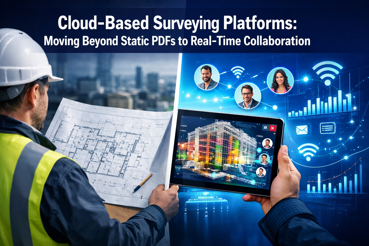
The surveying industry stands at a pivotal crossroads in 2026. For decades, surveyors delivered their findings through static PDF documents, emailed large files, or shipped physical hard drives containing point cloud data. Clients waited days for deliverables, struggled to visualize complex spatial information, and coordinated revisions through endless email chains. This traditional workflow has become a bottleneck in an era where construction projects demand instant access, real-time collaboration, and data-driven decision-making. Cloud-Based Surveying Platforms: Moving Beyond Static PDFs to Real-Time Collaboration represents more than a technological upgrade—it fundamentally transforms how surveying professionals deliver value, how clients interact with spatial data, and how entire project teams coordinate around a shared digital foundation.
Today's clients expect instant file sharing, browser-based 3D visualization without specialized software, and integrated communication channels that connect surveyors directly with architects, engineers, and project managers. These expectations are reshaping the surveying profession, pushing firms to adopt cloud-native platforms that turn spatial data into a living, collaborative asset rather than a static deliverable gathering digital dust in someone's inbox.
Key Takeaways
✅ Cloud platforms eliminate static deliverables by enabling instant web-based sharing, browser-native 3D visualization, and real-time revision synchronization, fundamentally changing client expectations in 2026.
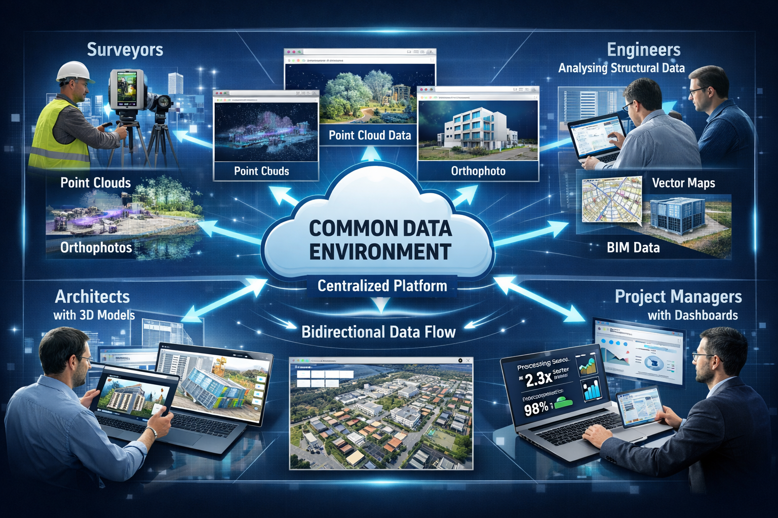
✅ Common Data Environments (CDEs) consolidate multiple data types—point clouds, imagery, orthophotos, 3D models, and vector maps—into unified platforms that serve as the single source of truth for entire project teams.
✅ Processing speeds have improved dramatically, with modern cloud platforms completing tasks in minutes that previously required multiple software tools, file transfers, and over a day of manual work.
✅ Reality capture has evolved from documentation to collaboration, with spatial data now serving as a common visual language that enables design conversations directly within 3D models rather than traditional 2D plans.
✅ Scalable cloud infrastructure provides on-demand processing power without complicated licensing or unpredictable billing, democratizing access to advanced surveying analytics for firms of all sizes.
The Evolution from Static Documents to Dynamic Data Environments
The Limitations of Traditional PDF Deliverables
The surveying profession built its reputation on precision and accuracy, yet the delivery method for that precision remained stubbornly analog. Traditional workflows centered on producing comprehensive reports packaged as PDF documents, often running hundreds of pages with embedded images, CAD drawings, and tabulated measurements. While these documents captured technical accuracy, they created significant friction in modern project workflows.
Static PDFs present several critical limitations:
- 📄 No interactivity: Clients cannot zoom into 3D point clouds, toggle data layers, or explore spatial relationships dynamically
- ⏰ Delayed delivery: Large files require compression, upload time, and often physical media shipping for multi-gigabyte datasets
- 🔄 Version control nightmares: Revisions generate new files with naming conventions like "Survey_Final_v3_REVISED_FINAL2.pdf"
- 🚫 Limited accessibility: Specialized software required to view certain data types, creating barriers for non-technical stakeholders
- 💬 Disconnected communication: Questions and clarifications happen through separate email threads, disconnected from the actual data
When conducting a structural survey in London, the traditional approach meant delivering a comprehensive PDF report that clients would review in isolation, then schedule follow-up calls to discuss findings. This sequential process added days or weeks to project timelines.
How Cloud Platforms Transform the Delivery Experience
Cloud-based surveying platforms fundamentally reimagine the relationship between surveyor and client. Rather than delivering a finished document, surveyors now provide access to a living data environment where clients can explore, question, and collaborate in real time.
Modern cloud platforms deliver four core capabilities that replace static deliverables[1]:
- Instant file sharing through secure web links that eliminate physical media and large email attachments
- 3D visualization in browser without requiring clients to install specialized CAD or point cloud software
- Real-time revision syncing where updates appear instantly for all authorized stakeholders
- Integrated communication with engineers and architects directly within the data environment
This transformation extends beyond convenience. When surveyors contribute to a drone roof survey in London, the captured imagery and 3D models become immediately accessible to roofing contractors, structural engineers, and property owners simultaneously. Everyone views the same data, at the same time, with the same context.
The Rise of Common Data Environments (CDEs)
Common Data Environments adoption is accelerating as the construction industry shifts toward data-driven operations[3]. Rather than producing isolated static plans or point clouds, surveyors now contribute to dynamic, shared environments where their work informs real-time decision-making.
CDEs represent a fundamental architectural shift in how project information flows. Instead of each discipline maintaining separate file repositories—architects with their BIM models, engineers with their structural calculations, surveyors with their point clouds—all project data converges into a unified platform.
Key characteristics of effective CDEs include:
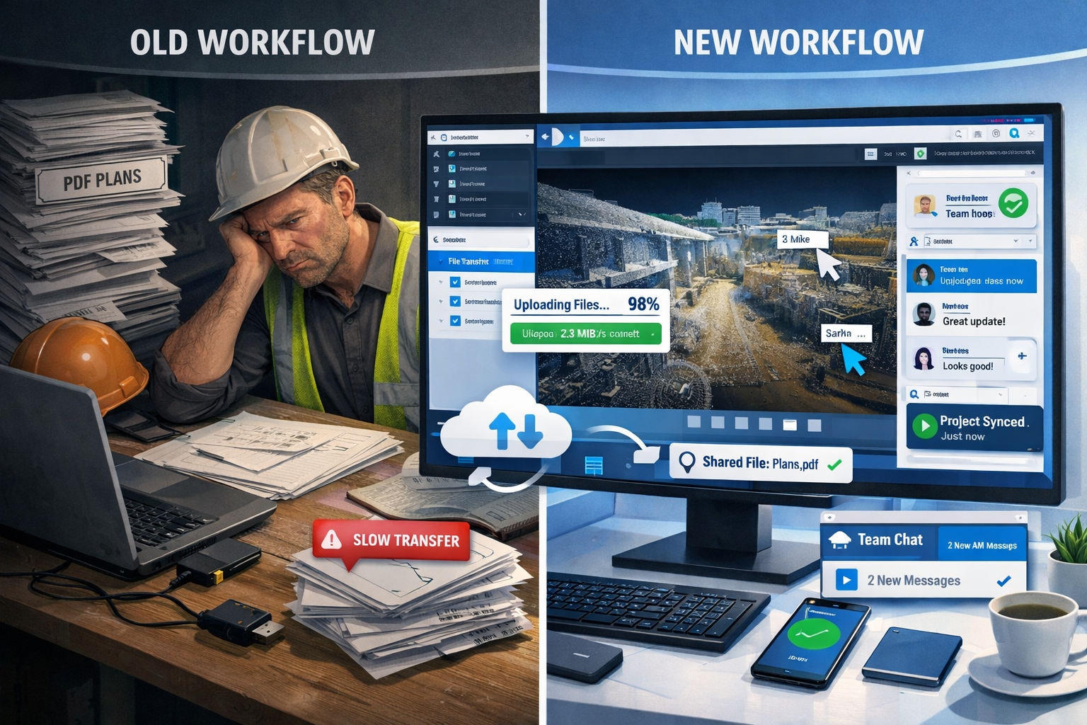
| Feature | Traditional Workflow | Cloud-Based CDE |
|---|---|---|
| Data Storage | Distributed across multiple systems | Centralized cloud repository |
| Access Method | Download files, install software | Browser-based instant access |
| Collaboration | Email attachments, version confusion | Real-time shared workspace |
| Update Propagation | Manual redistribution of revised files | Automatic synchronization |
| Audit Trail | Limited or manual tracking | Complete automated history |
| Mobile Access | Severely limited | Full field access via tablets/phones |
Unified data environments consolidate multiple data types in a single platform[2]. Solutions like Pointerra3D enable storing, visualizing, managing, sharing, and processing all spatial data types—point clouds, imagery, orthophotos, 3D models, and vector base maps—within one environment, eliminating data silos that plagued traditional workflows.
For professionals conducting a homebuyer report versus building survey, CDEs enable clients to access not just the written report but also the underlying photographic evidence, measurements, and spatial context in an interactive format that enhances understanding and transparency.
Cloud-Based Surveying Platforms: Moving Beyond Static PDFs to Real-Time Collaboration Through Advanced Processing
Cloud-Native Processing Capabilities
The shift to cloud platforms brings more than just better file sharing—it fundamentally transforms what surveyors can accomplish with spatial data. Advanced processing features are now cloud-native[2]: automated classification, feature extraction, lidar calibration, risk analysis, predictive insights, and photogrammetric processing occur within the same common data environment, eliminating the need for multiple standalone tools and complex manual exports/imports.
This consolidation addresses a major pain point in traditional workflows. Previously, a surveyor might capture point cloud data in the field, process it in one software package, classify features in another, extract measurements in a third, and finally compile deliverables in yet another application. Each transition required file conversions, quality checks, and potential data degradation.
Modern cloud platforms integrate the entire pipeline:
🔹 Data ingestion: Upload raw point clouds, imagery, or photogrammetric datasets directly to cloud storage
🔹 Automated processing: Cloud compute resources handle calibration, alignment, and initial classification
🔹 Feature extraction: AI-powered algorithms identify poles, wires, buildings, vegetation, and other features automatically
🔹 Quality assurance: Built-in validation tools flag potential issues before delivery
🔹 Deliverable generation: Create orthophotos, 3D models, and measurement reports within the same environment
🔹 Client access: Share results through secure web links with appropriate permission levels
Dramatic Improvements in Processing Speed
Processing speed has improved dramatically[2]. Pointerra3D demonstrated processing a 1-square-mile area in approximately 30 minutes of manual time using a laptop and standard conference Wi-Fi—including upload, calibration, classification, feature extraction (poles and wires), orthophoto creation, and digital delivery. Traditional workflows required multiple software products, file transfers, and well over a day of combined processing and quality assurance.
This speed improvement translates directly to business value. Surveyors can deliver results the same day as field capture, enabling clients to make decisions while site conditions remain fresh. For time-sensitive projects like subsidence surveys in London, rapid processing can mean the difference between catching a problem early or facing costly emergency repairs.
Scalable compute architecture via cloud infrastructure provides massive processing availability[2]. The technology enables teams to process exactly what they need, when they need it, without constraints from complicated licensing or unpredictable per-job billing models.
Traditional desktop processing limited surveyors to the computational power of their local workstations. A complex point cloud might take hours to process, locking up expensive hardware and preventing other work. Cloud platforms distribute processing across multiple servers, completing the same tasks in minutes while the surveyor's local computer remains available for other work.
Flexible Pricing Models for Cloud Processing
Modern cloud platforms have introduced tiered pricing that reflects actual usage rather than arbitrary seat licenses. Pointerra3D's Digital Surveyor Bundle introduced a tiered Processing Unit (PU) model[2] reflecting modern cloud economics:
- Explorer (50 PUs): Ideal for small projects or teams beginning cloud analytics adoption
- Professional (200 PUs): Suited for regular project workflows with moderate data volumes
- Enterprise (500+ PUs): Designed for large-scale operations with continuous processing needs
This model provides transparency and predictability. Surveyors know exactly what their processing costs will be before starting a project, and they only pay for what they use. Firms can start small with the Explorer tier and scale up as their cloud adoption matures, without renegotiating contracts or facing surprise bills.
Transforming Client Deliverables: From Files to Experiences
Instant Web-Based Sharing Replaces Physical Transfers
Instant web-based sharing replaces physical file transfers[2]. Modern platforms replace the traditional process of shipping hard drives with instant web links, enabling multi-user collaboration tools and secure cloud storage with always-available access.
The logistics of traditional data delivery created unnecessary delays and costs. A surveyor completing a comprehensive building survey might generate 50GB of point cloud data, high-resolution imagery, and supporting documentation. Uploading this to email services would fail due to size limits. File transfer services introduced security concerns and download complexity. Physical hard drives required packaging, shipping, and often got lost in transit.
Cloud platforms eliminate these friction points entirely. Upon completing processing, the surveyor generates a secure sharing link with customized permissions. The client receives an email notification and clicks the link to access the complete dataset instantly through their web browser. No downloads required. No software installation. No waiting for shipping.
Key advantages of web-based sharing include:
✔️ Immediate access: Clients view data within minutes of survey completion
✔️ Granular permissions: Control who can view, comment, edit, or download specific data layers
✔️ Automatic updates: Revisions appear instantly without resending files
✔️ Access logging: Track who viewed what data and when for compliance and audit purposes
✔️ Cross-device compatibility: Access from desktop, tablet, or smartphone with responsive interfaces
✔️ Bandwidth optimization: Stream only the data needed for current view, not entire datasets
Browser-Based 3D Visualization Without Specialized Software
Perhaps the most transformative aspect of cloud platforms is democratizing access to complex spatial data. Traditional point cloud viewers required specialized software that cost thousands of dollars per license and demanded powerful workstations with high-end graphics cards. This created a barrier where only technical specialists could interact with survey data, while decision-makers relied on simplified screenshots and static reports.
Modern cloud platforms render 3D point clouds, photogrammetric models, and BIM data directly in web browsers using WebGL technology. A property owner reviewing a roof survey in London can rotate the 3D model, zoom into specific areas of concern, toggle measurement overlays, and explore the data intuitively—all without installing any software.
Browser-based visualization enables:
- Interactive exploration: Clients navigate 3D environments with familiar mouse/touch controls
- Measurement tools: Built-in distance, area, and volume calculation without specialized training
- Annotation capabilities: Stakeholders add comments and questions directly on the 3D model
- Comparison views: Overlay multiple survey dates to visualize changes over time
- Integrated imagery: Link point cloud positions to corresponding photographs for context
- Cross-referencing: Click features in 3D to view related documentation, specifications, or reports
This accessibility transforms how clients engage with survey data. Instead of passively receiving a report, they actively explore their property or project site, developing deeper understanding and asking more informed questions.
Real-Time Collaboration and Integrated Communication
Visualization-driven workflows are transforming project collaboration[3]. Design conversations increasingly occur directly within 3D models rather than on traditional 2D plans, enabling quicker iterations, faster workflows, and stronger alignment throughout design and construction phases.
Cloud platforms integrate communication tools directly into the data environment. When an architect notices a potential issue while reviewing survey data, they can drop a pin at the exact 3D location, attach a comment, and tag the surveyor and structural engineer. All parties receive notifications and can respond within the same interface, maintaining context and creating a permanent record of the discussion.
Integrated collaboration features include:
💬 Contextual commenting: Attach discussions to specific 3D locations, measurements, or features
👥 Team workspaces: Organize stakeholders by role with appropriate access levels
📊 Activity feeds: Track all changes, comments, and updates chronologically
🔔 Smart notifications: Alert relevant team members when their input is needed
📸 Issue tracking: Document problems with photos, descriptions, and resolution status
🎯 Task assignment: Convert observations into actionable items with deadlines and ownership
This integrated approach eliminates the fragmentation that plagued traditional workflows. Instead of survey discussions happening in email, design revisions in separate BIM software, and project management in yet another platform, everything converges around the spatial data itself.
For complex projects involving chartered surveyors in London, this integration means the survey becomes the foundation for all subsequent project activities rather than just an initial documentation step.
Industry Trends Driving Cloud Adoption in 2026
Six Defining Trends Shaping Surveying Technology
Six defining trends identified by Trimble experts for 2026 shape the surveying industry landscape, centered on AI convergence, cloud-based collaboration, and interoperable hardware/software reshaping how spatial data is captured, processed, and shared[3].
These trends represent converging forces that make cloud adoption not just beneficial but essential for competitive surveying practices:
- AI-Powered Automation: Machine learning algorithms handle routine classification, feature extraction, and quality control tasks that previously required manual effort
- Cloud-First Architecture: New surveying tools are designed for cloud deployment from inception rather than retrofitting desktop software
- Hardware-Software Integration: Capture devices communicate directly with cloud platforms, eliminating intermediate transfer steps
- Mobile-First Access: Field teams access full platform capabilities on tablets and smartphones, not just limited mobile viewers
- Subscription Economics: Predictable monthly costs replace large upfront capital investments in software and processing infrastructure
- Open Data Standards: Interoperability enables mixing best-of-breed tools rather than vendor lock-in
These trends reinforce each other. AI automation becomes more powerful with cloud compute resources. Mobile access requires cloud architecture. Open standards facilitate the platform integrations that make CDEs effective.
Reality Capture as Project Management Foundation
Reality capture is now integral to project management workflows[3]. Surveyors can document conditions, visually track progress, and collaborate on solutions in real time, with spatial data serving as a common visual language across all project stakeholders.
This represents a fundamental shift in how reality capture is perceived. Previously, surveys happened at discrete project milestones: initial site documentation, as-built verification, final completion records. The survey was a snapshot in time, quickly outdated as construction progressed.
Cloud platforms enable continuous reality capture throughout project lifecycles. Weekly drone flights document construction progress. Monthly terrestrial scans verify that built conditions match design intent. Daily 360° photography creates visual timelines. All this data flows into the CDE where it's instantly accessible to the entire project team.
Continuous reality capture enables:
📈 Progress tracking: Compare actual construction against planned schedules with visual evidence
🎯 Quality control: Identify deviations from design specifications before they become costly problems
💰 Payment verification: Substantiate progress billing with objective spatial documentation
⚖️ Dispute resolution: Maintain complete visual record of site conditions to resolve disagreements
📋 Safety compliance: Document hazardous conditions and verify corrective actions
🔄 Change management: Visualize proposed changes in context of existing conditions
For professionals managing party wall matters, continuous documentation provides indisputable evidence of pre-existing conditions and construction impacts, reducing disputes and facilitating faster resolution when disagreements arise.
The Shift Toward Data-Driven Decision Making
Cloud platforms generate unprecedented visibility into project data. Every interaction—who viewed which data, when measurements were taken, which areas received the most attention—creates analytics that inform better business decisions.
Surveying firms can analyze which deliverable formats clients actually use versus which go ignored. They can identify bottlenecks in their processing workflows. They can quantify the time savings from automation and justify investments in new technology with concrete metrics.
Clients benefit from data-driven insights as well. When reviewing a schedule of condition report, property owners can see exactly which building elements received detailed inspection, compare findings against industry benchmarks, and prioritize maintenance investments based on objective condition assessments rather than subjective opinions.
Practical Implementation: Making the Transition to Cloud Platforms
Assessing Organizational Readiness
Transitioning from traditional workflows to cloud-based platforms requires more than just purchasing new software. Successful adoption demands organizational change management, staff training, and process redesign.
Key readiness factors include:
🔧 Technical infrastructure: Reliable high-speed internet, adequate bandwidth for data uploads, modern web browsers
👨💼 Leadership commitment: Executive support for changing established workflows and investing in training
📚 Staff capabilities: Team willingness to learn new tools and adapt to different delivery methods
💻 Client expectations: Understanding whether clients are ready for interactive deliverables or still prefer traditional reports
🔒 Security requirements: Ensuring cloud platforms meet data protection and confidentiality standards
💵 Financial planning: Budgeting for subscription costs, training time, and potential productivity dips during transition
Organizations don't need perfect conditions to begin cloud adoption. Many successful implementations start with pilot projects—selecting one or two clients who are enthusiastic about trying new delivery methods, then expanding based on lessons learned.
Selecting the Right Platform for Your Practice
The cloud surveying platform market has matured significantly, offering solutions tailored to different specializations and practice sizes. Selecting the right platform requires evaluating both current needs and future growth plans.
Critical evaluation criteria include:
| Consideration | Questions to Ask |
|---|---|
| Data Types Supported | Does it handle all formats you currently use (point clouds, imagery, CAD, BIM)? |
| Processing Capabilities | What automated workflows are included versus requiring third-party tools? |
| Collaboration Features | How do team members and clients interact with data and each other? |
| Mobile Access | Can field teams access full functionality or just limited viewers? |
| Integration Options | Does it connect with your existing CAD, BIM, and project management tools? |
| Pricing Structure | Are costs predictable and scalable with project volume? |
| Training Resources | What documentation, tutorials, and support are available? |
| Security Certifications | Does it meet industry standards for data protection and privacy? |
| Customization Options | Can you tailor workflows, templates, and deliverables to your brand? |
Many platforms offer free trials or demonstration projects. Taking advantage of these opportunities allows hands-on evaluation before committing to annual subscriptions.
Training Teams and Managing Change
Technology adoption fails when organizations focus solely on the tools while neglecting the human factors. Survey teams accustomed to traditional workflows may resist changes that disrupt familiar routines, even when new methods offer clear advantages.
Effective change management strategies include:
✅ Start with champions: Identify early adopters who embrace new technology and can mentor colleagues
✅ Provide comprehensive training: Invest in both initial onboarding and ongoing skill development
✅ Create clear processes: Document new workflows step-by-step to reduce confusion
✅ Celebrate quick wins: Highlight early successes to build momentum and demonstrate value
✅ Maintain support channels: Establish ways for team members to get help when they encounter challenges
✅ Gather feedback: Regularly solicit input on what's working and what needs improvement
✅ Allow parallel workflows: Permit traditional methods during transition while encouraging cloud adoption
The most successful implementations treat cloud adoption as a gradual evolution rather than an overnight revolution. Teams need time to develop proficiency, discover best practices, and build confidence in new delivery methods.
Future Outlook: What's Next for Cloud-Based Surveying
Emerging Technologies on the Horizon
Cloud platforms continue evolving rapidly, with several emerging technologies poised to further transform surveying workflows in the coming years.
Artificial intelligence and machine learning will advance beyond basic classification to predictive analytics. Future platforms may identify potential structural issues by comparing current conditions against historical patterns, flag areas requiring closer inspection, or automatically generate maintenance recommendations based on observed deterioration rates.
Augmented reality integration will enable field teams to overlay design models onto physical environments through smartphone cameras or AR glasses. Surveyors conducting site inspections could see exactly where proposed construction will occur, verify that existing conditions match design assumptions, and identify conflicts before they become problems.
Digital twin integration will connect survey data with building operations systems, creating living models that update continuously throughout a structure's lifecycle. The initial survey becomes the foundation for a digital twin that incorporates sensor data, maintenance records, and performance metrics over decades.
Blockchain verification may provide tamper-proof records of survey data, timestamps, and chain of custody—particularly valuable for legal proceedings, property disputes, or regulatory compliance where data integrity is paramount.
Evolving Client Expectations
As cloud platforms become standard practice, client expectations will continue rising. The firms that thrive will be those that view technology not as a burden but as an opportunity to deliver unprecedented value.
Tomorrow's clients will expect:
- 🕐 Same-day delivery: Survey data available within hours of field capture, not days or weeks
- 📱 Mobile-first access: Full functionality on smartphones and tablets, not just desktop computers
- 🤖 AI-powered insights: Automated analysis that highlights key findings and potential issues
- 🔗 Seamless integration: Survey data that flows directly into their existing project management and BIM workflows
- 🎥 Visual storytelling: Interactive presentations that communicate findings more effectively than static reports
- 📊 Analytics dashboards: Metrics that quantify conditions, track changes over time, and benchmark against standards
Surveying firms that embrace these expectations will differentiate themselves in competitive markets. Those that cling to traditional deliverables risk becoming commoditized, competing solely on price rather than value.
The Competitive Advantage of Early Adoption
Organizations that adopt cloud platforms early gain significant competitive advantages. They develop expertise while competitors are still learning. They build reputations as innovative technology leaders. They attract clients who value modern delivery methods and repel those who demand outdated workflows at unsustainable prices.
Early adopters benefit from:
💡 Learning curve advantages: Teams develop proficiency while the market is still transitioning
🏆 Differentiation opportunities: Stand out in proposals by offering capabilities competitors lack
📈 Efficiency gains: Realize productivity improvements and cost savings sooner
🤝 Client relationships: Deepen partnerships with forward-thinking clients who appreciate innovation
🎓 Knowledge leadership: Establish thought leadership through case studies and industry presentations
💰 Pricing power: Command premium fees for superior deliverables and faster turnaround
The transition to cloud-based surveying platforms represents one of the most significant shifts in professional practice since the introduction of total stations and GPS. Firms that recognize this transformation as an opportunity rather than a threat will position themselves for sustained success in an increasingly digital construction industry.
Conclusion: Embracing the Cloud Revolution in Surveying

Cloud-Based Surveying Platforms: Moving Beyond Static PDFs to Real-Time Collaboration represents far more than a technological upgrade—it fundamentally redefines what it means to deliver surveying services in 2026. The shift from static documents to dynamic data environments transforms surveyors from documentation specialists into collaborative partners who enable real-time decision-making throughout project lifecycles.
The evidence is compelling. Processing times have dropped from days to minutes. Clients access complex 3D data through simple web browsers without specialized software. Project teams collaborate within shared data environments where spatial information serves as a common visual language. Reality capture has evolved from periodic snapshots to continuous documentation that tracks progress, verifies quality, and resolves disputes with objective evidence.
The industry trends are clear. AI convergence, cloud-first architecture, and interoperable systems are reshaping how spatial data is captured, processed, and shared. Common Data Environments are becoming the standard foundation for construction projects. Clients increasingly expect instant access, browser-based visualization, and integrated communication—expectations that static PDFs simply cannot meet.
Actionable Next Steps for Surveying Professionals
Organizations ready to embrace cloud-based surveying platforms should consider these concrete actions:
1. Evaluate Current Workflows 📋
Document how long each step of your current process takes, from field capture through final delivery. Identify bottlenecks, manual tasks, and client pain points that cloud platforms could address.
2. Research Platform Options 🔍
Investigate platforms like Pointerra3D and comparable solutions that consolidate data storage, processing, visualization, and collaboration. Request demonstrations and trial projects to evaluate capabilities firsthand.
3. Start with Pilot Projects 🚀
Select one or two forward-thinking clients willing to try new delivery methods. Use these projects to develop internal expertise and demonstrate value before broader rollout.
4. Invest in Training 🎓
Allocate time and resources for comprehensive team training. Cloud platforms require different skills than traditional workflows—invest in developing those capabilities.
5. Communicate Value to Clients 💬
Educate clients about the benefits of cloud-based deliverables: instant access, interactive exploration, real-time collaboration, and continuous updates. Help them understand why this approach surpasses static PDFs.
6. Measure and Optimize 📊
Track metrics like processing time, delivery speed, client satisfaction, and revision cycles. Use this data to refine workflows and quantify the value cloud platforms deliver.
7. Stay Informed 📰
The technology landscape evolves rapidly. Follow industry publications, attend conferences, and participate in professional networks to stay current on emerging capabilities and best practices.
The transition from static PDFs to cloud-based collaboration platforms is not a distant future possibility—it's happening now in 2026. Surveying firms that embrace this transformation position themselves as essential partners in modern construction projects. Those that resist risk becoming obsolete, relegated to commodity services competing solely on price.
The choice is clear: evolve with the industry or be left behind. The tools are available. The benefits are proven. The clients are ready. The question is whether your organization will lead the transformation or follow reluctantly in its wake.
For surveying professionals committed to delivering exceptional value, maintaining competitive advantage, and building sustainable practices for the future, cloud-based platforms are not optional—they're essential. The revolution is here. The time to act is now.
References
[1] Future Land Surveying 2026 – https://haller-blanchard.com/future-land-surveying-2026/
[2] Transforming The Future Of Survey Mapping – https://www.geoweeknews.com/news/transforming-the-future-of-survey-mapping
[3] Doubling Down On Digital – https://amerisurv.com/2026/02/01/doubling-down-on-digital/