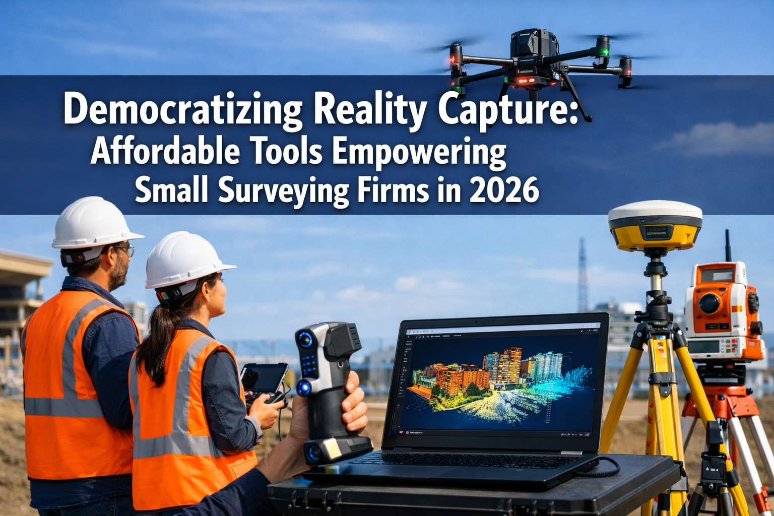
The surveying industry stands at a transformative crossroads in 2026. What was once the exclusive domain of large firms with deep pockets—reality capture technology—has become accessible to independent surveyors and small practices. This shift represents more than just technological advancement; it's a fundamental democratization that's reshaping competitive dynamics across the profession. Democratizing Reality Capture: Affordable Tools Empowering Small Surveying Firms in 2026 isn't merely a trend—it's the defining characteristic of today's surveying landscape, where user-friendly tools and dramatically reduced costs enable mainstream adoption without requiring massive capital investment.
The barriers that once kept small firms on the sidelines have crumbled. Advanced drone systems with integrated LiDAR, mobile 3D mapping platforms, and AI-powered processing software now cost a fraction of their predecessors while delivering comparable—sometimes superior—results. This accessibility revolution means that a two-person surveying practice can now compete for projects that previously demanded the resources of established firms with dozens of employees.
Key Takeaways
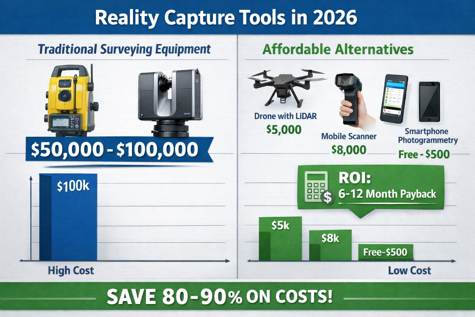
📊 Cost barriers have collapsed: Reality capture tools that cost $100,000+ just five years ago now have accessible alternatives priced at $5,000-$15,000, with ROI achievable within 6-12 months for most small firms.
🤖 AI and cloud platforms eliminate expertise gaps: Automated processing, intelligent feature detection, and cloud-based collaboration tools mean small firms no longer need specialized technicians to deliver professional-grade digital deliverables.
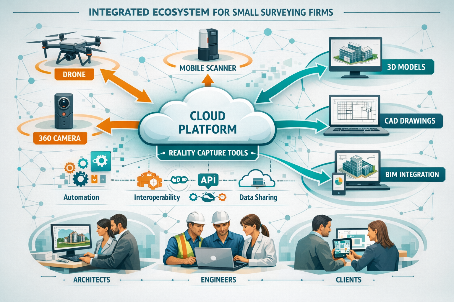
📱 Client expectations have fundamentally shifted: Organizations now routinely expect 3D models, point cloud data, and cloud-accessible survey information rather than traditional paper-based reports[2].
🚁 Drones and mobile scanners are now standard tools: UAV technology has transitioned from premium offering to essential equipment, with systems cheaper and more accessible than previous years[1].
🔗 Integration trumps individual capability: The surveying industry's focus has shifted from "What can this tool capture?" to "How does this data serve projects over time?"[3]
The Technology Revolution Lowering Entry Barriers
From Specialized Service to Mainstream Tool
Reality capture technology has undergone a remarkable transformation over the past decade. What began as highly specialized equipment requiring dedicated operators and substantial capital investment has evolved into user-friendly tools with broader platform support, making implementation significantly easier for firms of all sizes[2]. This transition represents the core of Democratizing Reality Capture: Affordable Tools Empowering Small Surveying Firms in 2026.
The shift mirrors the broader technology adoption curve seen across industries. Just as smartphones democratized photography and computing, modern reality capture tools have made professional-grade 3D documentation accessible to practitioners who previously couldn't justify the investment. The technology has moved beyond specialized applications into core service offerings for surveying firms seeking competitive differentiation[2].
For small surveying practices, this democratization opens entirely new revenue streams. Services like drone roof surveys and comprehensive structural surveys can now incorporate rich 3D data that enhances accuracy while reducing site visit requirements.
The Three Pillars of Democratization
The current wave of accessibility stems from the convergence of three enabling factors: artificial intelligence, cloud-based collaboration platforms, and interoperable hardware/software systems[2]. Each pillar addresses specific barriers that historically prevented small firms from adopting reality capture technology.
Artificial Intelligence eliminates the expertise bottleneck. Previously, processing massive point cloud datasets required specialized knowledge and considerable manual effort. In 2026, AI and machine learning capabilities enable rapid processing of massive datasets, with algorithms identifying patterns and detecting changes at scale—tasks that previously required specialized expertise[1]. Small firms can now deliver sophisticated analysis without hiring dedicated technicians.
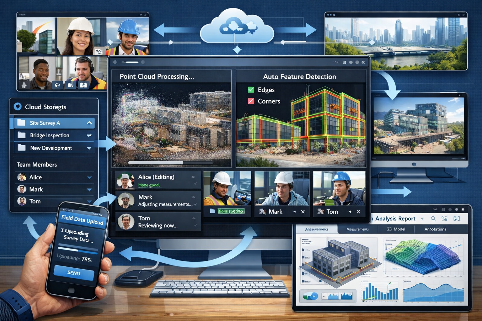
Cloud-based collaboration platforms solve the infrastructure challenge. Small firms no longer need powerful local workstations or expensive software licenses. Cloud platforms provide processing power on-demand, storage that scales with project needs, and collaboration tools that enable real-time workflows allowing surveyors to document site conditions, track progress visually, and collaborate across teams while reducing project misunderstandings[2].
Interoperable systems address the integration puzzle. Modern reality capture tools share common data formats and APIs, allowing small firms to build customized workflows using best-of-breed components rather than being locked into expensive proprietary ecosystems. This interoperability ensures that data captured today remains valuable tomorrow, addressing the industry's shift toward asking "How does this data serve projects over time?"[3]
Affordable Hardware: Breaking Down Cost Barriers
Drone Technology: From Premium to Standard
Cost barriers have substantially diminished for UAV/drone technology, with these systems now cheaper and more accessible than previous years, establishing them as standard tools for certain surveying tasks rather than premium offerings[1]. This transformation represents perhaps the most visible aspect of democratizing reality capture.
In 2026, small surveying firms can acquire high-resolution drone systems featuring integrated LiDAR sensors and advanced positioning (real-time kinematics/RTK and post-processing kinematic/PPK), enabling them to capture large datasets across difficult terrain and hard-to-reach areas efficiently[1]. These capabilities were exclusive to specialized service providers just a few years ago.
| Drone Category | Price Range (2026) | Key Features | Best For |
|---|---|---|---|
| Entry-Level Photogrammetry | $1,500-$3,500 | High-res camera, GPS, obstacle avoidance | Small property surveys, visual documentation |
| Mid-Range RTK | $5,000-$12,000 | RTK/PPK positioning, 20MP+ camera, extended flight time | Topographic surveys, construction monitoring |
| LiDAR-Equipped | $15,000-$35,000 | Integrated LiDAR, RTK, multiple sensors | Complex terrain, vegetation penetration, infrastructure |
| Enterprise Solutions | $50,000+ | Advanced sensors, redundant systems, extended range | Large-scale mapping, specialized applications |
The practical implications are substantial. A small firm investing $8,000 in a mid-range RTK drone can complete topographic surveys that previously required days of total station work in hours. The return on investment (ROI) typically materializes within 6-12 months when the drone replaces even a modest number of traditional survey days.
For firms offering specialized services like commercial dilapidation surveys, drones provide comprehensive documentation of building conditions without the time and safety risks associated with scaffolding or aerial platforms.
Mobile 3D Mapping: Bringing Scanning Indoors
Mobile 3D mapping systems create detailed 3D models from both indoor and outdoor environments without requiring bulky equipment or extended processing wait times[1]. These handheld or backpack-mounted systems represent another breakthrough in accessibility for small firms.
Traditional terrestrial laser scanners—while highly accurate—require stationary setup at multiple positions, making them time-consuming for large or complex spaces. Mobile mapping systems continuously capture data while the operator walks through the environment, dramatically reducing field time. Modern systems combine multiple technologies:
- LiDAR sensors for precise distance measurements
- Visual cameras for texture and color information
- Inertial measurement units (IMU) for orientation tracking
- SLAM algorithms (Simultaneous Localization and Mapping) for real-time positioning
Entry-level mobile mapping systems now start around $8,000-$15,000, with professional-grade options in the $25,000-$45,000 range. For comparison, traditional terrestrial scanners often exceed $50,000-$100,000. The reduced cost combined with faster field acquisition makes mobile systems particularly attractive for small firms.
These tools excel for interior documentation required in building surveys and renovation projects, where comprehensive as-built documentation accelerates design and reduces costly surprises during construction.
Smartphone-Based Solutions: Zero-Barrier Entry
The most dramatic democratization comes from smartphone-based reality capture applications. Modern smartphones equipped with LiDAR sensors (available on many mid-range and flagship devices since 2020) can capture surprisingly accurate 3D models using free or low-cost applications.
While smartphone-based capture doesn't match the precision of dedicated surveying equipment, it provides valuable capabilities for:
- Quick site documentation for preliminary assessments
- Client communication showing existing conditions
- Progress monitoring on construction projects
- Interior space planning for renovation projects
- Supplementary documentation supporting traditional survey methods
Applications like Polycam, Scaniverse, and Canvas offer subscription models starting at $0-$50/month, removing virtually all financial barriers to entry. Small firms can begin experimenting with reality capture workflows immediately, learning the technology and building client demand before investing in more sophisticated equipment.
Software and Processing: AI Eliminates Expertise Gaps
Cloud-Based Processing Platforms
The processing bottleneck historically presented as large an obstacle as hardware costs. Raw point cloud data requires substantial computational resources and specialized software to transform into usable deliverables. Cloud-based platforms have revolutionized this aspect of reality capture for small firms.
Modern cloud processing services operate on consumption-based pricing models. Small firms pay only for the processing power they actually use rather than maintaining expensive local infrastructure. Typical costs range from $0.10-$2.00 per gigabyte of processed data, with monthly subscription options providing predictable budgeting.
These platforms offer several critical advantages:
✅ Scalability: Process massive datasets without local hardware limitations
✅ Accessibility: Team members access projects from any device with internet connection
✅ Collaboration: Multiple stakeholders review and annotate shared models simultaneously
✅ Automatic updates: Software improvements deploy without manual installation
✅ Disaster recovery: Cloud storage protects against local data loss
The shift to cloud processing means a small firm can deliver the same quality outputs as larger competitors without the capital expenditure on workstations and software licenses that previously created insurmountable barriers.
AI-Powered Automated Analysis
AI-powered analysis capabilities are enabling "survey information modeling," allowing users to query large 3D datasets through natural interaction rather than manual navigation, with autonomous monitoring workflows alerting teams to changes[3]. This represents a fundamental shift in how surveyors interact with captured data.
Machine learning algorithms now automatically:
- Classify point cloud data into categories (ground, vegetation, buildings, utilities)
- Extract features like building corners, edges, and openings
- Detect changes between sequential scans for monitoring applications
- Identify defects in infrastructure and building elements
- Generate measurements from 3D models with minimal user input
- Create deliverables including floor plans, elevations, and cross-sections
These automated capabilities compress workflows that previously required hours of manual work into minutes of automated processing. A small firm can deliver sophisticated analysis without employing specialists in point cloud processing, fundamentally changing the economics of reality capture services.
For firms providing specific defect reports or subsidence surveys, AI-powered change detection can identify subtle structural movements that might escape manual observation.
Interoperable Data Formats
The surveying industry has largely converged on common data formats that ensure captured information remains accessible and valuable regardless of the specific tools used. This interoperability represents a crucial enabler for small firms building reality capture capabilities.
Standard formats include:
- E57: Universal point cloud exchange format supported by virtually all platforms
- LAS/LAZ: Compressed point cloud format widely used for LiDAR data
- IFC: Building Information Modeling (BIM) exchange format
- OBJ/FBX: 3D mesh formats for visualization and analysis
- GeoTIFF: Georeferenced raster imagery
This standardization means small firms can select tools based on capability and cost rather than ecosystem lock-in. A firm might capture data with one manufacturer's drone, process it in a cloud platform from another vendor, and deliver results in formats compatible with clients' existing workflows.
The emphasis on integration extends to project delivery. Sector-wide sessions at Geo Week 2026 (February 16-18 in Denver) highlight integration of advanced mapping technologies including airborne lidar, mobile mapping, terrestrial scanning, and drone surveys into coherent datasets serving multiple stakeholders[3].
ROI Calculations: Making the Business Case
Initial Investment Scenarios
Understanding the financial implications of reality capture adoption requires examining realistic investment scenarios for small surveying firms. The following models represent typical entry points in 2026:
Minimal Investment Scenario ($2,000-$5,000):
- Entry-level photogrammetry drone: $2,500
- Cloud processing subscription: $50/month
- Basic software licenses: $500
- Training and certification: $1,000
This minimal approach allows firms to begin offering aerial documentation and basic 3D modeling services immediately. The investment typically pays for itself within 3-6 months through enhanced service offerings and reduced field time.
Standard Implementation ($15,000-$25,000):
- Mid-range RTK drone with LiDAR: $12,000
- Mobile mapping system (entry-level): $8,000
- Cloud platform subscription: $150/month
- Professional software suite: $2,000
- Training and workflow development: $3,000
This standard configuration enables comprehensive reality capture services competitive with larger firms. ROI typically materializes within 6-12 months through new project types and improved efficiency.
Comprehensive Solution ($40,000-$60,000):
- Professional LiDAR drone: $25,000
- Advanced mobile mapping system: $30,000
- Terrestrial scanner (optional): $15,000
- Enterprise cloud platform: $300/month
- Full software ecosystem: $5,000
- Comprehensive training program: $5,000
This investment positions small firms to compete for complex projects requiring the highest accuracy and completeness. While the upfront cost is substantial, firms typically achieve ROI within 12-18 months while establishing themselves as technology leaders in their markets.
Revenue Enhancement Opportunities
Reality capture capabilities create multiple revenue streams for small surveying firms:
Expanded Service Offerings 🎯
Traditional surveying services enhanced with 3D deliverables command premium pricing. Clients increasingly expect digital models rather than paper plans, and firms equipped to deliver these products capture market share from competitors still using traditional methods[2].
Reduced Field Time ⏱️
Reality capture dramatically compresses data collection time. A topographic survey that might require 2-3 days with traditional methods can often be completed in hours with drone-based capture. This efficiency allows firms to complete more projects with existing staff.
Repeat Monitoring Services 🔄
Construction progress monitoring, infrastructure condition assessment, and environmental monitoring create recurring revenue opportunities. Clients value regular documentation that tracks changes over time, and reality capture makes these services economically viable.
Consulting and Training 📚
As early adopters, small firms can generate additional revenue by training other professionals or providing consulting services to clients implementing their own reality capture programs.
Value-Added Analysis 📊
Beyond basic documentation, firms can offer volumetric calculations, deformation analysis, clash detection, and other specialized services that leverage captured data. These analytical services often command higher margins than traditional surveying.
For practices offering chartered surveying services, reality capture enhances virtually every service line from boundary surveys to building condition assessments.
Cost Savings Analysis
Beyond revenue enhancement, reality capture generates substantial cost savings:
| Cost Category | Traditional Method | Reality Capture | Annual Savings |
|---|---|---|---|
| Field time (50 projects/year) | 300 days @ $800/day | 150 days @ $800/day | $120,000 |
| Return visits for missed data | 20 trips @ $500/trip | 2 trips @ $500/trip | $9,000 |
| Safety incidents/insurance | Higher risk exposure | Reduced exposure | $5,000-$15,000 |
| Client revisions | Frequent due to incomplete data | Minimal with comprehensive capture | $10,000 |
| Equipment depreciation | Multiple specialized tools | Consolidated platform | $8,000 |
| Total Annual Savings | — | — | $152,000-$162,000 |
These savings assume a small firm completing approximately 50 projects annually. The reduced field time represents the most significant impact, effectively doubling surveyor productivity for many project types.
The safety benefits deserve particular emphasis. Drone-based capture eliminates the need for surveyors to access dangerous locations—steep slopes, unstable structures, busy roadways, or contaminated sites. This risk reduction translates directly to lower insurance premiums and reduced liability exposure.
Vendor Landscape: Choosing the Right Tools
Leading Drone Manufacturers
The drone market has matured considerably, with several manufacturers offering solutions specifically designed for surveying applications:
DJI Enterprise remains the market leader, offering the Mavic 3 Enterprise series ($5,000-$7,000) for photogrammetry and the Matrice 300/350 RTK ($10,000-$15,000 without payload) for professional applications. DJI's ecosystem includes proprietary software and extensive third-party integrations.
Autel Robotics provides strong competition with the EVO II RTK series ($6,000-$8,000), offering comparable capabilities with some enhanced features for surveying workflows. Autel's advantage includes stronger data security for government and sensitive projects.
senseFly (Parrot Group) specializes in fixed-wing mapping drones like the eBee X ($20,000-$30,000), which excel at large-area surveys with extended flight times and coverage.
Quantum-Systems offers the Trinity Pro ($25,000-$35,000), a vertical takeoff and landing (VTOL) system combining the coverage of fixed-wing with the flexibility of multirotor designs.
For small firms, the DJI Mavic 3 Enterprise or Autel EVO II RTK represent optimal entry points, providing professional capabilities at accessible price points with extensive support ecosystems.
Mobile Mapping Solutions
The mobile mapping market offers diverse options across price and capability ranges:
GeoSLAM produces handheld and backpack systems ($15,000-$40,000) known for ease of use and rapid deployment. Their ZEB series excels in complex indoor environments and works effectively in GPS-denied areas.
NavVis offers the VLX series ($40,000-$60,000), combining high-accuracy scanning with panoramic imagery for detailed indoor documentation. These systems integrate well with BIM workflows.
Leica Geosystems provides the BLK2GO handheld scanner ($15,000-$20,000), offering professional accuracy in a highly portable package with intuitive operation.
Kaarta manufactures the Contour series ($20,000-$35,000), featuring rapid acquisition speeds and real-time visualization for immediate quality verification.
For small firms prioritizing indoor documentation and renovation projects, the GeoSLAM ZEB series or Leica BLK2GO offer excellent capability-to-cost ratios with minimal learning curves.
Software Platforms
The software ecosystem has evolved toward cloud-based platforms with flexible pricing:
Pix4D offers cloud and desktop solutions starting at $350/month, with specialized modules for surveying, construction, and agriculture. Their platform handles photogrammetry processing with minimal user intervention.
DroneDeploy provides subscription-based cloud processing from $99/month, focusing on ease of use and collaboration features. The platform excels for construction monitoring and progress documentation.
Autodesk ReCap integrates reality capture data with the broader Autodesk ecosystem (AutoCAD, Revit, Civil 3D) starting at $445/year, making it ideal for firms already using Autodesk tools.
Trimble Business Center offers comprehensive surveying workflows including reality capture processing, with pricing around $5,000-$8,000 for perpetual licenses or $200/month subscriptions.
CloudCompare provides powerful open-source point cloud processing at no cost, though with a steeper learning curve than commercial alternatives.
For small firms beginning their reality capture journey, DroneDeploy or Pix4D offer the most accessible entry points with comprehensive tutorials and support resources.
Implementation Strategies for Small Firms
Phased Adoption Approach
Successful reality capture implementation follows a strategic phased approach rather than attempting comprehensive deployment immediately:
Phase 1: Experimentation and Learning (Months 1-3)
Begin with minimal investment using smartphone-based capture or entry-level drone equipment. Focus on learning workflows, understanding data processing requirements, and identifying client demand. Complete 5-10 pilot projects, potentially offering discounted services while developing expertise.
Phase 2: Core Capability Development (Months 4-9)
Invest in professional-grade equipment based on identified opportunities. Implement cloud processing platforms and establish standardized workflows. Market enhanced capabilities to existing clients and pursue new project types that leverage reality capture advantages.
Phase 3: Service Expansion (Months 10-18)
Add complementary technologies (mobile scanning if starting with drones, or vice versa). Develop specialized expertise in high-value applications. Establish recurring monitoring services and long-term client relationships.
Phase 4: Optimization and Leadership (Months 18+)
Refine workflows for maximum efficiency. Consider advanced capabilities like AI-powered analysis or specialized sensors. Position the firm as a technology leader through case studies, presentations, and industry involvement.
This phased approach manages financial risk while building competency systematically. Firms avoid the common pitfall of over-investing in technology before developing the expertise to leverage it effectively.
Training and Skill Development
Technology acquisition represents only part of successful implementation. Skill development determines whether investments generate returns or gather dust:
Operator Certification 🎓
Drone operations require appropriate licensing (Part 107 in the US, equivalent certifications in other jurisdictions). Budget $200-$500 for examination preparation and fees. Many manufacturers offer equipment-specific training programs that accelerate proficiency.
Software Proficiency 💻
Cloud processing platforms typically provide extensive tutorial libraries and certification programs. Allocate 20-40 hours for initial training and ongoing learning. Many platforms offer free trial periods for skill development before committing to subscriptions.
Workflow Integration 🔧
The most challenging aspect involves integrating reality capture into existing surveying workflows. Consider engaging consultants or joining peer learning groups to accelerate this process. Industry associations increasingly offer workshops focused on practical implementation.
Safety and Compliance ⚠️
Reality capture operations introduce new safety considerations and regulatory requirements. Ensure team members understand airspace restrictions, privacy considerations, and safe operating procedures.
Firms serving specialized markets like party wall matters can leverage reality capture for comprehensive documentation that protects all parties' interests while reducing disputes.
Client Education and Marketing
Successful reality capture adoption requires educating clients about enhanced capabilities and value:
Demonstration Projects 📸
Create compelling case studies showcasing reality capture advantages. Before-and-after comparisons, time savings documentation, and enhanced deliverable examples resonate with prospective clients.
Sample Deliverables 📦
Provide clients with sample 3D models, interactive visualizations, and cloud-accessible data platforms. Many clients struggle to envision digital deliverables until experiencing them directly.
Value Proposition Clarity 💡
Articulate specific benefits relevant to client concerns: reduced project risk, faster decision-making, improved stakeholder communication, comprehensive documentation, and cost savings through reduced field visits.
Industry Presence 🎤
Present at local industry events, contribute articles to trade publications, and maintain active social media presence showcasing technology capabilities. Position the firm as an innovative leader rather than a traditional service provider.
Transparent Pricing 💰
Develop clear pricing structures for reality capture services. Consider value-based pricing that reflects project benefits rather than purely cost-plus models.
Organizations providing valuation services find that reality capture documentation enhances credibility and defensibility of valuation conclusions.
Future Outlook: Democratizing Reality Capture Beyond 2026
Emerging Technologies on the Horizon
Reality capture adoption is expected to expand dramatically in 2026, with the technology moving beyond specialized applications into core service offerings for surveying firms seeking competitive differentiation[2]. Several emerging technologies will further accelerate democratization:
Neural Radiance Fields (NeRF) represent the next evolution in 3D reconstruction, creating photorealistic models from standard images without specialized equipment. As these algorithms mature and become accessible through cloud platforms, the barrier to reality capture will drop even further.
5G connectivity enables real-time data streaming from field equipment to cloud processing platforms, allowing immediate quality verification and reducing the time between capture and deliverable delivery.
Augmented reality (AR) integration will transform how surveyors interact with captured data, overlaying historical scans onto current site conditions or visualizing proposed designs in existing environments through tablet or headset displays.
Autonomous capture systems are emerging, with drones capable of planning and executing surveys with minimal human intervention. These systems will further reduce the expertise barrier while improving consistency and coverage.
Miniaturization continues across all sensor types, with capabilities that currently require dedicated equipment becoming integrated into everyday devices. The smartphone LiDAR sensors introduced in 2020 represent just the beginning of this trend.
Industry Transformation Implications
The democratization of reality capture fundamentally alters competitive dynamics within the surveying profession:
Specialization opportunities emerge for small firms willing to develop deep expertise in specific applications—heritage documentation, industrial facility management, construction monitoring, or environmental assessment. Technology accessibility allows small firms to compete on expertise rather than equipment investment.
Geographic barriers diminish as remote collaboration tools and efficient data capture allow small firms to serve clients beyond their traditional service areas. A regional practice can compete for projects anywhere when comprehensive site documentation requires minimal on-site time.
Service integration becomes increasingly important. Firms offering commercial property surveying can integrate reality capture with traditional valuation and condition assessment services, providing comprehensive solutions that larger firms struggle to match.
Client relationships deepen when firms transition from episodic service providers to ongoing technology partners. Reality capture enables monitoring and documentation services that create long-term engagement rather than transactional relationships.
Competitive pressure intensifies as technology accessibility eliminates traditional moats. Firms that fail to adopt reality capture capabilities will find themselves increasingly unable to compete for projects where clients expect digital deliverables as standard offerings.
Preparing for Continued Evolution
Small surveying firms can position themselves for continued success amid rapid technological evolution:
Maintain learning orientation 📖
Technology evolution continues accelerating. Allocate time and resources for ongoing education, experimentation with emerging tools, and participation in industry forums where innovations are discussed.
Build flexible workflows 🔄
Design processes around data standards and interoperable formats rather than specific tools. This flexibility allows adopting improved technologies without disrupting established operations.
Cultivate technology partnerships 🤝
Develop relationships with equipment manufacturers, software vendors, and peer firms. These connections provide early access to innovations and collaborative problem-solving opportunities.
Focus on value delivery 🎯
Remember that technology serves client needs rather than existing for its own sake. Continuously assess whether investments enhance value delivery or simply add complexity.
Document and share knowledge 📝
Create internal knowledge bases capturing lessons learned, workflow optimizations, and best practices. This documentation accelerates new team member integration and protects organizational knowledge.
Firms providing comprehensive services across multiple London locations benefit from reality capture's ability to maintain consistent quality and documentation standards regardless of project location or team member.
Conclusion: Seizing the Democratization Opportunity
The transformation encapsulated in Democratizing Reality Capture: Affordable Tools Empowering Small Surveying Firms in 2026 represents a once-in-a-generation opportunity for independent surveyors and small practices. The convergence of affordable hardware, cloud-based processing, and AI-powered analysis has eliminated the barriers that previously restricted advanced capabilities to large firms with substantial capital resources.
Small surveying firms that embrace this democratization gain significant competitive advantages: reduced field time, enhanced service offerings, improved safety, recurring revenue opportunities, and stronger client relationships. The financial case for adoption has never been stronger, with ROI typically achievable within 6-18 months depending on implementation scope.
Success requires more than equipment acquisition. Firms must invest in skill development, workflow integration, and client education to realize technology's full potential. The phased adoption approach outlined above manages financial risk while building competency systematically.
The future belongs to firms that recognize reality capture not as a specialized service but as a fundamental capability integrated throughout their operations. Client expectations have shifted permanently toward digital deliverables, and this trend will only accelerate. Organizations that delay adoption risk finding themselves unable to compete for projects where comprehensive 3D documentation has become standard rather than premium.
Actionable Next Steps
For small surveying firms ready to capitalize on democratized reality capture:
- Assess current capabilities and gaps – Identify which reality capture technologies align with your service offerings and client needs
- Start with minimal investment – Begin experimentation using smartphone-based tools or entry-level equipment to build familiarity
- Develop pilot projects – Complete 5-10 projects using reality capture to refine workflows and demonstrate value to clients
- Invest strategically – Based on pilot results, acquire professional-grade equipment matched to identified opportunities
- Prioritize training – Allocate sufficient time and resources for skill development across your team
- Market enhanced capabilities – Educate clients about new services and value through demonstrations and case studies
- Join industry networks – Participate in professional associations and user groups to accelerate learning and stay current with innovations
- Measure and optimize – Track ROI, efficiency gains, and client satisfaction to continuously refine your approach
The democratization of reality capture has fundamentally leveled the competitive playing field. Small surveying firms now possess the tools to compete with established players while maintaining the agility and client focus that define successful independent practices. The question is no longer whether to adopt reality capture, but how quickly firms can integrate these capabilities to serve evolving client expectations and capture emerging opportunities.
References
[1] The Future Of Land Surveying Technology And Upcoming Trends In 2026 – https://metricop.com/blogs/land-surveying/the-future-of-land-surveying-technology-and-upcoming-trends-in-2026
[2] Doubling Down On Digital – https://amerisurv.com/2026/02/01/doubling-down-on-digital/
[3] Reality Capture Network At Geo Week 2026 A Focus On Integration Precision And Enduring Data Value – https://www.geoweeknews.com/news/reality-capture-network-at-geo-week-2026-a-focus-on-integration-precision-and-enduring-data-value
[4] Reality Capture Technologies – https://www.vectorsinc.com/pages/reality-capture-technologies
[5] Geo Week 2026 Highlights Reality Capture S Strategic Role – https://www.gim-international.com/content/news/geo-week-2026-highlights-reality-capture-s-strategic-role
[6] Reality Capture Goes Mainstream Accessible Tools Transforming Property Surveys In 2026 – https://nottinghillsurveyors.com/blog/reality-capture-goes-mainstream-accessible-tools-transforming-property-surveys-in-2026