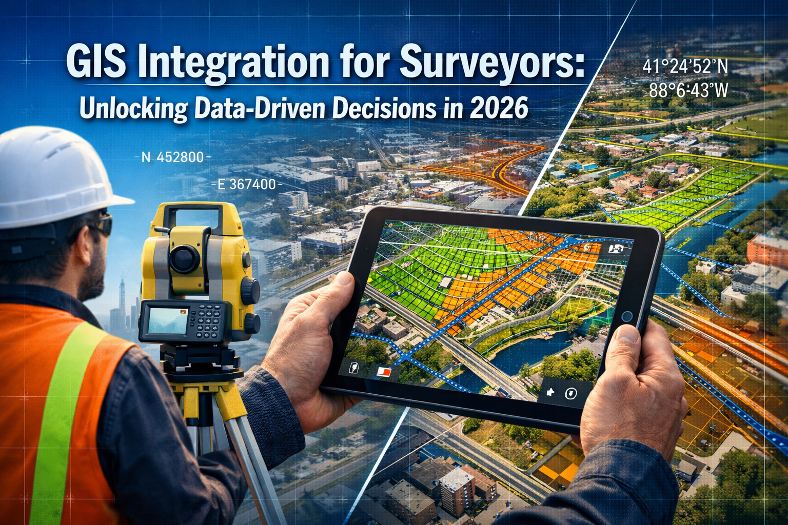
Picture this: A surveyor stands at a proposed development site, tablet in hand, viewing not just the physical boundaries before them, but layers upon layers of critical data—zoning regulations, underground utilities, environmental constraints, and historical land use—all overlaid in a single, interactive map. This is the power of GIS Integration for Surveyors: Unlocking Data-Driven Decisions in 2026, where geographic information systems transform raw spatial data into actionable intelligence that shapes smarter land management decisions.
The surveying profession has evolved dramatically from the days of theodolites and paper plans. Today's surveyors operate at the intersection of traditional fieldwork and cutting-edge technology, where the ability to overlay multiple data sources in Geographic Information Systems (GIS) has become essential for delivering comprehensive, value-driven insights to clients. Whether assessing property boundaries, planning infrastructure projects, or resolving complex land disputes, GIS integration enables surveyors to visualize relationships between different data layers that would otherwise remain hidden in separate databases and file systems.
GIS Integration for Surveyors: Unlocking Data-Driven Decisions in 2026 represents more than just technological advancement—it signifies a fundamental shift in how surveying professionals approach their work, moving from isolated measurements to holistic spatial analysis that considers zoning, utilities, environmental factors, and development potential simultaneously.
Key Takeaways
- 🗺️ Multi-layer data visualization allows surveyors to overlay zoning boundaries, utility networks, property lines, and environmental constraints in a single GIS platform for comprehensive land analysis
- 🤖 AI-enhanced spatial insights are transforming GIS capabilities in 2026, enabling predictive modeling, pattern recognition, and automated analysis that accelerates decision-making processes
- ☁️ Cloud-based GIS platforms improve accessibility, collaboration, and scalability while reducing implementation costs for surveying firms of all sizes
- 🔗 Interoperability between systems eliminates data silos and ensures seamless information flow across diverse software platforms used by surveyors, engineers, and planners
- 📊 Real-time data integration from IoT sensors, drone surveys, and reality capture technologies provides surveyors with up-to-the-minute spatial information for dynamic project environments
Understanding GIS Integration in Modern Surveying Practice
Geographic Information Systems have revolutionized how surveyors collect, analyze, and present spatial data. At its core, GIS integration refers to the process of combining multiple data sources—from traditional survey measurements to satellite imagery, municipal records, and real-time sensor feeds—into a unified platform that enables sophisticated spatial analysis and visualization.
What Makes GIS Essential for Surveyors?
For surveyors working in 2026, GIS provides centralized data management capabilities that allow vast geospatial datasets to be stored, organized, and accessed efficiently[1]. Rather than maintaining separate files for topographic surveys, utility maps, zoning information, and property records, integrated GIS platforms consolidate these diverse data sources into coherent, queryable databases.
The analytical power of GIS extends far beyond simple map creation. Modern GIS platforms enable surveyors to:
- Identify spatial patterns and trends in land use, development potential, and environmental constraints
- Perform complex overlay analysis to determine how different factors interact in specific locations
- Generate predictive models that forecast future conditions based on historical data and current trends
- Create visual outputs that communicate technical findings to clients, planners, and stakeholders in easily understandable formats[1]
The Evolution Toward Data-Driven Surveying
The surveying profession has witnessed a fundamental transformation in recent years. Traditional surveying focused primarily on precise measurements and boundary determination. While accuracy remains paramount, modern surveyors are increasingly expected to provide contextual intelligence that informs broader land management and development decisions.
This evolution has been accelerated by several converging trends. Reality capture technologies—including laser scanning, photogrammetry, and drone-based surveys—now generate massive point cloud datasets that document existing conditions with unprecedented detail[2]. These datasets become exponentially more valuable when integrated with GIS platforms that can overlay additional contextual information.
Professional surveying firms, including chartered surveyors across London, are adopting GIS integration to enhance the value they deliver to clients. Whether conducting structural surveys or boundary surveys, the ability to present findings within a comprehensive GIS context differentiates leading practitioners from those still relying on traditional deliverables alone.
Key Components of Effective GIS Integration
Successful GIS integration for surveyors requires several foundational elements:
Data Acquisition Infrastructure: Modern surveying operations combine multiple data collection methods—total stations, GNSS receivers, laser scanners, and unmanned aerial vehicles—all of which must feed into the GIS platform seamlessly.
Spatial Database Management: Robust database systems organize diverse data types (vector, raster, point clouds, attribute tables) while maintaining spatial relationships and enabling efficient queries.
Analysis and Modeling Tools: Advanced GIS platforms provide analytical capabilities ranging from simple buffer analysis to complex spatial statistics and machine learning algorithms.
Visualization and Output Generation: The ability to create compelling maps, 3D visualizations, and interactive web applications transforms technical data into actionable intelligence for decision-makers.
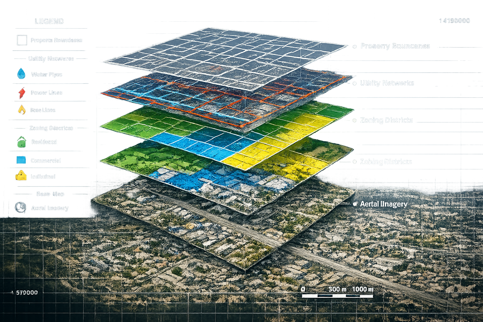
GIS Integration for Surveyors: Overlaying Critical Data Layers
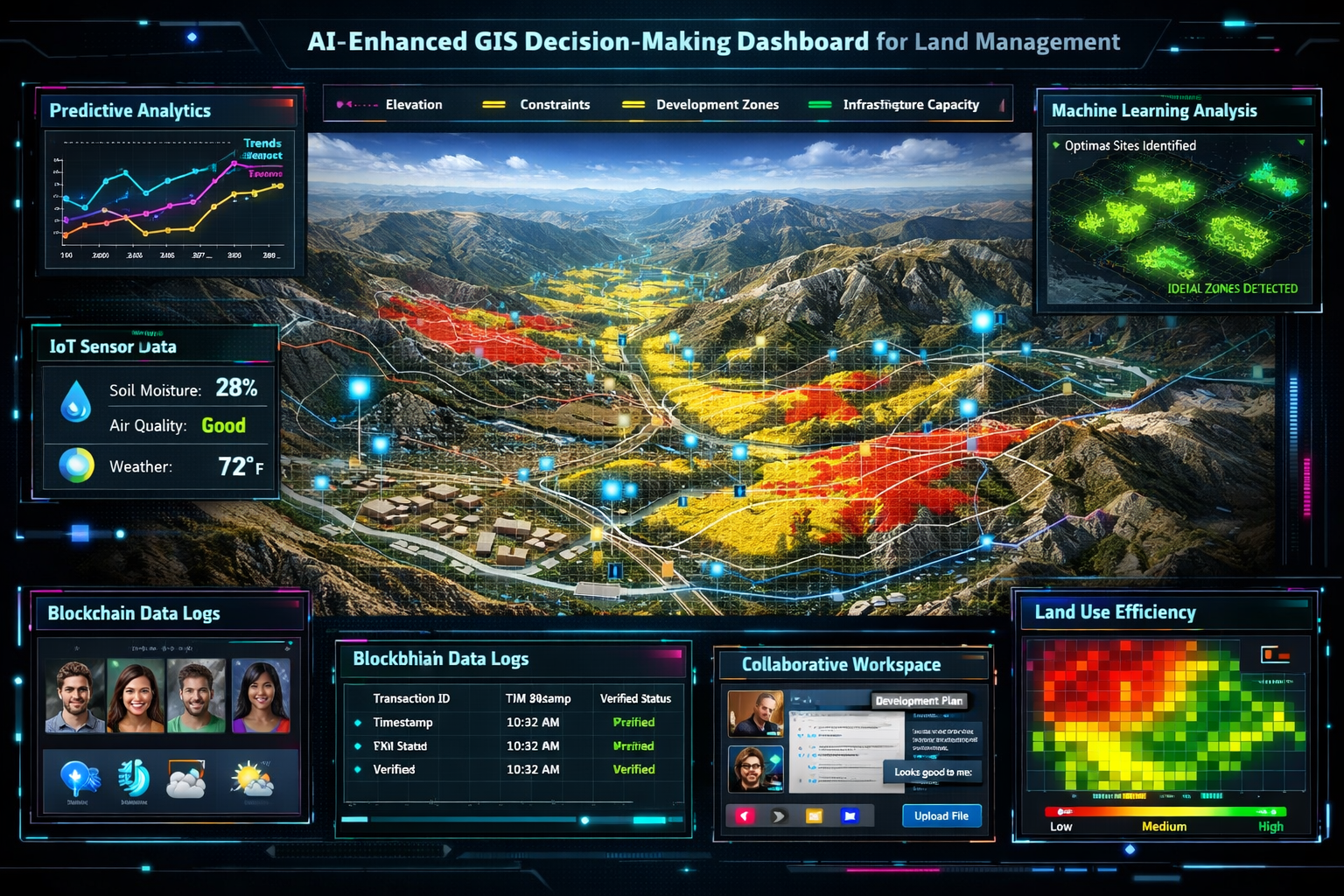
The true power of GIS Integration for Surveyors: Unlocking Data-Driven Decisions in 2026 emerges when multiple data layers are overlaid to reveal relationships and constraints that inform land management decisions. This multi-layer approach transforms surveying from a measurement exercise into a comprehensive analytical process.
Zoning and Land Use Regulations
Zoning information represents one of the most critical data layers for surveyors involved in development projects. By overlaying zoning district boundaries with property parcels and proposed development footprints, surveyors can immediately identify regulatory constraints and opportunities.
Modern GIS platforms allow surveyors to integrate:
- Zoning classifications (residential, commercial, industrial, mixed-use)
- Density restrictions (floor area ratios, height limits, setback requirements)
- Overlay districts (historic preservation, environmental protection, design review areas)
- Future land use plans that indicate anticipated zoning changes
This integration proves invaluable during feasibility studies and site selection processes. For example, a surveyor evaluating potential sites for a mixed-use development can quickly filter parcels that meet minimum size requirements, fall within appropriate zoning districts, and align with municipal growth plans—all through spatial queries within the GIS platform.
Utility Infrastructure Networks
Underground and overhead utilities represent both constraints and opportunities in land development. Utility mapping within GIS platforms enables surveyors to visualize the complex networks that serve properties and identify potential conflicts or connection points.
Critical utility layers include:
| Utility Type | Data Elements | Survey Implications |
|---|---|---|
| Water | Distribution mains, service lines, valves, hydrants | Connection capacity, easement requirements |
| Sanitary Sewer | Gravity mains, force mains, manholes, pump stations | Elevation constraints, capacity analysis |
| Storm Drainage | Storm sewers, culverts, detention basins, outfalls | Drainage patterns, flood risk assessment |
| Electric | Transmission lines, distribution lines, transformers | Clearance requirements, service capacity |
| Gas | High-pressure mains, distribution lines, regulators | Safety setbacks, service availability |
| Telecommunications | Fiber optic lines, conduits, access points | Connectivity options, right-of-way conflicts |
By overlaying utility networks with proposed development plans, surveyors can identify potential conflicts early in the design process, estimate connection costs, and determine whether existing infrastructure has adequate capacity to serve new development. This analysis proves particularly valuable for infrastructure projects where coordination among multiple utility providers is essential.
Property Boundaries and Easements
Accurate property boundary data forms the foundation of land surveying, and GIS integration enhances how this information is utilized and communicated. Modern GIS platforms allow surveyors to overlay legal descriptions, recorded plats, and field survey data to create comprehensive property databases.
Key boundary-related layers include:
- Parcel boundaries with associated ownership and assessment data
- Recorded easements for utilities, access, drainage, and conservation
- Rights-of-way for roads, railroads, and public access
- Encroachments identified through field surveys
- Disputed boundaries requiring resolution
This integration supports various surveying applications. When conducting boundary surveys in London, surveyors can reference historical parcel data, identify potential conflicts with adjacent properties, and present findings in context with surrounding land use patterns. The GIS platform becomes a powerful tool for identifying and resolving boundary disputes by visualizing competing claims alongside objective survey measurements.
Environmental and Topographic Constraints
Environmental data layers add another critical dimension to land analysis. Surveyors increasingly incorporate environmental constraints into their GIS platforms to identify development limitations and opportunities for sustainable design.
Essential environmental layers include:
- 🌊 Floodplains and flood zones based on hydraulic modeling
- 🌳 Wetlands and water bodies requiring regulatory protection
- ⛰️ Steep slopes and unstable soils limiting development potential
- 🦅 Habitat areas for protected species
- 🏛️ Historic and archaeological sites requiring preservation consideration
- 🌲 Tree canopy and vegetation coverage
Topographic data—including elevation contours, digital elevation models, and slope analysis—provides the foundation for understanding site conditions and drainage patterns. Modern surveying workflows often combine traditional ground surveys with aerial LiDAR data to create highly detailed terrain models that integrate seamlessly with other GIS layers.
Real-World Infrastructure Project Example
Consider a municipal infrastructure expansion project where a surveyor must evaluate potential routes for a new water main extension. Using GIS Integration for Surveyors: Unlocking Data-Driven Decisions in 2026, the analysis workflow might proceed as follows:
Step 1: Define Constraints
- Overlay existing utility networks to identify potential conflicts
- Add environmental layers showing wetlands, streams, and protected areas
- Include property boundaries and easements to determine right-of-way availability
- Layer zoning data to identify areas where construction permits may face restrictions
Step 2: Analyze Alternatives
- Generate multiple route alternatives using network analysis tools
- Calculate construction costs based on terrain, soil conditions, and pavement restoration requirements
- Evaluate each alternative against environmental, property, and utility constraints
- Assess long-term maintenance access and future expansion potential
Step 3: Visualize and Communicate
- Create 3D visualizations showing proposed routes in context with existing conditions
- Generate cross-sections at critical conflict points
- Produce interactive web maps allowing stakeholders to explore alternatives
- Export data to engineering design software for detailed construction planning
This integrated approach, impossible with traditional surveying methods alone, enables data-driven decisions that balance technical feasibility, environmental responsibility, and economic efficiency.
Emerging Technologies Transforming GIS Integration for Surveyors
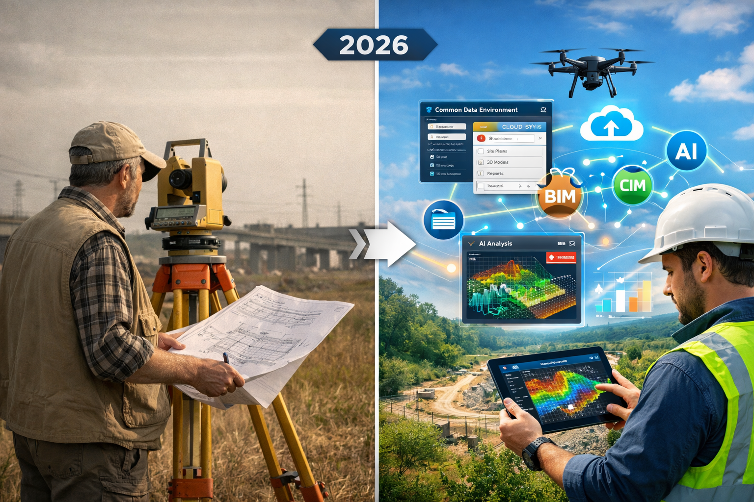
The landscape of GIS Integration for Surveyors: Unlocking Data-Driven Decisions in 2026 continues to evolve rapidly as new technologies enhance data collection, analysis, and visualization capabilities. Understanding these emerging trends is essential for surveying professionals seeking to maintain competitive advantage and deliver maximum value to clients.
Reality Capture and AI-Enhanced Spatial Analysis
Reality capture has become integral to project management workflows, enabling surveyors to document existing conditions, visually track progress, and collaborate on solutions in real time using AI, machine learning, and cloud-based platforms[2]. The convergence of reality capture with GIS creates powerful new capabilities for spatial analysis and decision support.
Modern reality capture workflows typically involve:
- Terrestrial laser scanning that generates millions of survey-grade points per second
- Mobile mapping systems that capture corridor data while driving at normal speeds
- Aerial photogrammetry using drones to create orthophotos and 3D models
- 360-degree imagery that provides immersive documentation of site conditions
When integrated with GIS platforms, these reality capture datasets enable surveyors to perform analyses that were previously impractical or impossible. For instance, AI-powered feature extraction can automatically identify and classify objects within point clouds—detecting utility poles, pavement markings, vegetation, and building features—then populate GIS databases with this information without manual digitization[2].
Machine learning algorithms can also analyze historical spatial data to identify patterns and generate predictive models. A surveyor working on subsidence monitoring might train an algorithm to recognize early warning signs in elevation data, enabling proactive intervention before significant structural damage occurs. This capability proves particularly valuable for subsidence surveys where early detection is critical.
Cloud-Based GIS Platforms and Collaboration
Cloud-based GIS platforms are improving accessibility, scalability, and collaboration while reducing implementation costs and maintenance burdens for surveying firms of all sizes[1][3]. The shift from desktop-centric GIS to cloud-native platforms represents one of the most significant technological transitions in the geospatial industry.
Cloud GIS platforms offer several compelling advantages:
Accessibility: Team members can access project data from any location using web browsers or mobile devices, eliminating the need for specialized workstations and enabling field crews to view and update GIS data in real time.
Scalability: Cloud infrastructure automatically scales computing and storage resources based on demand, allowing firms to handle large projects without investing in expensive hardware upgrades.
Collaboration: Multiple users can work with the same datasets simultaneously, with changes synchronized in real time and version control managed automatically.
Cost Efficiency: Subscription-based pricing models eliminate large upfront software purchases and reduce IT infrastructure and maintenance costs.
For surveying firms serving diverse geographic areas—such as those providing chartered surveyor services across Surrey, Hertfordshire, and Buckinghamshire—cloud-based GIS enables centralized data management while supporting distributed teams working across multiple project sites simultaneously.
Common Data Environments and Interoperability
Common Data Environments (CDEs) are accelerating in adoption as the construction industry becomes data-driven; CDEs function as both delivery platforms and collaboration tools that transform how spatial information integrates with broader project data rather than existing in isolation[2].
The concept of CDEs addresses a persistent challenge in the architecture, engineering, and construction (AEC) industry: information silos that prevent effective collaboration and lead to costly errors when data handoffs occur between disciplines. For surveyors, CDEs provide a framework for ensuring that survey data flows seamlessly to engineers, architects, contractors, and facility managers throughout the project lifecycle.
Interoperability is unlocking seamless data integration across diverse teams and technology platforms, reducing friction in data handoffs and allowing survey data to flow seamlessly between systems regardless of software differences[2]. Modern GIS platforms support numerous data exchange formats and standards, including:
- Industry Foundation Classes (IFC) for building information modeling integration
- LandXML for civil engineering and surveying data exchange
- Open Geospatial Consortium (OGC) standards for web services and data formats
- Cloud-optimized formats like Cloud Optimized GeoTIFF (COG) for efficient web delivery
This interoperability proves essential when surveyors collaborate with other professionals. A surveyor conducting a drone roof survey in London can deliver results in formats that integrate directly with the architect's building information model, the structural engineer's analysis software, and the facility manager's asset management system—all without manual data conversion or reformatting.
3D GIS and Visualization-Driven Workflows
Visualization-driven workflows are transforming project integration, with design conversations increasingly occurring directly within 3D models rather than on traditional 2D plans, enabling quicker iterations and stronger alignment throughout design and construction phases[2].
The adoption of 3D GIS represents one of the most significant emerging trends in geospatial technology[3]. Unlike traditional 2D GIS that represents features as points, lines, and polygons on a flat plane, 3D GIS models the built and natural environment in three dimensions, enabling more realistic visualization and sophisticated analysis.
3D GIS capabilities relevant to surveying include:
3D Visualization: Creating realistic representations of existing conditions and proposed developments that stakeholders can explore interactively, improving understanding and facilitating informed decision-making.
Volumetric Analysis: Calculating earthwork quantities, building volumes, and spatial relationships between 3D objects with greater accuracy than 2D approximations.
Line-of-Sight Analysis: Determining visibility from specific viewpoints, essential for telecommunications tower siting, viewshed protection, and security planning.
Shadow Analysis: Modeling how proposed structures will cast shadows throughout the day and year, informing solar access studies and urban design decisions.
Underground Utility Modeling: Representing subsurface infrastructure in true 3D, enabling conflict detection and clearance verification during excavation planning.
For surveyors conducting building surveys or commercial property assessments, 3D GIS provides powerful tools for presenting findings in context and enabling clients to visualize conditions and recommendations more effectively than traditional 2D plans and reports allow.
Internet of Things (IoT) Integration
The integration of Internet of Things (IoT) data into GIS platforms represents another transformative trend[3]. IoT sensors deployed across infrastructure networks, buildings, and environmental monitoring stations generate continuous streams of real-time data that can be visualized and analyzed within GIS platforms.
Surveying applications of IoT-GIS integration include:
- Structural monitoring sensors that track building movement, stress, and environmental conditions over time
- Environmental sensors measuring air quality, noise levels, temperature, and precipitation
- Traffic and pedestrian counters providing data for transportation planning and site access analysis
- Utility monitoring systems reporting flow rates, pressure, and system performance
- Construction site sensors tracking equipment location, material deliveries, and progress milestones
By integrating IoT data streams with traditional survey measurements and GIS analysis, surveyors can provide clients with dynamic, real-time insights rather than static snapshots of conditions at a single point in time. This capability proves particularly valuable for infrastructure asset management, where continuous monitoring enables predictive maintenance and extends asset lifecycles.
Blockchain for Secure Data Management
Blockchain technology is being implemented for secure data management within GIS platforms[3], addressing growing concerns about data integrity, provenance, and security in an era of increasing cyber threats and regulatory compliance requirements.
For surveyors, blockchain applications in GIS include:
Survey Data Certification: Creating immutable records of survey measurements, field notes, and deliverables that provide verifiable proof of when data was collected and by whom, reducing disputes and liability exposure.
Property Records Management: Maintaining transparent, tamper-proof records of property boundaries, ownership transfers, and easement agreements that all parties can trust.
Multi-Party Collaboration: Enabling secure data sharing among project stakeholders while maintaining clear audit trails of who accessed or modified information.
Smart Contracts: Automating certain aspects of surveying workflows, such as triggering payment releases when specific deliverables are verified and recorded on the blockchain.
While blockchain integration in GIS remains in relatively early stages of adoption, forward-thinking surveying firms are exploring how this technology can enhance data security, reduce administrative overhead, and provide additional value to clients concerned about long-term data integrity.
Implementing GIS Integration: Practical Strategies for Surveying Firms
Successfully implementing GIS Integration for Surveyors: Unlocking Data-Driven Decisions in 2026 requires more than simply purchasing software licenses. Surveying firms must develop comprehensive strategies that address technology selection, staff training, workflow redesign, and data management practices.
Assessing Current Capabilities and Defining Objectives
Before investing in GIS integration, surveying firms should conduct honest assessments of their current technological capabilities and clearly define what they hope to achieve. Key questions to consider include:
Technology Infrastructure:
- What data collection equipment does the firm currently use?
- Are existing systems capable of producing outputs compatible with GIS platforms?
- Does the firm have adequate computing infrastructure to support GIS software?
- What is the current state of internet connectivity and bandwidth?
Staff Skills and Experience:
- Do staff members have GIS experience, or will training be required?
- Are there champions within the organization who can lead adoption efforts?
- What is the firm's capacity to absorb new technology while maintaining current project commitments?
Business Objectives:
- What specific client needs could GIS integration address more effectively?
- Which service offerings could be enhanced or expanded through GIS capabilities?
- What competitive advantages might GIS integration provide?
- How will success be measured and evaluated?
Firms providing specialized services—such as party wall surveys or dilapidation surveys—should consider how GIS integration might enhance these specific practice areas rather than pursuing technology for its own sake.
Selecting Appropriate GIS Platforms and Tools
The GIS software market offers numerous options ranging from enterprise-level platforms to specialized surveying applications. Selection criteria should include:
Functionality Requirements:
- Does the platform support the specific analysis and visualization capabilities needed?
- Can it integrate with existing survey equipment and software?
- Does it provide mobile field data collection capabilities?
- Are the output formats compatible with client requirements?
Scalability and Flexibility:
- Can the platform grow with the firm's needs?
- Does it support both desktop and cloud-based workflows?
- Can licenses be added or removed as project demands fluctuate?
Cost Considerations:
- What are the total costs including software, training, support, and infrastructure?
- Are subscription-based or perpetual license models more appropriate?
- What is the expected return on investment timeline?
Vendor Support and Community:
- Does the vendor provide adequate technical support and training resources?
- Is there an active user community for peer support and knowledge sharing?
- What is the vendor's track record for product development and innovation?
Many surveying firms adopt a phased approach, starting with core GIS capabilities and expanding functionality as staff expertise grows and additional use cases emerge. This strategy reduces initial investment risk while allowing the organization to learn and adapt incrementally.
Developing Data Management Protocols
Effective GIS integration depends on robust data management practices that ensure accuracy, consistency, and accessibility. Surveying firms should establish clear protocols addressing:
Data Standards:
- Coordinate systems and datums for all spatial data
- Attribute naming conventions and data types
- Accuracy standards for different data collection methods
- Metadata requirements documenting data sources, collection dates, and processing methods
Quality Control Procedures:
- Verification workflows for data entering the GIS
- Validation rules to prevent erroneous data entry
- Regular audits of data accuracy and completeness
- Processes for correcting errors and documenting changes
Data Security and Backup:
- Access controls limiting who can view or modify sensitive data
- Regular backup schedules and disaster recovery procedures
- Encryption for data transmission and storage
- Retention policies complying with professional and legal requirements
Data Sharing and Delivery:
- Standard formats for delivering GIS data to clients
- Web mapping applications for stakeholder access
- Integration with client systems and workflows
- Documentation and training for data recipients
Firms conducting sensitive work—such as matrimonial valuations or commercial dilapidation surveys—must pay particular attention to data security protocols to protect client confidentiality and comply with privacy regulations.
Training and Skill Development
Staff training represents one of the most critical success factors for GIS integration. Effective training programs should address both technical skills and conceptual understanding of spatial analysis principles.
Training strategies include:
Formal Education:
- Vendor-provided training courses on specific software platforms
- Professional development courses from industry associations
- University certificate programs in GIS and geospatial technology
- Online learning platforms offering self-paced instruction
Hands-On Learning:
- Pilot projects that allow staff to apply new skills in controlled environments
- Mentoring relationships pairing experienced GIS users with newcomers
- Regular "lunch and learn" sessions where staff share techniques and discoveries
- Participation in user groups and professional conferences
Role-Specific Training:
- Field crew training focused on mobile data collection and quality control
- Office staff training emphasizing analysis, visualization, and deliverable production
- Management training on GIS capabilities, project scoping, and client communication
- IT staff training on platform administration, security, and integration
Successful firms recognize that GIS training is not a one-time event but an ongoing process as software capabilities evolve and new applications emerge. Allocating dedicated time and resources for continuous learning demonstrates organizational commitment and helps retain skilled staff.
Redesigning Workflows for GIS Integration
Implementing GIS technology often requires workflow redesign to realize its full potential. Rather than simply automating existing processes, firms should reimagine how work flows from data collection through analysis to deliverable production.
Key workflow considerations include:
Field-to-Office Integration: Eliminate redundant data entry by ensuring field-collected data flows directly into GIS databases with appropriate quality control checkpoints.
Collaborative Work Environments: Design workflows that allow multiple team members to work on different aspects of a project simultaneously, with clear coordination protocols.
Automated Processing: Identify repetitive tasks that can be automated through scripts or model builders, freeing staff to focus on analysis and problem-solving.
Iterative Review Cycles: Build in regular review points where preliminary results are shared with clients and stakeholders, enabling course corrections before significant resources are invested.
Deliverable Standardization: Develop templates and standard operating procedures for common deliverable types, ensuring consistency and efficiency.
For firms offering diverse services across multiple locations—from central London to west London and beyond—standardized workflows ensure consistent quality regardless of which team members are assigned to specific projects.
Measuring Success and Continuous Improvement
Successful GIS integration requires ongoing evaluation and refinement. Firms should establish metrics to assess whether technology investments are delivering expected benefits:
Efficiency Metrics:
- Time required to complete common tasks before and after GIS integration
- Reduction in rework due to errors or miscommunication
- Increase in project capacity with existing staff levels
Quality Metrics:
- Client satisfaction scores and feedback
- Reduction in errors or omissions requiring correction
- Professional recognition or awards for innovative applications
Financial Metrics:
- Revenue growth from new or enhanced service offerings
- Profit margins on projects utilizing GIS capabilities
- Return on investment compared to initial projections
Strategic Metrics:
- Market differentiation and competitive positioning
- Staff satisfaction and retention
- Ability to pursue larger or more complex projects
Regular review of these metrics enables firms to identify areas where GIS integration is succeeding, recognize opportunities for improvement, and make informed decisions about future technology investments.
Future Outlook: The Evolving Landscape of GIS Integration for Surveyors
As we progress through 2026, the trajectory of GIS Integration for Surveyors: Unlocking Data-Driven Decisions in 2026 points toward increasingly sophisticated, automated, and accessible spatial analysis capabilities. Understanding emerging trends helps surveying professionals prepare for the future and position their practices for continued success.
Autonomous Data Collection and Processing
Future surveying technology is moving toward fully integrated digital workflows using AI, cloud platforms, autonomous drones, and real-time 3D modeling to deliver instant, highly accurate survey data with increased automation and reduced manual work[1].
Autonomous systems are already transforming data collection:
Autonomous Drones: Advanced unmanned aerial systems can fly pre-programmed missions, automatically adjusting flight parameters based on environmental conditions, and uploading data to cloud platforms for immediate processing without human intervention.
Mobile Mapping Vehicles: Self-driving vehicles equipped with laser scanners and cameras can autonomously survey road networks and urban corridors, operating during off-peak hours to minimize traffic disruption.
Robotic Total Stations: Automated surveying instruments can track targets, measure points, and record data based on programmed instructions, enabling single-operator workflows for tasks that traditionally required multi-person crews.
Automated Feature Extraction: AI algorithms continue to improve at identifying and classifying objects within imagery and point clouds, reducing the manual digitization work required to populate GIS databases.
These autonomous capabilities don't eliminate the need for professional surveyors but rather shift their focus from routine data collection toward quality assurance, complex problem-solving, and client consultation—higher-value activities that leverage professional judgment and expertise.
Predictive Analytics and Digital Twins
The convergence of GIS with predictive analytics and digital twin technologies creates new opportunities for surveyors to provide forward-looking insights rather than simply documenting current conditions.
Digital twins—virtual replicas of physical assets that are continuously updated with real-time data—enable sophisticated scenario modeling and predictive maintenance. Surveyors contribute to digital twin development by providing accurate as-built documentation and ongoing monitoring data that keeps virtual models synchronized with physical reality.
Applications include:
Infrastructure Asset Management: Municipalities can create digital twins of water distribution systems, combining survey data, IoT sensor feeds, and predictive models to forecast pipe failures and optimize maintenance schedules.
Building Performance Optimization: Facility managers can use digital twins integrating survey data, building systems, and occupancy patterns to optimize energy efficiency and space utilization.
Development Impact Analysis: Planners can model how proposed developments will affect traffic patterns, utility demand, and environmental conditions using digital twins that incorporate survey data, demographic trends, and behavioral models.
The U.S. Department of Transportation is actively addressing next-generation geospatial tools integration, with strategic plans to establish collaborative interagency groups and ensure geospatial data needs are included in artificial intelligence planning initiatives[4], signaling growing governmental recognition of these technologies' importance.
Augmented Reality for Field Operations
Augmented reality (AR) technology is beginning to transform how surveyors visualize and interact with spatial data in field environments. AR devices overlay digital information onto the physical world, enabling surveyors to "see" underground utilities, property boundaries, and design proposals in real-world context.
Field applications of AR-GIS integration include:
Utility Locating: Viewing the modeled positions of underground infrastructure overlaid on the actual ground surface, improving excavation safety and reducing utility strikes.
Layout and Stakeout: Visualizing design elements in their proposed locations without physically marking points, accelerating construction layout and reducing material costs.
As-Built Verification: Comparing constructed conditions against design models in real time, identifying discrepancies immediately while corrections are still cost-effective.
Client Presentations: Demonstrating proposed improvements or explaining site constraints to clients while standing at the actual location, improving understanding and facilitating decision-making.
As AR hardware becomes more affordable and software integration improves, these capabilities will transition from experimental novelty to standard practice for progressive surveying firms.
Democratization of Spatial Analysis
Cloud-based platforms and increasingly intuitive user interfaces are democratizing access to spatial analysis capabilities that once required specialized expertise. This trend creates both opportunities and challenges for surveying professionals.
On one hand, clients and stakeholders can now perform basic spatial queries and create simple maps without engaging surveyors, potentially commoditizing routine services. On the other hand, this democratization creates opportunities for surveyors to provide higher-level consulting services, helping clients interpret spatial data, design sophisticated analyses, and make informed decisions based on spatial intelligence.
Successful surveyors will position themselves as trusted advisors who help clients navigate the increasingly complex landscape of spatial data and analysis tools, rather than simply as data collectors or mapmakers. This consultative role leverages professional judgment, local knowledge, and technical expertise that cannot be easily replicated by software alone.
Sustainability and Climate Adaptation
Growing emphasis on sustainability and climate change adaptation is creating new applications for GIS-enabled surveying services. Clients increasingly seek spatial analysis that considers environmental impacts, climate risks, and long-term sustainability.
Relevant applications include:
Flood Risk Assessment: Combining topographic surveys with climate projections and hydraulic modeling to evaluate flood vulnerability under future conditions.
Green Infrastructure Planning: Analyzing opportunities for sustainable stormwater management, urban tree canopy expansion, and habitat connectivity.
Energy Efficiency Analysis: Integrating building surveys with solar exposure modeling and energy consumption data to identify retrofit opportunities.
Climate Adaptation Planning: Evaluating infrastructure vulnerability to sea-level rise, extreme heat, and changing precipitation patterns.
Surveyors who develop expertise in these emerging areas position themselves to serve clients' evolving needs while contributing to broader societal goals of environmental stewardship and climate resilience.
Regulatory Evolution and Standards Development
As GIS integration becomes standard practice, regulatory frameworks and professional standards continue to evolve. Surveying professionals should monitor developments in:
Data Sharing Requirements: Increasing governmental mandates for open data and interoperability may affect how survey data is collected, formatted, and delivered.
Accuracy Standards: As automated data collection becomes more prevalent, professional organizations are developing standards for different accuracy tiers and appropriate applications.
Liability Considerations: Legal frameworks are adapting to address questions of professional responsibility when AI-assisted analysis is involved or when data from multiple sources is integrated.
Licensure and Certification: Professional licensing boards are considering whether and how to incorporate GIS competency into surveyor qualifications and continuing education requirements.
Staying informed about these regulatory developments and participating in standards development processes helps ensure that professional surveyors' perspectives are represented as the regulatory landscape evolves.
Conclusion: Embracing Data-Driven Decision Making Through GIS Integration
GIS Integration for Surveyors: Unlocking Data-Driven Decisions in 2026 represents far more than a technological upgrade—it embodies a fundamental transformation in how surveying professionals approach their work, deliver value to clients, and contribute to informed land management and development decisions.
The ability to overlay zoning boundaries, utility networks, property lines, environmental constraints, and countless other data layers within integrated GIS platforms enables surveyors to provide comprehensive spatial intelligence that informs smarter decisions. Whether evaluating development sites, planning infrastructure improvements, resolving boundary disputes, or managing asset portfolios, GIS-enabled analysis reveals relationships and insights that remain hidden when data exists in isolated silos.
The technological trends shaping surveying practice in 2026—including AI-enhanced spatial analysis, cloud-based collaboration platforms, reality capture integration, and autonomous data collection—continue to expand what's possible while simultaneously raising expectations for what surveyors should deliver. Firms that embrace these capabilities position themselves as strategic advisors rather than mere technicians, commanding premium fees for the superior insights they provide.
Actionable Next Steps for Surveying Professionals
For surveying professionals seeking to enhance their GIS integration capabilities, consider these concrete actions:
1. Assess Current State: Conduct an honest evaluation of your firm's current GIS capabilities, identifying gaps between what you can deliver today and what clients increasingly expect.
2. Define Strategic Objectives: Clarify specific business goals that GIS integration should support—whether expanding service offerings, improving efficiency, enhancing quality, or differentiating from competitors.
3. Invest in Education: Commit resources to staff training, recognizing that technology investments only deliver value when people can effectively use them. Consider both formal training and hands-on learning opportunities.
4. Start Small, Scale Strategically: Begin with pilot projects that demonstrate value without overwhelming the organization, then expand capabilities based on lessons learned and proven success.
5. Establish Data Management Protocols: Develop clear standards for data collection, quality control, storage, and sharing before accumulating large datasets that become difficult to organize retroactively.
6. Engage with Clients: Educate clients about GIS capabilities and explore how spatial analysis might address their evolving needs, creating pull for enhanced services rather than pushing technology they don't understand.
7. Monitor Industry Developments: Stay informed about emerging technologies, regulatory changes, and professional standards through industry publications, conferences, and peer networks.
8. Collaborate Across Disciplines: Build relationships with engineers, planners, architects, and other professionals who can benefit from and contribute to integrated spatial analysis, creating ecosystem value that exceeds what any single discipline can deliver alone.
The surveying profession stands at an inflection point where those who embrace data-driven decision-making through GIS integration will thrive, while those who cling to traditional methods risk obsolescence. The tools, technologies, and knowledge required for success are increasingly accessible—what matters most is the commitment to continuous learning and adaptation.
For firms across the industry—from those providing chartered surveyor services in Surrey to specialists conducting specific defect reports or schedule of condition assessments—GIS integration offers pathways to enhanced service delivery, improved client outcomes, and sustainable competitive advantage.
The future of surveying belongs to professionals who can combine traditional expertise in measurement and spatial relationships with modern capabilities in data integration, analysis, and visualization. By unlocking the power of GIS to overlay diverse data sources and generate actionable spatial intelligence, surveyors transform from documenters of existing conditions into strategic advisors who shape better decisions about land use, infrastructure investment, and built environment development.
The journey toward comprehensive GIS integration may seem daunting, but the destination—a practice positioned to deliver exceptional value in an increasingly data-driven world—makes the effort worthwhile. The question is not whether to pursue GIS integration, but how quickly and effectively your firm can embrace the capabilities that define professional surveying excellence in 2026 and beyond.
References
[1] The Future Of Land Surveying Technology And Upcoming Trends In 2026 – https://metricop.com/blogs/land-surveying/the-future-of-land-surveying-technology-and-upcoming-trends-in-2026
[2] Doubling Down On Digital – https://amerisurv.com/2026/02/01/doubling-down-on-digital/
[3] Gis Industry 14668 – https://www.datainsightsmarket.com/reports/gis-industry-14668
[4] Us Dot Gis Strategic Plan 2026 30 – https://www.transportation.gov/sites/dot.gov/files/2025-12/US-DOT-GIS-Strategic-Plan-2026-30.pdf
[5] Gis Integration For Surveyors Overlaying Data For Smarter Land Management Decisions – https://nottinghillsurveyors.com/blog/gis-integration-for-surveyors-overlaying-data-for-smarter-land-management-decisions
[6] 6 Geospatial Trends To Watch In 2026 Insights From Intergeo 2025 – https://geo-matching.com/articles/6-geospatial-trends-to-watch-in-2026-insights-from-intergeo-2025