By 2030, an estimated 68% of the world's population will live in urban areas — yet fewer than 15% of local governments currently have the geospatial data infrastructure needed to plan that growth responsibly. That gap between ambition and evidence is exactly where sustainability-driven surveying steps in. The practice of sustainability-driven surveying: using geospatial data to guide responsible development is rapidly reshaping how land professionals, planners, and developers approach every stage of a project — from the first site assessment to the final boundary confirmation.
Surveyors are no longer simply measuring distances and recording elevations. They are capturing ecological baselines, modelling flood risk corridors, mapping biodiversity hotspots, and feeding that intelligence directly into planning decisions. The result is a profession that sits at the centre of responsible land stewardship.
Key Takeaways
- Geospatial data collected during the surveying process is now a primary tool for identifying environmental risk before development begins.
- International frameworks, including the UN's Sustainable Development Goals, are driving demand for disaggregated, location-specific environmental data at the local level.
- Technologies such as LiDAR, drone surveys, Synthetic Aperture Radar, and AI-powered geospatial models are expanding what surveyors can measure and predict.
- Responsible development depends on integrating ecological survey data early — not as a compliance afterthought but as a design input.
- Chartered surveyors working in urban and peri-urban areas are uniquely positioned to bridge the gap between environmental science and built environment practice.
Why Geospatial Data Has Become Central to Responsible Development
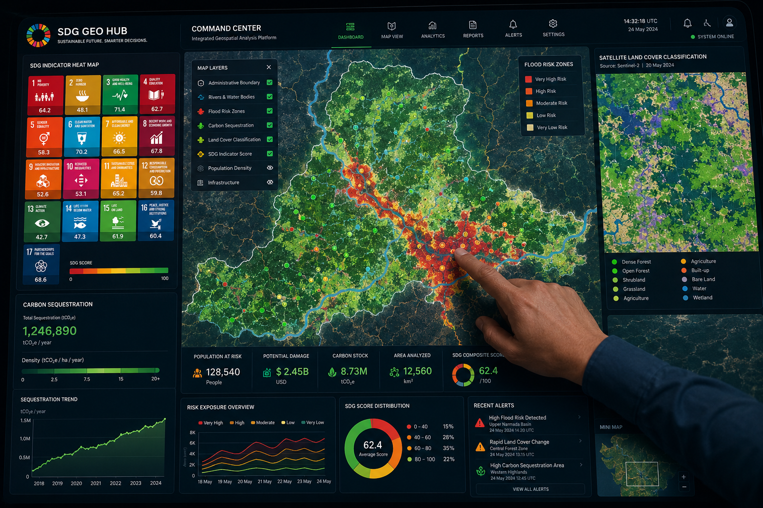
The connection between land surveying and environmental stewardship is not new, but the tools available today have transformed the depth and speed of ecological intelligence that surveyors can provide. Geospatial data — information tied to specific locations on the Earth's surface — now encompasses everything from soil permeability readings and tree canopy density to urban heat island measurements and groundwater recharge zones.
The United Nations Committee of Experts on Global Geospatial Information Management (UN-GGIM) has made it clear that high-quality, accessible, and timely geospatial data is essential to monitoring progress on the Sustainable Development Goals, particularly at sub-national and local levels [2]. For surveyors working in London, the South East, or any rapidly developing region, this global mandate translates into a very practical obligation: the data gathered on a site survey must be accurate, georeferenced, and usable by multiple stakeholders.
In February 2026, the United Nations Environment Programme released the fourth edition of its "Measuring Progress" series, proposing specific disaggregations for 92 environment-related SDG indicators [1]. The report's central argument is that broad national statistics mask local environmental crises. A development site in a flood-prone river valley and one on chalk downland carry entirely different ecological profiles — and only granular, location-specific geospatial data can reveal that difference before a single foundation is poured.
What this means in practice:
- Site surveys must capture ecological baselines, not just legal boundaries.
- Data must be georeferenced to enable integration with national and local planning databases.
- Surveyors need to communicate environmental findings in formats that planners, ecologists, and developers can all use.
For those beginning the process of commissioning a survey, understanding what type of survey you need is the essential first step — and sustainability considerations are increasingly shaping that decision.
The Technologies Driving Sustainability-Driven Surveying
LiDAR, Drones, and SAR: Seeing the Land in New Ways
The physical toolkit of the modern surveyor has expanded dramatically. Three technologies in particular are driving the shift toward sustainability-driven surveying: using geospatial data to guide responsible development in ways that were simply not possible a decade ago.
LiDAR (Light Detection and Ranging) fires millions of laser pulses per second at the ground, generating dense three-dimensional point clouds that reveal micro-topography, vegetation structure, and drainage patterns with centimetre-level accuracy. This data allows surveyors to model how water will move across a site during a storm event, identify areas of compaction risk, and map tree root zones that may be affected by construction.
Drone surveys bring aerial geospatial intelligence within reach of standard residential and commercial projects. A drone roof survey can assess not only structural condition but also solar exposure potential, green roof suitability, and proximity to protected bird nesting sites — all in a single flight. The data captured feeds directly into sustainability assessments and planning applications.
Synthetic Aperture Radar (SAR) operates through cloud cover and at night, making it particularly valuable for monitoring ground movement, subsidence risk, and land cover change over time. In January 2025, researchers introduced OpenEarthMap-SAR, a benchmark SAR dataset designed for global high-resolution land cover mapping, aimed at enhancing the accuracy and scalability of land cover classification in support of sustainable development initiatives [8].
"The surveyor who arrives on site with only a tape measure and a theodolite is leaving behind the most important data the project will ever need."
AI and Geospatial Foundation Models
Artificial intelligence is accelerating what geospatial data can tell us. A May 2025 study explored the application of large-scale, pre-trained AI systems — known as geospatial foundation models — in analysing satellite and sensor data to support scalable solutions for complex sustainability challenges [9]. These models can classify land cover, detect informal settlements, predict erosion risk, and identify ecological corridors across vast areas in hours rather than months.
The UNDP's GeoHub platform already offers over 4,300 datasets and interactive maps to support policymakers in visualising and analysing data relevant to the SDGs [6]. Surveyors who can integrate their field data with platforms like GeoHub are providing clients with a level of environmental intelligence that directly supports planning approval and long-term asset value.
The Food and Agriculture Organization's SDG Indicators Data Portal provides access to geospatial datasets related to land use, soil health, and agricultural sustainability [3] — resources that are directly relevant to any development on greenfield or previously agricultural land.
Ecological Data Collection: What Surveyors Capture Before Development Begins
Mapping Environmental Risk at the Site Level
The most consequential contribution a surveyor makes to responsible development often happens before any design work begins. Ecological data collection during the pre-development phase can prevent costly mistakes, reduce planning objections, and protect developers from legal liability.
Key environmental datasets that sustainability-focused surveyors now routinely capture or commission include:
| Data Type | Surveying Method | Development Relevance |
|---|---|---|
| Flood risk zones | LiDAR topography, hydrological modelling | Site suitability, drainage design |
| Ground movement and subsidence | SAR, geotechnical survey | Foundation specification |
| Tree canopy and root zones | Drone photogrammetry, LiDAR | Planning constraints, biodiversity net gain |
| Soil contamination indicators | Ground-penetrating radar, sampling | Remediation planning |
| Ecological corridors | Habitat mapping, aerial imagery | Biodiversity net gain compliance |
| Solar exposure | Drone survey, GIS modelling | Renewable energy potential |
A structural survey in London conducted with sustainability in mind will incorporate several of these data streams, giving the client a far richer picture of site constraints and opportunities than a conventional condition report alone.
The GRID3 initiative has demonstrated the power of this approach at scale. Their spatial data solutions focus on accurately mapping populations and settlements to support effective humanitarian and development decisions, ensuring communities are correctly represented in geospatial data [4]. The same principle applies at the project level: accurate spatial representation of ecological features is the foundation of responsible planning.
Biodiversity Net Gain and the Surveyor's Role
England's mandatory Biodiversity Net Gain (BNG) requirements, now embedded in the planning system, have created a direct professional obligation for surveyors to engage with ecological data. Developers must demonstrate a measurable improvement in biodiversity compared to the pre-development baseline — and that baseline must be established through rigorous, georeferenced survey data.
This is not a task that can be delegated entirely to ecologists. Surveyors provide the spatial framework — the accurate boundary data, the topographic model, the drainage patterns — within which ecological assessments are conducted. A boundary dispute or party wall matter that goes unresolved before development begins can undermine the entire ecological baseline, because the area being assessed may not accurately reflect the land that will actually be developed.
Practical steps surveyors take to support BNG compliance:
- Establish precise site boundaries using GPS and total station equipment before ecological surveys begin.
- Produce georeferenced topographic surveys that ecologists can overlay with habitat data.
- Identify and record existing landscape features — hedgerows, ponds, mature trees — that carry high biodiversity value.
- Model drainage and surface water flow to identify areas where habitat creation will be most effective.
- Provide ongoing monitoring data through repeat drone surveys to verify that BNG commitments are being met post-construction.
Forecasting Environmental Impact: From Data to Decision
Sustainability-driven surveying: using geospatial data to guide responsible development is most powerful when it moves from description to prediction. Modern GIS platforms allow surveyors and planners to run scenario models — testing how a proposed development will affect surface water runoff, urban heat, air quality, and ecological connectivity before a planning application is submitted.
Esri's GIS platform, widely used across the surveying profession, enables the visualisation and analysis of community and environmental data, facilitating the identification of critical needs and the implementation of impactful development plans [5]. When a surveyor uses GIS to model the shadow impact of a proposed building on an adjacent green space, or to test whether a new road will fragment a wildlife corridor, they are performing exactly the kind of predictive environmental analysis that responsible development requires.
The Federal Geographic Data Committee's 2023 Annual Report highlighted significant advances in integrating geospatial information into federal decision-making processes in the United States [7] — a trajectory that mirrors the direction of travel in UK planning policy, where geospatial evidence is increasingly expected rather than optional.
Ethical considerations matter too. A 2023 study on the philosophical foundations of GeoAI emphasised the importance of sustainability, diversity, and bias mitigation in geospatial data science, advocating for responsible research practices to ensure that AI-driven geospatial systems contribute positively to sustainable development [10]. Surveyors using AI-assisted analysis tools should be aware of these considerations, particularly when data is being used to make decisions that affect communities and ecosystems.

Integrating Geospatial Sustainability Data into the Development Process
From Survey to Planning Application
The value of geospatial sustainability data is only realised when it is effectively integrated into the development process. Too often, environmental survey data sits in a technical appendix, unread by the design team and unused by planners. Surveyors who understand how to communicate geospatial findings clearly — through maps, 3D models, and plain-language summaries — are providing a service that directly improves planning outcomes.
For developments in London and the surrounding regions, chartered surveyors are increasingly expected to present geospatial environmental data in formats compatible with local authority GIS systems. This requires not only technical competence but also familiarity with local planning policy and the specific environmental sensitivities of different areas.
Developments in areas like Surrey or Essex — where green belt land, ancient woodland, and protected river corridors are common constraints — require particularly careful geospatial analysis before any development proposal is advanced.
The Long-Term Value of Geospatial Environmental Records
Geospatial sustainability data does not lose its value once planning permission is granted. Environmental records created during the survey phase become part of the long-term asset record for a property or development. They inform:
- Insurance reinstatement valuations, where environmental risk factors affect rebuilding costs and coverage requirements.
- Future development appraisals, where historical ecological data provides a baseline for new BNG calculations.
- Dilapidations assessments, where environmental condition at the start of a lease must be compared to condition at the end.
For anyone involved in dilapidation surveys or property valuations, the availability of georeferenced environmental records from the original development survey can significantly reduce disputes and speed up assessments.
The surveying profession is also increasingly involved in post-occupancy monitoring — using repeat drone surveys and remote sensing data to verify that sustainability commitments made at the planning stage are being delivered in practice. This ongoing role positions surveyors as long-term environmental stewards, not just pre-development data collectors.
Conclusion
Sustainability-driven surveying: using geospatial data to guide responsible development is not a niche specialism — it is rapidly becoming the standard of practice for any surveyor working on land that matters to communities and ecosystems. The combination of advanced sensing technologies, AI-powered analysis, and internationally recognised sustainability frameworks has created both the tools and the mandate for surveyors to play a central role in environmental stewardship.
Actionable next steps for developers, planners, and property professionals:
- Commission geospatial ecological surveys at the earliest possible stage of any development project — before design work begins.
- Ensure that surveying briefs explicitly require georeferenced environmental data in formats compatible with local authority GIS systems.
- Use LiDAR, drone, and SAR data to model environmental risk scenarios before submitting planning applications.
- Engage chartered surveyors who understand both the technical and regulatory dimensions of biodiversity net gain compliance.
- Retain all geospatial environmental records as part of the long-term asset file for the property.
- Stay current with evolving international frameworks, including UN-GGIM guidance and UNEP's disaggregated SDG indicators, which are increasingly shaping national planning policy.
The surveyor who arrives on site equipped with geospatial tools and an environmental brief is not just measuring land — they are helping to decide what kind of future that land will support.
References
[1] Data Impact Measuring Progress Through Disaggregated Sdg Indicators – https://www.unep.org/resources/report/data-impact-measuring-progress-through-disaggregated-sdg-indicators?utm_source=openai
[2] Sustainable Development – https://ggim.un.org/Sustainable-Development/?utm_source=openai
[3] fao – https://www.fao.org/sustainable-development-goals-data-portal/en?utm_source=openai
[4] grid3 – https://grid3.org/?utm_source=openai
[5] Overview – https://www.esri.com/en-us/industries/sustainable-development/overview?utm_source=openai
[6] geohub.data.undp – https://geohub.data.undp.org/?utm_source=openai
[7] Annual%20reports – https://www.fgdc.gov/resources/whitepapers-reports/annual%20reports?utm_source=openai
[8] arxiv – https://arxiv.org/abs/2501.10891?utm_source=openai
[9] arxiv – https://arxiv.org/abs/2505.24528?utm_source=openai
[10] arxiv – https://arxiv.org/abs/2304.06508?utm_source=openai