Seventy-three percent of construction professionals now use Building Information Modelling in their daily workflows — a figure that stood at barely 10% a decade ago [1]. That shift is not simply a technology trend. It represents a fundamental change in how geospatial data moves from the ground into the hands of architects, engineers, and project managers. For land surveyors, BIM integration for land surveyors: enhancing construction efficiency in 2026 is no longer an optional upgrade — it is the professional baseline that separates firms winning large contracts from those being quietly sidelined.
This article explains how surveyors can fuse geospatial data into BIM models, reduce design conflicts before they reach the construction phase, and position themselves as indispensable collaborators in modern project teams.
Key Takeaways
- BIM adoption has reached 73% across the construction industry, making geospatial integration a core surveyor competency in 2026 [1].
- Fusing GIS and point-cloud data into BIM models cuts clash detection errors and reduces change orders by 15-20% [2].
- BIM users report 10-20% shorter project timelines and up to 20% savings in material costs through precise quantity takeoffs [2].
- Surveyors who upskill in BIM workflows become strategic partners for architects and engineers, not just data suppliers.
- Structured data handover protocols and common data environments (CDEs) are the practical foundation of effective BIM collaboration.
What BIM Integration Means for Land Surveyors Today
Building Information Modelling is a process, not a piece of software. At its core, BIM creates a shared digital representation of a built asset — a model that carries geometry, spatial relationships, geographic information, quantities, and properties of building components. For a land surveyor, the critical question is: where does survey data enter that model, and how does it stay accurate throughout the project lifecycle?
Traditional surveying produced drawings and reports that were handed over and then largely disconnected from the design process. BIM changes that relationship entirely. Survey data — topographic surveys, measured building surveys, underground utility mapping, and boundary data — becomes the georeferenced foundation on which every other discipline builds. Errors at this stage propagate through the entire model, which is precisely why surveyors with strong BIM competency are in high demand.
In the UK context, chartered surveyors in London and across major urban centres are increasingly expected to deliver data in formats compatible with Autodesk Revit, Bentley Systems, or open IFC (Industry Foundation Classes) standards. Clients commissioning structural surveys in London now routinely request that findings be embedded directly into a project BIM model rather than delivered as a standalone PDF report.
The Shift from 2D to Information-Rich 3D Data
The practical change for most surveying firms involves three transitions:
- From CAD drawings to georeferenced 3D point clouds — captured via terrestrial laser scanning (TLS) or drone-based LiDAR.
- From standalone reports to model-embedded data — attaching condition notes, material specifications, and measurement data directly to BIM objects.
- From project handover to continuous data management — maintaining survey accuracy through construction and into the asset management phase.
Each transition requires both new tools and new professional relationships. Surveyors are no longer the first stop before design begins; they are continuous contributors throughout the project.
Geospatial Data Fusion: The Technical Core of BIM Integration for Land Surveyors: Enhancing Construction Efficiency in 2026

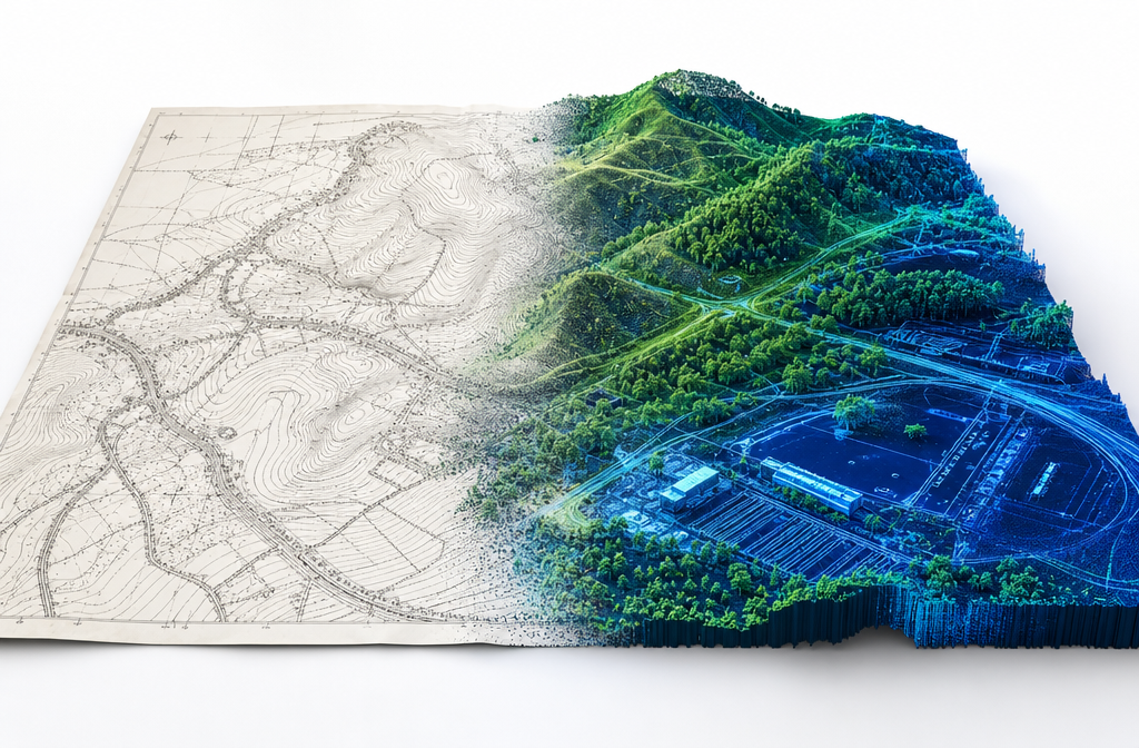
The phrase "geospatial data fusion" describes the process of combining data from multiple spatial sources — GPS coordinates, LiDAR scans, GIS layers, drone photogrammetry, and traditional total station measurements — into a single, coherent, georeferenced model. This is where BIM integration for land surveyors: enhancing construction efficiency in 2026 delivers its most measurable value.
Why Geospatial Accuracy Cuts Conflicts
Design conflicts — clashes between structural elements, mechanical systems, and electrical runs — are one of the most expensive problems in construction. BIM-integrated surveying enables clash detection at the design stage, before a single brick is laid or a pipe is ordered [3]. When the survey data underpinning a BIM model is imprecise or poorly georeferenced, clash detection becomes unreliable. Conversely, when survey data is accurate and properly fused into the model, teams can identify and resolve conflicts in a virtual environment at a fraction of the cost of on-site rework.
Research validates this directly: BIM reduces change orders by 15-20% through enhanced visualization [2]. Change orders are among the primary drivers of cost overruns and programme delays on construction projects. Eliminating even half of them through better upfront data has a compounding effect on project profitability.
BIM and GIS: A Powerful Combination
Geographic Information Systems (GIS) and BIM have historically operated in separate silos. GIS manages large-scale geographic context — land use, infrastructure networks, environmental constraints, planning zones. BIM manages building-scale detail. Fusing the two creates something more powerful than either alone.
Companies such as VolkerWessels have demonstrated this at scale, combining BIM and GIS to achieve new levels of insight, efficiency, and sustainability while creating a single source of entry for all project information [4]. For land surveyors, this integration means that a topographic survey does not simply inform a site plan — it connects to planning data, utility records, flood risk mapping, and environmental assessments within one unified environment.
Practical steps for surveyors pursuing BIM-GIS fusion include:
- Delivering survey data in coordinate systems compatible with national mapping frameworks (e.g., OSGB36/ETRS89 in the UK).
- Using software bridges such as Esri ArcGIS Pro connectors for Revit or Bentley's iTwin platform to transfer GIS layers into BIM environments.
- Tagging survey features with metadata that persists through model updates, ensuring that road centrelines, drainage outfalls, and boundary markers remain traceable.
Visual SLAM and Real-Time Construction Monitoring
An emerging frontier for surveyors is the integration of BIM with Visual Simultaneous Localisation and Mapping (Visual SLAM) systems. When validated on real construction sites, BIM-assisted Visual SLAM has been shown to reduce trajectory error by an average of 23.71% and map RMSE by 7.14% compared to standard visual SLAM baselines [5]. In practical terms, this means autonomous robots and mobile scanning devices can navigate construction sites more accurately when they reference an underlying BIM model — and the survey data feeding that model determines how well the system performs.
This is a direct incentive for surveyors to maintain model accuracy not just at project inception but throughout construction. The surveyor's role expands from initial data capture to ongoing model custodian.
Collaboration, Upskilling, and the Business Case for BIM Integration for Land Surveyors: Enhancing Construction Efficiency in 2026

The business case for BIM integration is compelling. Among BIM users, 71% report increased productivity, 51% note enhanced profitability, and 85% state that BIM increases project coordination [1]. Project timelines are 10-20% shorter, and material cost savings of 10-20% are achievable through precise quantity takeoffs [2]. These are not marginal improvements — they are the kind of performance differences that determine whether a firm retains major clients.
What Architects and Engineers Need from Surveyors
Architects and structural engineers working within BIM environments have specific expectations of survey data quality. Understanding those expectations is the first step in becoming a preferred collaborator rather than a commodity data supplier.
| Requirement | What It Means for Surveyors |
|---|---|
| Georeferenced point clouds | LiDAR or photogrammetry data tied to a national coordinate system |
| IFC-compatible deliverables | Model files that open in standard BIM authoring tools without conversion loss |
| Level of Detail (LOD) clarity | Survey data labelled with appropriate LOD (100-500) so designers know what to trust |
| Clash-ready geometry | Clean, watertight meshes or parametric objects, not raw scan data |
| Metadata-rich objects | Survey features tagged with material, condition, date, and measurement uncertainty |
Surveyors who can deliver against this table consistently will find themselves embedded in project teams from feasibility through to handover. Those who cannot will continue to receive one-off commissions with limited influence over project outcomes.
Upskilling Pathways for Surveyors in 2026
The skills gap between traditional surveying practice and BIM-ready practice is real but bridgeable. Key upskilling areas include:
- BIM authoring software — Autodesk Revit, Bentley MicroStation, or ArchiCAD at a working level.
- Point cloud processing — software such as Leica Cyclone, Faro Scene, or Autodesk ReCap for converting raw scans into usable model geometry.
- IFC and open standards — understanding how data is structured and exchanged without vendor lock-in.
- Common Data Environment (CDE) management — platforms such as Autodesk Construction Cloud, Aconex, or BIMcollab for managing model versions and information workflows.
- ISO 19650 compliance — the international standard governing BIM information management, increasingly required on public sector contracts in the UK.
Professional bodies including the Royal Institution of Chartered Surveyors (RICS) and the Chartered Institution of Civil Engineering Surveyors (CICES) offer structured BIM competency pathways. Surveyors working in areas with high construction activity — such as those covered by chartered surveyors in Central London or chartered surveyors in Essex — will find that BIM competency is increasingly listed as a prerequisite in tender documents.
Reducing Disputes Through Better Data
One underappreciated benefit of BIM integration is its role in reducing construction disputes. When survey data, design intent, and as-built conditions are all captured within a single model with version history, the factual basis for any dispute is far clearer. This matters significantly in boundary disagreements, construction disputes resolution, and dilapidations assessments.
For surveyors involved in commercial dilapidation surveys in London, BIM models that record the condition of a building at lease commencement provide an unambiguous baseline against which end-of-lease condition can be measured. This reduces the scope for disagreement and accelerates settlement.
Similarly, boundary surveys in London that are conducted with georeferenced precision and embedded into a shared model give all parties — owners, developers, planners, and neighbours — a common reference point. The result is fewer disputes reaching formal resolution stages, saving time and legal costs for everyone involved.
Safety as a BIM Dividend
Safety improvements are a frequently cited but sometimes underweighted benefit of BIM. Seventy-one percent of BIM users believe BIM contributes to safer project environments [1]. For surveyors, this manifests in several ways: clash detection prevents dangerous conflicts between structural and service elements; accurate site models allow safety planners to identify hazards before workers arrive on site; and as-built models support safe facility management long after construction is complete.
Surveyors working on complex urban projects — whether for building surveyor services in dense residential areas or large commercial developments — can point to safety outcomes as a tangible value-add of their BIM-integrated approach when pitching for work.
Practical Implementation: Getting Started with BIM Integration
Moving from awareness to active BIM integration does not require a complete overnight transformation of a surveying practice. A phased approach is more realistic and more sustainable.
Phase 1 — Data Compatibility (Months 1-3)
Audit current survey deliverables. Identify which outputs can be converted to IFC or Revit-compatible formats with existing tools. Invest in point cloud processing software if not already in use.
Phase 2 — Workflow Integration (Months 4-9)
Establish a standard operating procedure for georeferencing survey data to national coordinate systems. Build relationships with one or two architectural or engineering firms willing to collaborate on a pilot BIM project.
Phase 3 — Full CDE Participation (Months 10-18)
Join project Common Data Environments as a named contributor. Begin delivering survey data in LOD-specified formats. Pursue ISO 19650 awareness training.
Phase 4 — Specialisation (Ongoing)
Develop niche expertise — for example, heritage building scanning, underground utility BIM, or infrastructure GIS-BIM integration — that commands premium fees and differentiates the practice.
Surveyors seeking expert guidance on the intersection of survey practice and modern construction requirements can find relevant resources through expert surveyor advice and specialist residential structural engineering services in London.
Conclusion
The evidence is unambiguous. BIM integration for land surveyors: enhancing construction efficiency in 2026 is not a future consideration — it is a present competitive necessity. With 73% of construction professionals already using BIM [1], the question for surveyors is not whether to integrate but how quickly and how deeply.
The core opportunity lies in geospatial data fusion: combining LiDAR point clouds, GIS layers, GPS coordinates, and traditional measurement data into georeferenced BIM models that serve architects, engineers, and contractors throughout the project lifecycle. Surveyors who master this fusion reduce design conflicts, cut change orders, shorten timelines, and make themselves indispensable to project teams.
Actionable next steps for surveying professionals:
- Audit current deliverables for BIM compatibility and identify the nearest format gap to close.
- Invest in point cloud processing and at least one BIM authoring platform at a working proficiency level.
- Approach one existing client — ideally an architectural or engineering firm — about piloting a BIM-integrated survey delivery on an upcoming project.
- Register for ISO 19650 awareness training through RICS or an accredited provider.
- Build a GIS-BIM integration capability, even at a basic level, to position the practice ahead of the majority of competitors.
The surveyors who take these steps now will be the ones shaping how construction projects are planned, delivered, and managed for the next decade.
References
[1] A Digital Evolution Majority Using Bim – https://www.thenbs.com/about-nbs/press-releases/a-digital-evolution-majority-using-bim?utm_source=openai
[2] Bim Industry Statistics – https://zipdo.co/bim-industry-statistics?utm_source=openai
[3] Bim Integration For Property Surveyors Seamless Collaboration In Modern Construction Projects – https://wimbledonsurveyors.com/bim-integration-for-property-surveyors-seamless-collaboration-in-modern-construction-projects/?utm_source=openai
[4] Volkerwessels Bim Gis Story – https://www.autodesk.com/customer-stories/volkerwessels-bim-gis-story?utm_source=openai
[5] arxiv – https://arxiv.org/abs/2509.13972?utm_source=openai