Roughly one in five boundary disputes that reach the courts in England and Wales could have been avoided if the parties had understood one fundamental fact from the outset: the red line on a Land Registry title plan is not a legal boundary. It is an approximation. Yet every year, homeowners, developers, and even some practitioners treat that red edging as definitive proof of where one property ends and another begins, a misreading that can trigger years of costly litigation.
Understanding the full picture behind Boundary Disputes and Title Plans: Why Surveyors Must Not Treat the Land Registry Plan as the Whole Answer is not merely an academic exercise. It is a practical necessity for any surveyor, solicitor, or property owner who wants to resolve a dispute efficiently, accurately, and with the least possible damage to neighbourly relations.

Key Takeaways
- Land Registry title plans show general boundaries only, not precise legal lines, under Section 60 of the Land Registration Act 2002.
- At the standard 1:1250 scale, a single line on a title plan can represent up to 1.25 metres on the ground, making exact boundary determination impossible from the plan alone.
- Resolving a boundary dispute requires a layered approach: title plans, historic conveyance documents, physical features, aerial photographs, and expert topographic surveys.
- Surveyors acting as expert witnesses must present findings with calibrated certainty, neither overstating nor understating the evidence.
- A formally determined boundary, recorded at the Land Registry, can fix a line to within plus or minus 10 mm and prevent future disputes.
The General Boundaries Rule: What the Law Actually Says
Section 60 of the Land Registration Act 2002 establishes what practitioners call the general boundaries rule. In plain terms, this rule confirms that the boundary of a registered title shown on the title plan is a general boundary only, unless it has been formally determined [1]. The Land Registry does not guarantee the exact line of any boundary.
This is not a loophole or an oversight. It is a deliberate policy position, acknowledged jointly by HM Land Registry and Ordnance Survey, who have confirmed in a published joint statement that OS maps are used as a base for title plans but were never intended to establish legal property lines [3].
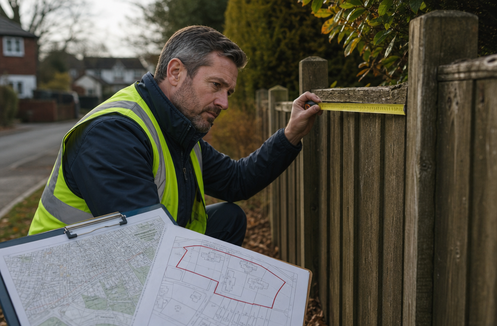
The practical consequence is significant. Title plans are typically drawn at a scale of 1:1250 in urban areas and 1:2500 in rural areas. At 1:1250, one millimetre on the plan equals 1.25 metres on the ground. A line drawn with even a fine pen nib can therefore represent a strip of land more than a metre wide [2]. When a fence, a wall, or a hedge sits somewhere within that strip, the title plan alone cannot tell you which side of the physical feature the legal boundary falls on.
"The red edging on a title plan tells you approximately where a property sits on the map. It does not tell you who owns the fence, where the exact line runs, or which neighbour has encroached on whose land."
This distinction matters enormously in practice. A homeowner who builds an extension, erects a fence, or plants a hedge based solely on their interpretation of the title plan may be acting on fundamentally flawed information.
Why Title Plans Alone Cannot Resolve Boundary Disputes and Title Plans: Why Surveyors Must Not Treat the Land Registry Plan as the Whole Answer
The limitations of title plans extend well beyond scale. Several structural weaknesses make them an unreliable sole source of boundary evidence.
Ordnance Survey Maps Do Not Capture Every Feature
Ordnance Survey maps are updated periodically, not continuously. Small physical features, a newly erected fence, a repositioned hedge, a low retaining wall, may not appear on the underlying OS base map at all, or may be shown in a position that no longer reflects reality on the ground [6]. When the Land Registry creates a title plan from this base, any inaccuracies in the OS data are inherited by the plan.
Historic Errors Compound Over Time
Many title plans for older properties were first registered decades ago, sometimes from hand-drawn conveyance plans of variable quality. Errors in the original registration, whether from imprecise drawing or ambiguous description, are carried forward into every subsequent title plan. By the time a dispute arises, the plan may reflect an error that is fifty or more years old [6].
Common Causes of Boundary Disputes in 2026
Understanding why disputes arise helps surveyors focus their investigations:
| Cause | Typical Scenario |
|---|---|
| Fence placement | Owner erects fence based on title plan; neighbour disputes position |
| Building extensions | Extension built close to boundary; encroachment alleged |
| Hedge boundaries | Hedge grows and shifts; original line becomes unclear |
| Historic conveyance errors | Original plan was imprecise or inconsistently drawn |
| Land subdivision | Developer splits plot; new boundaries not clearly defined |
| Adverse possession | Long-term use of land creates competing ownership claims |
Each of these scenarios demands evidence that goes far beyond what a title plan can provide [6].
The Role of the Conveyance and Transfer Documents
When a title plan is ambiguous or silent on a particular feature, the courts look first to the conveyance or transfer deed that originally created the boundary [1]. This document, often predating Land Registry registration, may contain a verbal description of the boundary, references to physical features, or an attached plan drawn at a larger scale with greater precision.
If the conveyance plan and the current title plan conflict, the conveyance plan will generally take precedence, because it represents the intention of the parties at the time the land was transferred. Surveyors and solicitors working on boundary disputes must therefore obtain and carefully analyse all historic conveyance documents, not just the current registered title [8].
The Surveyor's Role: Evidence, Method, and Expert Witness Obligations
The surveyor's contribution to resolving a boundary dispute is irreplaceable, but it must be approached with rigour and appropriate caution. RICS has explicitly urged caution when practitioners take on boundary disputes, noting that the work requires specialist knowledge, careful methodology, and an honest acknowledgement of uncertainty [7].
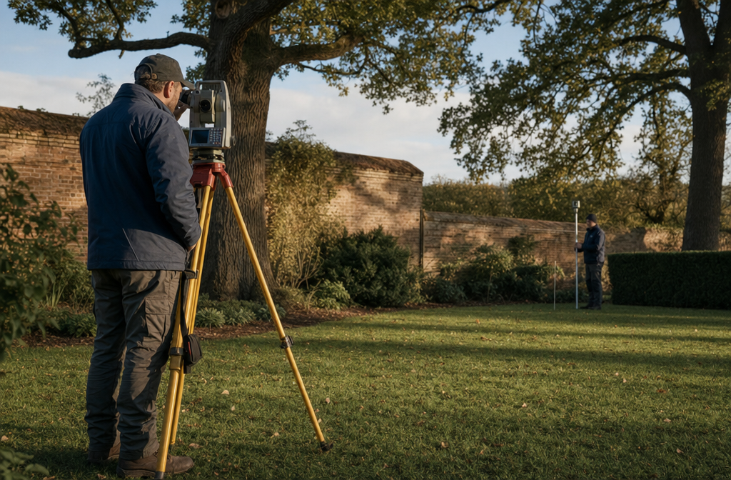
Conducting a Topographic Survey
Where precise boundary identification is necessary, RICS recommends that a topographic survey be conducted [4]. This involves using calibrated instruments, typically a total station or GPS equipment, to measure the positions of physical features on the ground to a high degree of accuracy. The resulting survey plan can then be overlaid on the title plan and historic conveyance plans to identify discrepancies and narrow the range of possible boundary positions.
For property owners and developers in London and the surrounding counties, working with experienced boundary surveyors in London ensures that topographic data is collected to the standard required for both negotiation and litigation.
Layers of Evidence a Surveyor Should Examine
A competent boundary surveyor does not rely on a single source. The investigation should draw on multiple layers of evidence:
- Current title plan – to establish the approximate registered extent
- Historic conveyance deeds and plans – to identify the original boundary intention
- Ordnance Survey historic maps – to track changes in physical features over time
- Aerial photographs – to show the position of fences, hedges, and walls at different dates
- Topographic survey data – to record current physical features with precision
- Witness evidence – long-standing neighbours or previous owners may recall the original boundary position
- Photographs and planning records – building control documents, planning applications, and site photographs can all assist
Physical features on the ground, walls, hedges, fences, and ditches, carry particular evidential weight. Courts have consistently held that where documentary evidence is ambiguous, the physical features present at the time of the original conveyance may be determinative [9]. A surveyor who ignores these features in favour of a title plan reading is missing the most tangible evidence available.
The Expert Witness and the Duty of Calibrated Certainty
When a boundary dispute reaches litigation or formal dispute resolution, a surveyor may be instructed to prepare an expert witness report. This is a role that carries specific obligations. The expert's duty is to the court or tribunal, not to the instructing party. An expert witness report on a boundary matter must:
- Clearly state the methodology used
- Identify all sources of evidence examined
- Acknowledge where the evidence is ambiguous or conflicting
- Express conclusions with appropriate qualification, neither overstating certainty where none exists, nor understating a well-supported conclusion
RICS guidance is explicit on this point: surveyors acting as expert witnesses in boundary disputes must avoid advocacy and must present their findings in a way that assists the decision-maker to understand the technical issues [7]. Overstating the precision of a title plan, or presenting a single interpretation as the only possible answer when the evidence supports a range, is a failure of professional duty.
For cases that involve structural elements close to or on the boundary, such as shared walls or party structures, the intersection with party wall disputes adds further complexity, and the surveyor must be familiar with both the boundary evidence and the relevant provisions of the Party Wall etc. Act 1996.
Resolving the Dispute: From Evidence to Determined Boundary

Once the evidence has been gathered and analysed, there are several routes to resolution. The appropriate route depends on the strength of the evidence, the willingness of the parties to cooperate, and the nature of the dispute.
Negotiated Agreement
Where the evidence points clearly in one direction, the parties may be able to reach a negotiated agreement, supported by a boundary agreement or transfer of land that formally records the agreed line. This is the fastest and least expensive route, and it preserves the neighbourly relationship better than litigation.
Formal Boundary Determination
Property owners can apply to HM Land Registry for a determined boundary, a process that fixes the exact position of a boundary and records it on the title plan to a precision of plus or minus 10 mm [5]. This requires either the agreement of the neighbouring owner or a decision by the First-tier Tribunal (Property Chamber). Once determined, the boundary is binding on all future owners of the land.
The determined boundary process is rigorous. It requires a detailed survey plan prepared to a specified standard, and the surveyor involved must be competent to produce work of that quality. For those seeking specialist support, the guide to boundary dispute and party wall surveyors in London provides a useful starting point for understanding the professional landscape.
Mediation and the First-tier Tribunal
Where the parties cannot agree, mediation offers a structured but non-binding route to resolution. If mediation fails, the First-tier Tribunal (Property Chamber) has jurisdiction to determine boundary disputes and can make binding orders. Litigation in the courts remains an option but is generally the most expensive and time-consuming route, and judges have made clear in numerous cases that they expect parties to have exhausted other options first [8].
When Party Wall Issues Intersect
Boundary disputes frequently intersect with party wall matters, particularly where a proposed building works is close to or on the boundary. Understanding what a party wall dispute involves and how it differs from a pure boundary dispute is essential for both surveyors and property owners. The two issues require different legal frameworks and different professional responses, though the underlying factual evidence often overlaps significantly.
For properties where works are planned near the boundary, serving the correct notices and understanding the party wall agreement process can prevent a boundary disagreement from escalating into a formal dispute.
Practical Guidance for Surveyors and Property Owners in 2026
The following principles should guide any professional or property owner facing a boundary question.
For surveyors:
- Never present a title plan as definitive evidence of a legal boundary without qualification
- Always obtain and review historic conveyance documents before forming a view
- Conduct a topographic survey where precision is required; do not rely on scaled measurements from a title plan
- When preparing expert witness reports, express conclusions with calibrated certainty and acknowledge the limits of the evidence
- Be familiar with the RICS guidance on boundary identification, demarcation, and dispute resolution [5]
For property owners:
- Do not assume the red line on your title plan is the legal boundary
- Before erecting fences, walls, or extensions near a boundary, obtain professional advice
- Gather and preserve all historic documents relating to your property, including old conveyance deeds, photographs, and planning records
- If a dispute arises, seek both legal and surveying advice early; early intervention is almost always less costly than litigation
- Consider the determined boundary process if you want certainty for the future
For those in London and the Home Counties, access to experienced chartered surveyors who understand both the technical and legal dimensions of boundary disputes is essential. Whether the property is in central London, Essex, or further afield, working with chartered surveyors in London who specialise in boundary matters provides the best foundation for a successful resolution.
Where a dispute also raises questions about the structural condition of a property or shared elements, a structural survey in London may provide additional evidence relevant to the boundary question, particularly where building works are alleged to have encroached on neighbouring land.
Conclusion
Boundary Disputes and Title Plans: Why Surveyors Must Not Treat the Land Registry Plan as the Whole Answer is not simply a professional caution, it is a statement of legal and practical reality. The general boundaries rule, the inherent scale limitations of title plans, and the priority given to historic conveyance documents and physical features all confirm that the red line on a title plan is a starting point for investigation, not a conclusion.
Surveyors who understand this approach disputes with the right mindset: gathering multiple layers of evidence, conducting precise topographic surveys where needed, and presenting findings with the calibrated certainty that expert witness work demands. Property owners who understand it make better decisions, avoid costly errors, and resolve disputes more efficiently.
Actionable next steps:
- If you are involved in or anticipating a boundary dispute, instruct a specialist boundary surveyor to review all available documentary and physical evidence before forming any view.
- Obtain copies of all historic conveyance deeds and plans from your solicitor or the Land Registry.
- Commission a topographic survey if the dispute involves a precise measurement question.
- Consider the determined boundary process if you want a binding, permanent record of the boundary position.
- Seek legal advice alongside surveying advice; the two disciplines are complementary, not interchangeable.
- If works near the boundary are planned, ensure party wall obligations are addressed separately and in parallel.
Taking these steps in 2026 will not only resolve the immediate dispute more effectively, it will protect the value and integrity of the property for every future owner.
References
[1] Land Registry Plans Boundaries Practice Guide 40 Supplement 3 – https://www.gov.uk/government/publications/land-registry-plans-boundaries/land-registry-plans-boundaries-practice-guide-40-supplement-3
[2] Boundary Disputes Understanding Title Plans – https://www.ansteyhorne.co.uk/news/boundary-disputes-understanding-title-plans
[3] Joint Statement Ordnance Survey And Land Registry – https://www.gov.uk/government/publications/joint-statement-ordnance-survey-and-land-registry/joint-statement-ordnance-survey-and-land-registry
[4] Topographic Surveys And Boundary Disputes How To Establish Your Property's Boundaries – https://www.rics.org/consumer-guides/topographic-surveys-and-boundary-disputes-how-to-establish-your-propertys-boundaries
[5] RICS Boundaries: Procedures for Boundary Identification, Demarcation and Dispute Resolution, October 2022 – https://www.rics.org/content/dam/ricsglobal/documents/standards/Boundaries%20procedures%20for%20boundary%20identification_%20demarcation%20and%20dispute%20resolution_October%202022.pdf
[6] Land Registry Title Plans – https://www.myboundarydisputesurveyor.co.uk/blog/land-registry-title-plans.html
[7] Caution Urged When Taking On Boundary Disputes – https://ww3.rics.org/uk/en/journals/built-environment-journal/caution-urged-when-taking-on-boundary-disputes.html
[8] Boundary Disputes Land Registry – https://towers-richardson.co.uk/boundary-disputes-land-registry/
[9] Lexology – Boundary Disputes and Physical Features – https://www.lexology.com/library/detail.aspx?g=e5b082a0-19de-474b-84bb-287cf14a2308