
AI-Enhanced Terrain Classification: Automating Anomaly Detection in Property Risk Assessments
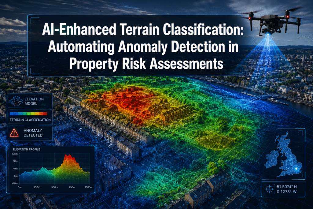
Subsidence-related insurance claims in the United Kingdom cost the industry an estimated £400 million in a single dry year, yet traditional ground surveys still miss early-stage soil movement that satellite and drone sensors can detect weeks in advance. That gap between what conventional methods catch and what machine learning can flag is precisely where AI-Enhanced […]
Surveying for Data Centers: Precision Requirements for Hyperscale Computing Sites in 2026

Global data center construction spending is projected to exceed $500 billion by the end of 2026, driven almost entirely by the insatiable compute demands of artificial intelligence workloads [6]. Behind every server hall that powers large language models and cloud platforms sits a surveying effort of extraordinary precision — one where a floor flatness error […]
Precision Farming Surveys: How UAVs and GIS Are Transforming Agriculture
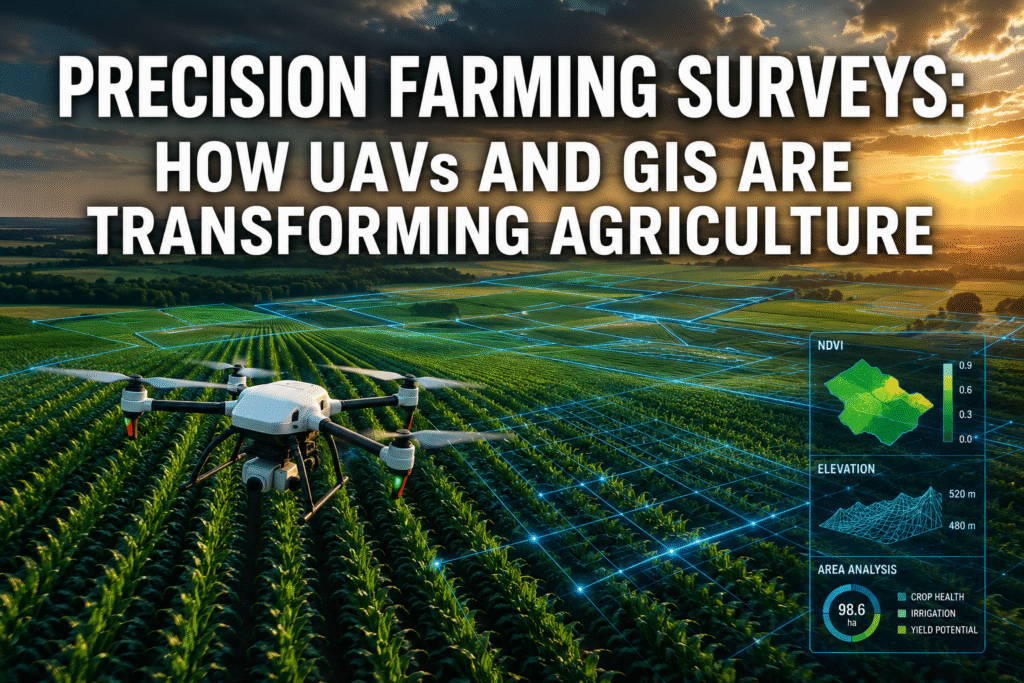
A single wheat farm in Kansas loses an estimated $25,000 per season to undetected soil variability — money that better field mapping could save. Across the globe, farmers are discovering that precision farming surveys using unmanned aerial vehicles (UAVs) and Geographic Information Systems (GIS) are not a luxury reserved for large agribusinesses. They are fast […]


