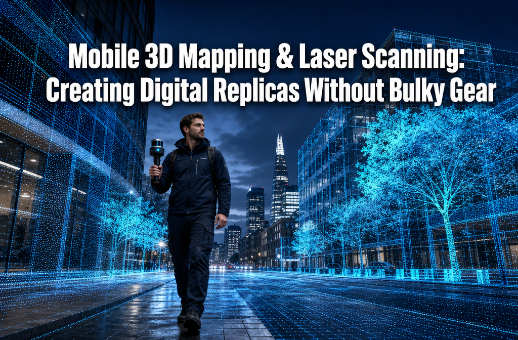

A single surveyor, a backpack, and 45 minutes — that is now all it takes to produce a millimetre-accurate digital replica of a multi-storey building interior. As recently as five years ago, the same task would have required a three-person crew, a cart-mounted scanner weighing over 20 kg, and a full day on site. The shift is not incremental; it is structural, and it is reshaping how professionals across construction, property, infrastructure, and urban planning capture the built environment in 2026.
Mobile 3D mapping and laser scanning: creating digital replicas without bulky gear is no longer a niche research topic. It is an active, fast-moving field where smartphone LiDAR, SLAM algorithms, backpack scanners, and UAV-mounted sensors are converging to make high-fidelity digital twins accessible to smaller teams with tighter budgets. This article breaks down how these systems work, what they can deliver, and how to put them to practical use — step by step.
Key Takeaways 📌
- SLAM-powered mobile scanners eliminate the need for static tripod setups, allowing operators to walk through a space and capture it in a single continuous pass.
- Smartphone LiDAR apps such as Polycam and Scaniverse have turned consumer devices into legitimate 3D capture tools for small-area surveys. [2]
- Backpack and vehicle-mounted systems now deliver engineering-grade point clouds for corridor mapping, road surveys, and construction sites without large crews. [4]
- Automated processing pipelines convert raw scan data into point clouds, textured meshes, floor plans, and BIM-ready assets with minimal manual effort. [8]
- Market growth in 2026 is being driven primarily by mobile and handheld solutions, as demand for faster, less intrusive as-built capture accelerates across industries. [7]
What Has Changed: From Static Rigs to Mobile 3D Mapping
The Problem With Traditional Laser Scanning
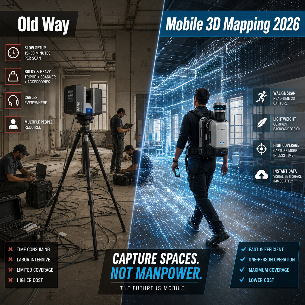
For decades, high-accuracy 3D laser scanning meant setting up a heavy tripod-mounted scanner at dozens of individual stations, waiting for each scan to complete, then spending hours in the office stitching point clouds together through a process called registration. The hardware was expensive, the workflow was slow, and moving it between stations was physically demanding.
Even modern compact tripod scanners — like Leica's RTC360, which captures up to 2 million points per second with in-field automatic registration — still require station-by-station deployment. [10] While faster than older systems, they still demand significant setup time and a skilled operator at each position.
The Mobile Revolution: SLAM + LiDAR
The game-changer is SLAM — Simultaneous Localisation and Mapping. This algorithm allows a moving device to build a map of its environment while simultaneously tracking its own position within that map. Combined with compact LiDAR sensors and inertial measurement units (IMUs), SLAM enables continuous scanning while the operator simply walks.
Key benefits of SLAM-based mobile scanning include:
- ✅ No target placement or station setup required
- ✅ Real-time point cloud preview on a connected device
- ✅ Single-pass capture of large, complex spaces
- ✅ Drastically reduced field time compared to static scanning [1]
💬 "Mobile 3D mapping is changing the landscape of project management by enabling faster, more agile as-built capture and design coordination — without the need to set up a static scanner at multiple stations." — Association for Project Management [1]
The Hardware Spectrum in 2026
Mobile scanning hardware now spans a wide range, from consumer smartphones to purpose-built professional rigs:
| Device Type | Accuracy | Best Use Case | Approx. Cost |
|---|---|---|---|
| Smartphone LiDAR (iPhone/iPad) | 1–5 cm | Small rooms, heritage objects | £0–£200 (apps) |
| Handheld scanner (e.g., Matterport) | 3–10 mm | Indoor spaces, property surveys | £3,000–£8,000 |
| Backpack/vest-mounted system | 5–20 mm | Buildings, campuses, tunnels | £15,000–£60,000 |
| Vehicle-mounted MLS | 10–50 mm | Roads, corridors, urban mapping | £50,000+ |
| UAV LiDAR | 10–30 mm | Rooftops, large sites, terrain | £10,000–£80,000 |
For building surveyor services and property professionals, the handheld and backpack tiers offer the most practical balance of accuracy and portability.
Step-by-Step: How Mobile 3D Mapping and Laser Scanning Creates Digital Replicas Without Bulky Gear
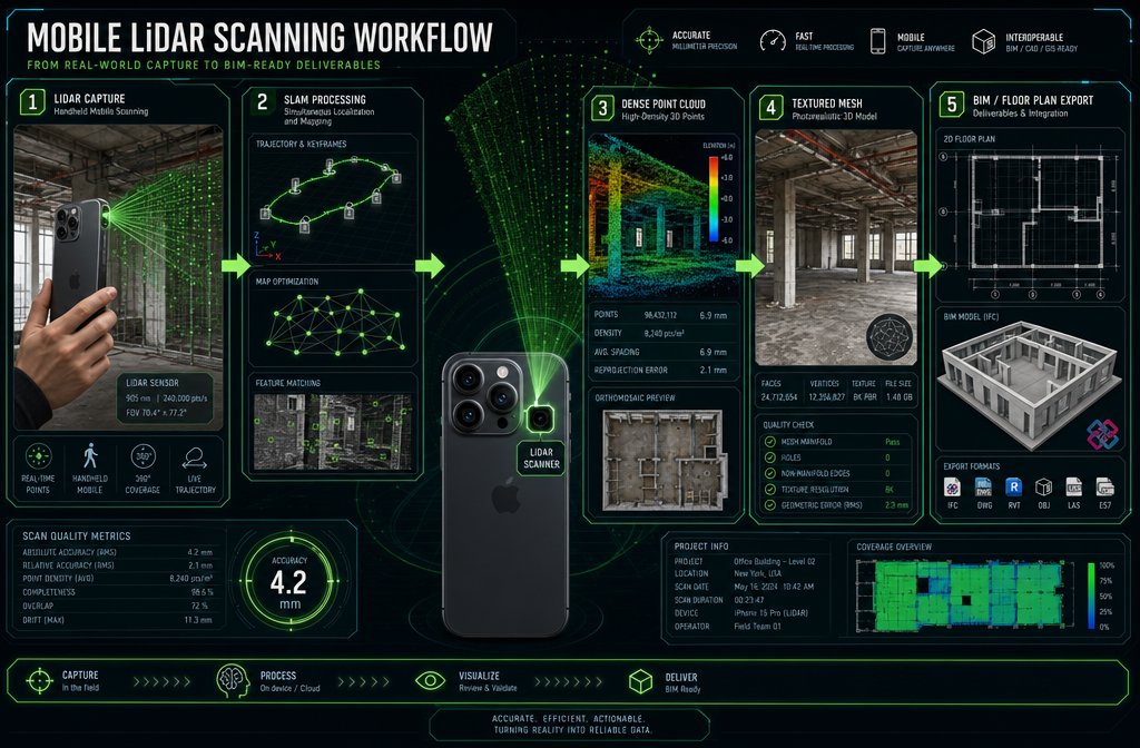
Understanding the workflow is essential for anyone planning to adopt mobile scanning. The process breaks down into five clear stages.
Stage 1 — Pre-Scan Planning and Simulation
Before a single scan is taken, intelligent planning saves significant time on site. Research published in 2025 shows that planners can now simulate scanner positions, coverage zones, and potential occlusions within a BIM or 3D environment before arriving on site. [9] This is particularly valuable for complex buildings with many rooms, tight corridors, or heritage features.
Pre-scan checklist:
- Define the required output (floor plan, point cloud, full mesh, BIM model)
- Identify areas of high complexity or restricted access
- Plan the walking route to minimise gaps and overlap
- Check lighting conditions for photogrammetry-combined workflows
For properties involved in boundary surveys in London or detailed structural assessments, pre-scan planning is especially critical to ensure complete coverage of boundary features and structural elements.
Stage 2 — Data Capture (The Walk-Through)
With SLAM-based systems, capture is straightforward: the operator walks through the space at a steady pace while the device continuously fires laser pulses and records returns. The onboard processor tracks position in real time.
Best practice tips for mobile capture:
- Walk at a consistent pace (typically 0.5–1.5 m/s)
- Overlap start and end points to close the SLAM loop and reduce drift
- Capture multiple heights where ceilings and floors need detail
- Use slower passes in areas with complex geometry or fine detail
Smartphone apps like Polycam and Scaniverse have made this accessible to non-specialists — turning LiDAR-equipped iPhones and iPads into everyday 3D capture tools for small areas. [2] For professional-grade work, backpack systems from manufacturers such as GeoSLAM, NavVis, and Leica provide superior accuracy and range.
Stage 3 — Automated Processing and Point Cloud Generation
Once capture is complete, the raw sensor data is processed — either on-device, on a connected laptop, or increasingly in the cloud. Modern software pipelines ingest data from compact capture devices and output:
- Dense point clouds (millions to billions of 3D coordinate points)
- Textured 3D meshes (photorealistic surface models)
- Orthomosaics (flat, georeferenced overhead images)
- Floor plans (automatically extracted 2D drawings)
- BIM-ready files (IFC, RVT formats for Revit and similar tools)
This automation is a critical productivity multiplier. What once required days of manual registration and modelling now takes hours or minutes. [2]
Stage 4 — Quality Checking and Refinement
Even automated pipelines benefit from human review. Key quality checks include:
- Drift assessment — does the point cloud close cleanly at loop points?
- Gap identification — are there areas with insufficient scan coverage?
- Accuracy verification — comparing scan data against known control points or tape measurements
- Noise filtering — removing spurious returns from glass, water, or moving objects
For dilapidation surveys or roof surveys in London, accuracy verification is particularly important, as survey outputs may be used in legal or contractual contexts.
Stage 5 — Output Delivery and Digital Twin Integration
The final stage converts processed data into deliverables. Depending on the project, outputs may be:
- Shared via cloud platforms (e.g., Autodesk Construction Cloud, Matterport Cloud)
- Exported as CAD or BIM files for design teams
- Integrated into GIS systems for urban planning
- Used as baseline documentation for home renovation projects or planning applications
Some mobile scanning devices now export directly to MP4 for walkthroughs shareable on social media or with remote clients — a feature explicitly marketed by several 2025/2026 compact scanner vendors. [3]
Real-World Applications: Urban Surveying, Infrastructure, and Beyond
Urban Buildings and Property Surveys
For chartered surveyors working across dense urban areas, mobile 3D mapping and laser scanning offers a decisive advantage: speed without sacrificing accuracy. A surveyor covering properties across central London or Camden can now complete an as-built scan of a Victorian terrace in under an hour, producing floor plans and a full point cloud in a single visit.
This is directly relevant to services such as:
- As-built documentation for extensions and conversions
- Licence to alter applications requiring accurate existing drawings
- Dilapidations and schedule of condition work
- Expert witness reports requiring precise spatial evidence
The ability to capture a complete digital replica without bulky gear also reduces disruption to occupants — a significant practical benefit in occupied residential and commercial properties.
Road and Transport Infrastructure
For road and transport projects, Mobile Laser Scanning (MLS) mounted on vehicles now enables near-automatic extraction of 3D road objects — signs, lane markings, barriers, kerbs — from a single drive-through pass. [8] Automated classification algorithms process the resulting dense point clouds, dramatically reducing manual modelling time.
This approach is being adopted for:
- Highway asset management
- Road condition surveys
- Urban mobility and smart city mapping
- Bridge and tunnel inspection
Mining, Construction, and Heavy Industry
At the industrial end of the spectrum, long-range mobile laser scanners are now field-deployable for open-pit mining surveys, with some systems reaching ranges of approximately 3,500 metres in long-range configuration. [3] GNSS-integrated backpack scanners allow construction site volume calculations without deploying large survey rigs — a significant operational efficiency gain.
Bowman Consulting's adoption of mobile LiDAR illustrates the productivity impact clearly: by shifting from static tripod scanners to vehicle- and backpack-mounted mobile systems, the firm reported drastically reduced field time for corridor and roadway projects while still achieving engineering-grade point clouds. [4]
💬 "Versatile mobile LiDAR is changing the game — crews can capture linear assets and complex sites in a single pass with compact rigs instead of moving heavy scanners station by station." [4]
UAV and Drone-Based 3D Mapping
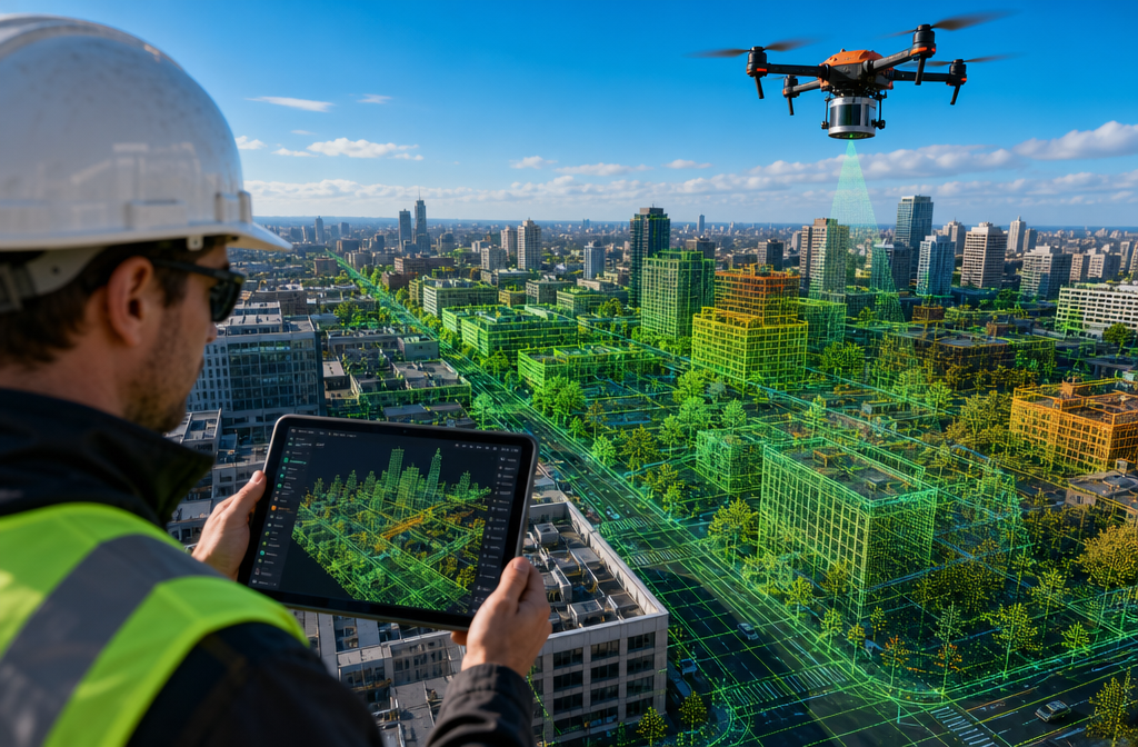
UAV-mounted LiDAR and photogrammetry systems represent the aerial dimension of mobile 3D mapping. Industry events in early 2026, including Geo Week, are prominently featuring UAV Innovation and 3D Mobile Mapping as headline topics — reflecting a consensus that the future of spatial data capture is lightweight, mobile, and cloud-connected. [6]
Drone-based scanning is particularly effective for:
- Rooftop and façade surveys of tall buildings
- Large construction site progress monitoring
- Terrain and topographic mapping
- Heritage documentation of large complexes
Choosing the Right Mobile Scanning Approach
Key Decision Factors
Selecting the right mobile scanning workflow depends on several variables:
1. Required accuracy
Consumer smartphone LiDAR suits room-level documentation. Engineering-grade work — such as structural assessments or commercial building surveys — demands professional backpack or tripod systems.
2. Area size and complexity
Small rooms: smartphone or handheld scanner. Multi-storey buildings: backpack system. Linear infrastructure: vehicle-mounted MLS. Large outdoor sites: UAV LiDAR.
3. Output format requirements
If the deliverable is a BIM model for a planning application or a schedule of dilapidations, the processing pipeline must support IFC or RVT export with sufficient accuracy.
4. Budget and frequency of use
For occasional use, scanning-as-a-service from specialist firms is often more cost-effective than owning professional hardware. For high-volume survey firms, investment in backpack systems typically delivers strong ROI within 12–18 months.
The Market Direction in 2026
Market analysis in 2026 confirms that mobile and handheld solutions are the primary growth segments in the global 3D laser scanner market, driven by demand from construction, automotive, and mining sectors seeking faster, less intrusive as-built capture methods. [7] The trajectory is clear: lighter, faster, more automated is the dominant design direction, and the gap between consumer and professional-grade mobile scanning continues to narrow.
Conclusion: Actionable Next Steps for 2026
Mobile 3D mapping and laser scanning: creating digital replicas without bulky gear has moved from experimental to essential in 2026. The combination of SLAM algorithms, compact LiDAR sensors, intelligent pre-scan planning, and automated processing pipelines means that high-quality digital replicas of buildings, infrastructure, and terrain are now within reach for teams of any size.
Actionable Next Steps ✅
- Assess your current workflow — identify where static scanning or manual measurement is creating bottlenecks in your survey or construction process.
- Trial smartphone LiDAR — use apps like Polycam or Scaniverse to capture a small space and evaluate the output quality for your needs.
- Define your output requirements — clarify whether you need point clouds, floor plans, BIM files, or full textured meshes before selecting hardware or a service provider.
- Engage a specialist surveyor — for professional-grade work such as as-built documentation, dilapidations, or boundary surveys, work with chartered surveyors experienced in mobile scanning workflows.
- Plan before you scan — use simulation tools to optimise your walking route and avoid coverage gaps, especially in complex buildings. [9]
- Stay current — the mobile scanning landscape is evolving rapidly; monitor industry events and vendor updates to ensure your tools and methods remain competitive.
The era of the bulky scanner is not over, but it is no longer the default. For urban surveying, property documentation, and infrastructure mapping in 2026, mobile is the new standard.
References
[1] How 3D Mobile Mapping Is Changing The Landscape Of Project Management – https://www.apm.org.uk/blog/how-3d-mobile-mapping-is-changing-the-landscape-of-project-management/
[2] Best 3D Mapping Software – https://www.skyebrowse.com/news/posts/best-3d-mapping-software
[3] Watch (December 3D Scanner News) – https://www.youtube.com/watch?v=cIwK4oP9DoU
[4] Versatile Mobile LiDAR Changes The Game For Bowman Consulting – https://lidarnews.com/versatile-mobile-lidar-changes-the-game-for-bowman-consulting/
[6] Geo Week 2026 Instagram Post – https://www.instagram.com/p/DU5MAivls10/
[7] 3D Laser Scanners Market – https://www.persistencemarketresearch.com/market-research/3d-laser-scanners-market.asp
[8] Mobile Laser Scanning Point Clouds: Automatic 3D Mapping Of Road Objects – https://www.gim-international.com/content/article/mobile-laser-scanning-point-clouds-automatic-3d-mapping-of-road-objects
[9] Model-Based Planning of Complex 3D Laser Scanning Campaigns – https://www.sciencedirect.com/science/article/abs/pii/S0926580525003292
[10] A New Development In Laser Scanning Technology (Leica RTC360) – https://leica-geosystems.com/products/laser-scanners/scanners/leica-rtc360/a_new_development_in_laser_scanning_technology