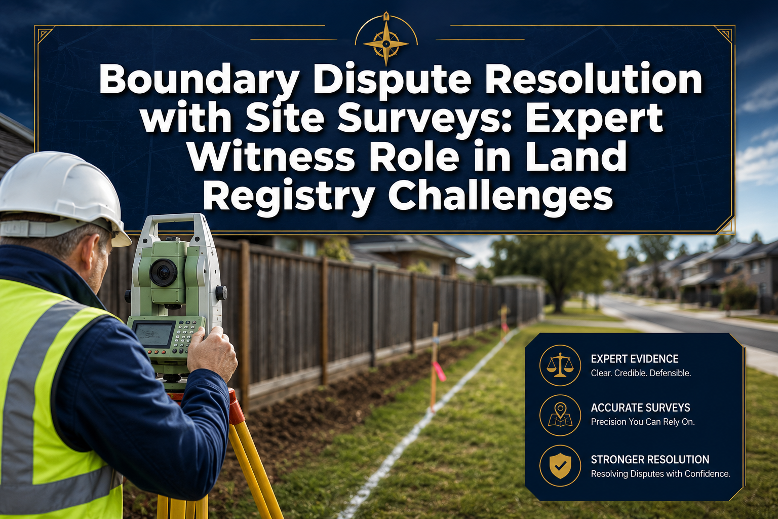

Over 175,000 boundary disputes are estimated to arise across England and Wales every year — yet the majority of property owners don't realise that the red-edged plan on their Land Registry title is not, in law, a definitive statement of where their boundary actually lies. That single misunderstanding fuels enormous legal cost, neighbourly conflict, and years of unresolved uncertainty. Boundary dispute resolution with site surveys: expert witness role in Land Registry challenges sits at the intersection of precision measurement, legal interpretation, and courtroom advocacy — and understanding how the process works can save thousands of pounds and years of stress.
Key Takeaways 📌
- HM Land Registry title plans show only the general boundary — not the exact legal boundary line. Site surveys are essential to determine the true position.
- A structured, seven-stage survey process — from instruction through to formal registration — is the industry-standard approach endorsed by RICS.
- Expert witnesses must be impartial, methodologically transparent, and court-ready, distinguishing clearly between factual findings and professional opinion.
- Modern technology (GNSS, 3D laser scanning, UAV imagery) significantly strengthens the evidential weight of a boundary survey in Land Registry challenges.
- Alternative Dispute Resolution (ADR) is strongly preferred before formal litigation or Land Registry applications, and a well-prepared survey report is the foundation of any successful ADR process.
Why Land Registry Title Plans Are Not Enough
A common assumption is that once a property is registered with HM Land Registry, the boundary is settled. This is not correct. [2] [3]
💬 "The Land Registry general boundary plan identifies the plot — not the precise legal boundary. Disputes and registry challenges must be resolved by interpreting deeds, physical features, and survey evidence."
HM Land Registry uses the "general boundary rule" under the Land Registration Act 2002. This means the red-edged plan on a title register is drawn from Ordnance Survey mapping at a scale where 1mm on paper can represent over a metre on the ground. Fences, walls, hedges, and other physical boundary features may be entirely misrepresented — or simply not shown at all. [1]
This is why boundary dispute resolution with site surveys is indispensable before pursuing:
- A determined boundary application (Land Registration Act 2002, s.60)
- A rectification claim to correct a registration error
- A boundary agreement between neighbouring landowners
- Any court action involving trespass or encroachment
For property owners in London and the surrounding areas, working with chartered surveyors in London who specialise in boundary work is the most reliable starting point.
The Seven-Stage Survey Process for Boundary Dispute Resolution with Site Surveys: Expert Witness Role in Land Registry Challenges
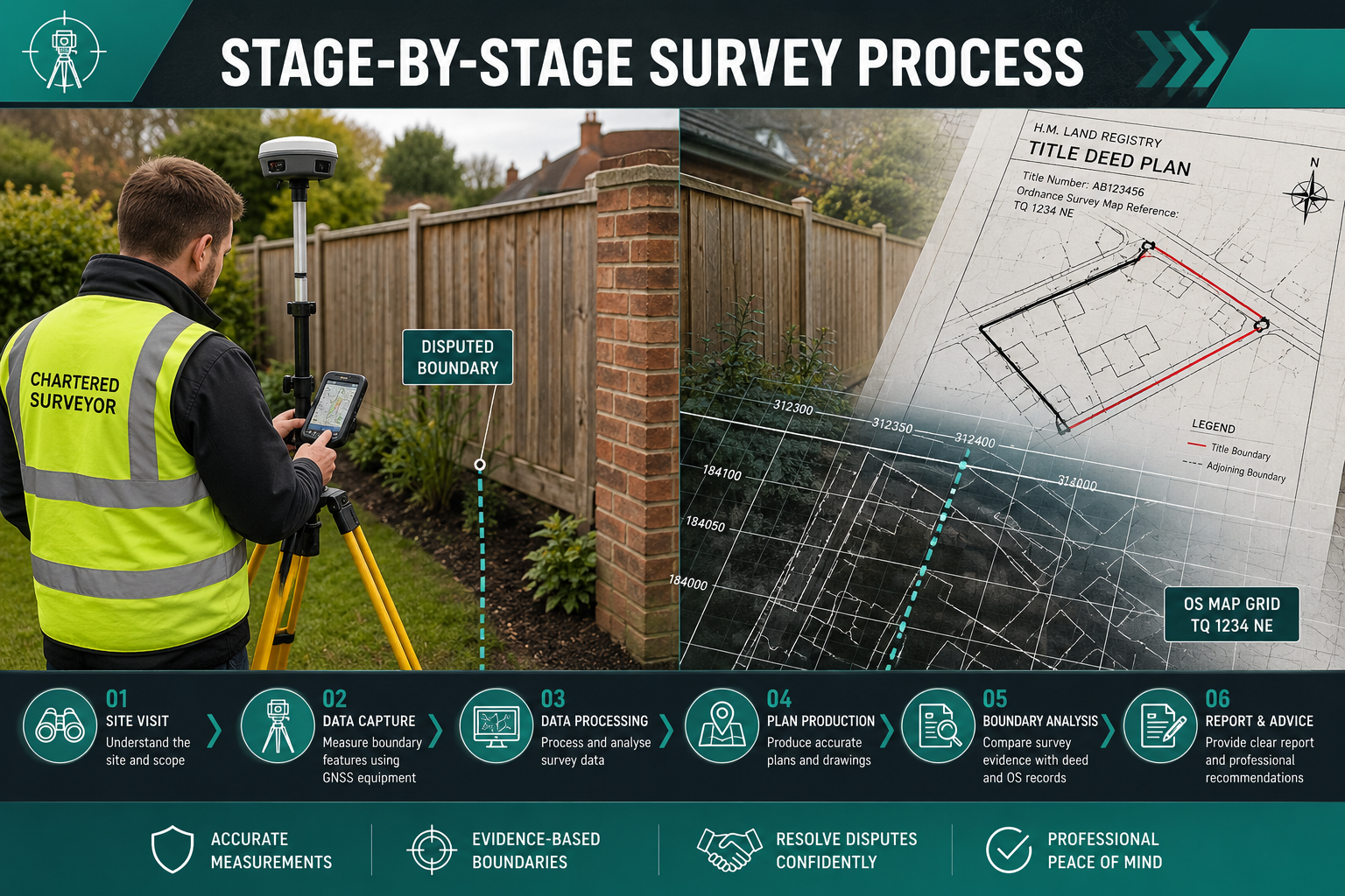
The Royal Institution of Chartered Surveyors (RICS) and leading industry practitioners endorse a structured, seven-stage process for survey-based boundary dispute resolution. [5] [9] Understanding each stage helps property owners, solicitors, and land professionals manage expectations and costs effectively.
Stage 1: Instruction and Scoping
The surveyor is formally instructed, the dispute is defined, and the scope of the survey is agreed. This includes identifying:
- Which boundaries are in dispute
- What documents and records are available
- Whether the instruction is as a single-party expert, joint expert, or expert witness for court
Stage 2: Research and Document Review
Before visiting the site, a thorough desk-based review is carried out. This typically includes: [2]
| Document Type | Purpose |
|---|---|
| Title deeds and conveyances | Establish original boundary descriptions |
| Land Registry title register and plan | Identify current registered extent |
| Historic OS maps | Track changes to physical features over time |
| Prior survey plans | Identify any previously agreed positions |
| Aerial photography | Confirm historical land use and features |
This archival research is critical. Boundary disputes frequently turn on the interpretation of a Victorian conveyance or a 1950s transfer plan — documents that predate modern digital mapping entirely. [3]
Stage 3: Site Visit and Measured Survey
This is the technical core of the process. The surveyor visits the property and carries out a detailed measured survey using one or more of the following methods: [8]
- 🛰️ GNSS/GPS receivers — high-precision satellite positioning
- 📐 Total stations — electronic theodolites measuring angles and distances
- 🔴 3D laser scanners — capturing millions of data points in a point cloud
- 🚁 UAV/drone imagery — aerial perspective for context and feature mapping
Physical features are recorded: walls, fences, hedges, ditches, buildings, and any other markers that may indicate the historic boundary position. Photography is taken systematically.
Stage 4: Overlay Analysis and Report
The surveyor overlays field measurements onto record data — title plans, deed plans, and historic mapping — to determine the "true" boundary position in line with accepted surveying rules. [5] [10]
This comparative overlay frequently reveals:
- Registration errors where the general boundary plan doesn't match physical features
- Encroachments that have occurred gradually over decades
- Gaps or discrepancies between successive conveyances
The written report sets out: methodology, factual findings, and a reasoned professional opinion. It must clearly distinguish between what was measured and what the surveyor concludes from those measurements.
For a deeper understanding of how boundary surveys work in practice, the boundary surveys London service page provides useful context on scope and deliverables.
Stage 5: Negotiation and ADR
Before any formal Land Registry application or litigation, Alternative Dispute Resolution (ADR) is strongly recommended — and increasingly required by courts. [7] Options include:
- Direct negotiation between the parties, supported by the survey report
- Mediation with a neutral third party
- Expert determination — where an independent expert makes a binding decision
A well-prepared survey report often resolves disputes at this stage, avoiding the cost and stress of formal proceedings entirely.
Stage 6: Litigation (If ADR Fails)
Where ADR fails, the matter proceeds to court — typically the First-tier Tribunal (Property Chamber) or the County Court. The surveyor's report becomes expert evidence, and the surveyor may be required to give oral testimony and face cross-examination. [6] [7]
Stage 7: Formal Recording at Land Registry
Once a boundary is agreed, determined, or ordered by a court, the outcome is formally recorded at HM Land Registry. This may involve:
- A boundary agreement lodged under rule 40 of the Land Registration Rules 2003
- A determined boundary application under s.60 of the Land Registration Act 2002
- A rectification of the register under schedule 4 of the Act
The Expert Witness Role in Boundary Dispute Resolution with Site Surveys: Expert Witness Role in Land Registry Challenges
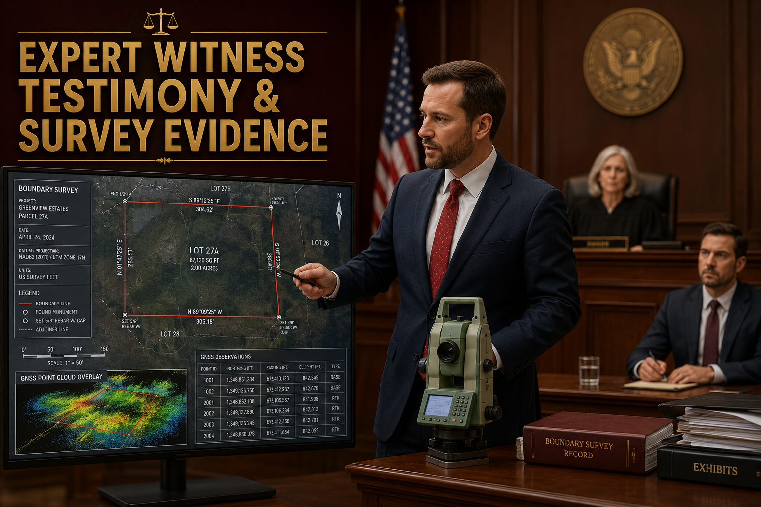
The role of the surveyor as expert witness has become increasingly formalised and specialised. [6] [7] Courts and tribunals expect a high standard of technical rigour, impartiality, and clear communication.
What Courts Expect from a Surveyor Expert Witness
A surveyor acting as expert witness must: [7] [8]
✅ Comply with court rules on expert evidence — in England and Wales, this means Part 35 of the Civil Procedure Rules (CPR) and the associated Practice Direction
✅ Owe their duty to the court, not the instructing party — impartiality is non-negotiable
✅ Distinguish facts from opinion — the report must be transparent about what is measured data and what is professional interpretation
✅ Explain methodology clearly — GNSS workflows, total station procedures, and data standards must be described in terms a non-specialist can understand
✅ Be prepared for cross-examination — including challenges to measurement uncertainty, equipment calibration, and data processing
💬 "Rising demand for surveyor-experts reflects courts' increasing reliance on technical boundary evidence in a more litigious property market — particularly as 2026 sees continued pressure on urban land values." [7]
The Difference Between a Party Expert and a Joint Expert
| Role | Instructed By | Duty |
|---|---|---|
| Party expert | One side only | Duty to court; assists one party |
| Joint expert | Both parties jointly | Duty to court; neutral by design |
| Single joint expert (SJE) | Court direction | Highest level of neutrality |
Courts increasingly encourage the use of single joint experts in boundary disputes to reduce costs and adversarial tension. Where parties cannot agree on a joint expert, each side may instruct their own — but the experts are then typically required to meet, produce a statement of agreed and disputed issues, and narrow the technical points for the judge. [5]
Courtroom Presentation of Boundary Evidence
Effective courtroom presentation of a boundary survey requires: [8]
- Clear, annotated plans — colour-coded to show different data sources and the surveyor's opinion line
- Photographic evidence — systematically referenced to the survey plan
- Transparent uncertainty statements — acknowledging the precision limits of the survey methods used
- Chain of custody for data — full metadata, calibration records, and audit trails for digital survey data
Surveyors are increasingly expected to present 3D point cloud visualisations and drone footage alongside traditional 2D plans, particularly in complex cases involving multiple overlapping features. [8]
For property owners dealing with related issues, understanding party wall disputes is often important alongside boundary matters, as the two frequently overlap in urban settings.
Modern Survey Technology and Its Role in Land Registry Challenges
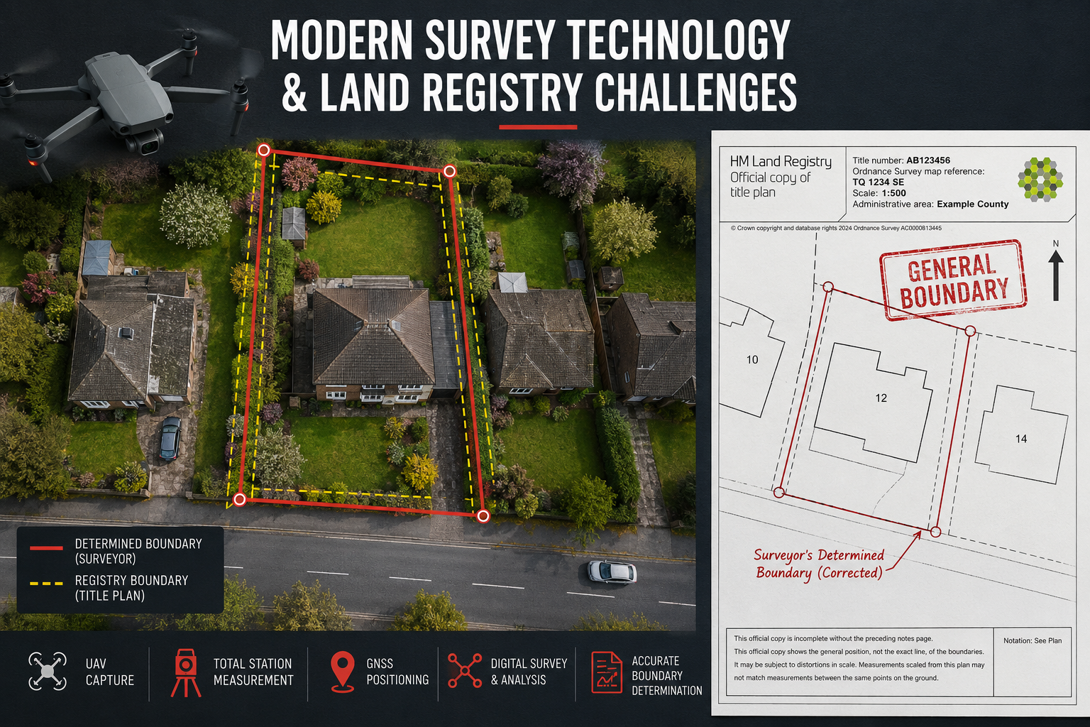
The evidential value of a boundary survey has been transformed by modern technology. [8] What was once a matter of tape measures and hand-drawn plans is now a highly precise, digitally documented process that can withstand rigorous expert scrutiny.
Key Technologies in 2026 Boundary Surveys
🛰️ High-Precision GNSS
Modern GNSS receivers achieve sub-centimetre accuracy in Real-Time Kinematic (RTK) mode. This means boundary positions can be established with a level of precision that was simply impossible with traditional methods — and the results are fully reproducible and auditable.
🔴 3D Laser Scanning
Terrestrial laser scanners capture millions of measurement points in minutes, creating a detailed point cloud of the entire survey area. This is particularly valuable for:
- Recording the precise position of walls, fences, and structures
- Documenting the state of features at a specific point in time
- Enabling forensic reconstruction of historic boundary features from photographic and mapping evidence [8]
🚁 UAV/Drone Surveys
Drone imagery provides an aerial perspective that contextualises ground-level measurements and can reveal boundary features that are invisible from street level. Drone surveys are now widely used in boundary dispute work, particularly for larger plots or where access is restricted. [4]
📊 Digital Data Standards
Surveyors are encouraged to maintain full metadata, calibration records, and repeatable workflows so that survey plans and point clouds can withstand expert scrutiny in Land Registry objections or court proceedings. [8] This "forensic" approach to data management is increasingly a differentiator between surveyors who can and cannot withstand cross-examination.
Challenging an Existing Land Registry Entry
Where a survey reveals that the Land Registry title plan is materially incorrect, the options are:
- Determined boundary application — establishes the exact legal boundary by reference to a surveyor's plan, permanently recorded at Land Registry
- Rectification of the register — corrects a registration error under schedule 4 of the Land Registration Act 2002
- Boundary agreement — a consensual solution lodged with Land Registry, avoiding formal proceedings
In all three cases, the survey evidence and expert witness report are the foundation of the application. [1] [10]
For those navigating related neighbour issues, the guide to boundary dispute and party wall surveyors in London offers practical guidance on choosing the right professional for the situation.
Choosing the Right Surveyor for Boundary Dispute Resolution
Not every surveyor is qualified or experienced to act as an expert witness in a Land Registry challenge. When selecting a professional, look for: [6] [9]
- RICS chartership — the benchmark qualification for UK boundary surveyors
- Specific experience in boundary dispute work — cadastral and boundary surveying is a specialist discipline
- Courtroom and tribunal experience — expert witness work requires skills beyond technical surveying
- Familiarity with Land Registry procedures — including determined boundary applications and rectification claims
- Access to modern survey technology — GNSS, laser scanning, and UAV capability
💬 "The expert witness function in boundary disputes has become highly specialised — surveyors now market specific 'forensic' capabilities for historic boundary reconstruction alongside their technical survey skills." [6]
It is also worth considering whether a schedule of condition report is needed to document the current state of boundary features before any disputed works begin — a proactive step that can significantly strengthen a party's position in later proceedings.
For those dealing with neighbour-related issues more broadly, exploring resources on neighbour disputes can help identify the full range of professional support available.
Common Pitfalls to Avoid in Boundary Dispute Cases
Understanding what not to do is as important as knowing the right process: [3] [5]
❌ Relying solely on the Land Registry title plan — it is not definitive on the exact boundary
❌ Starting physical works before the dispute is resolved — this can constitute trespass and significantly worsen the legal position
❌ Instructing a surveyor without expert witness experience — a technically sound survey presented poorly in court can fail to persuade
❌ Ignoring ADR — courts take a dim view of parties who refuse reasonable ADR offers, with cost consequences
❌ Delaying action — adverse possession claims can crystallise over time, and evidence (physical features, witnesses) deteriorates
Conclusion: Actionable Next Steps for 2026
Boundary dispute resolution with site surveys: expert witness role in Land Registry challenges is a structured, evidence-driven process — but it requires the right professional expertise at every stage. The key message for property owners and legal practitioners in 2026 is clear: the Land Registry title plan is a starting point, not a conclusion.
Actionable Next Steps ✅
- Commission a professional boundary survey at the earliest opportunity — before any works, negotiations, or formal proceedings begin
- Gather all available documents — title deeds, historic conveyances, prior surveys, and correspondence
- Choose a RICS-chartered surveyor with specific boundary dispute and expert witness experience
- Explore ADR options — mediation or expert determination can resolve most disputes faster and cheaper than litigation
- If proceedings are necessary, ensure the survey report complies with CPR Part 35 and is prepared with courtroom presentation in mind
- Record the outcome — whether by boundary agreement, determined boundary application, or court order, always ensure the result is formally registered at Land Registry
Taking these steps systematically — supported by accurate site survey evidence and a qualified expert witness — gives any party the strongest possible foundation for resolving a boundary dispute efficiently and definitively.
References
[1] Land Boundaries – https://cnettleman.net/land-boundaries/
[2] How Land Surveyors Help Resolve Boundary Disputes – https://www.mckissock.com/blog/land-surveyor/how-land-surveyors-help-resolve-boundary-disputes/
[3] Boundary Disputes How Professional Land Surveyors Resolve Conflicts – https://www.mcneilengineering.com/boundary-disputes-how-professional-land-surveyors-resolve-conflicts/
[4] Watch – https://www.youtube.com/watch?v=y8ibFqPED5g
[5] Boundary Dispute Resolution Proven Field Techniques And Courtroom Strategies For Property Surveyors – https://www.canterburysurveyors.com/blog/boundary-dispute-resolution-proven-field-techniques-and-courtroom-strategies-for-property-surveyors/
[6] Land Surveying Expert Witness – https://seakexperts.com/specialties/land-surveying-expert-witness
[7] Expert Witness Essentials For 2026 Boundary Disputes Strengthening Cases In A Recovering Property Market – https://nottinghillsurveyors.com/blog/expert-witness-essentials-for-2026-boundary-disputes-strengthening-cases-in-a-recovering-property-market
[8] Expert Witness Testimony In Boundary Disputes Leveraging Latest Survey Technology And Data Standards – https://princesurveyors.co.uk/blog/expert-witness-testimony-in-boundary-disputes-leveraging-latest-survey-technology-and-data-standards/
[9] Surveysboundarydisputeresolution – https://www.scribd.com/document/606260696/SurveysBoundaryDisputeResolution
[10] Boundary Dispute Resolution – https://www.apexsurveyor.com/boundary-dispute-resolution