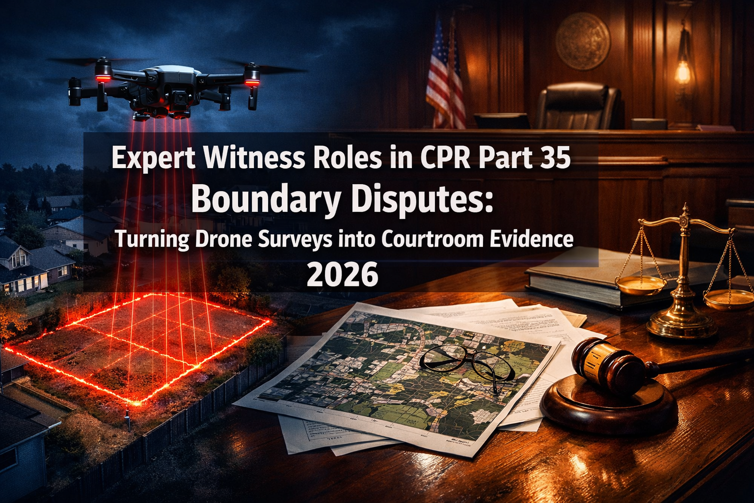
Boundary disputes in England and Wales cost property owners an estimated £1.6 billion annually in legal fees, lost time, and diminished property values — yet the single most decisive factor in resolving them is rarely the law itself. It is the quality of the evidence presented. In 2026, drone survey technology has fundamentally changed what "quality evidence" looks like in a boundary dispute courtroom. The challenge is no longer capturing precise spatial data — it is transforming that data into a CPR Part 35-compliant expert witness report that a judge can trust and act upon.
This article explores Expert Witness Roles in CPR Part 35 Boundary Disputes: Turning Drone Surveys into Courtroom Evidence 2026 — covering the legal framework, the surveyor's duties, the technical standards for drone-derived evidence, and the practical steps needed to make aerial survey data stand up in court.
Key Takeaways 📋
- CPR Part 35 places the expert's primary duty to the court, not to the instructing party — a principle that shapes every aspect of how drone survey evidence must be prepared and presented.
- Drone surveys offer centimetre-level accuracy that traditional ground surveys cannot always match, making them powerful tools in contested boundary cases.
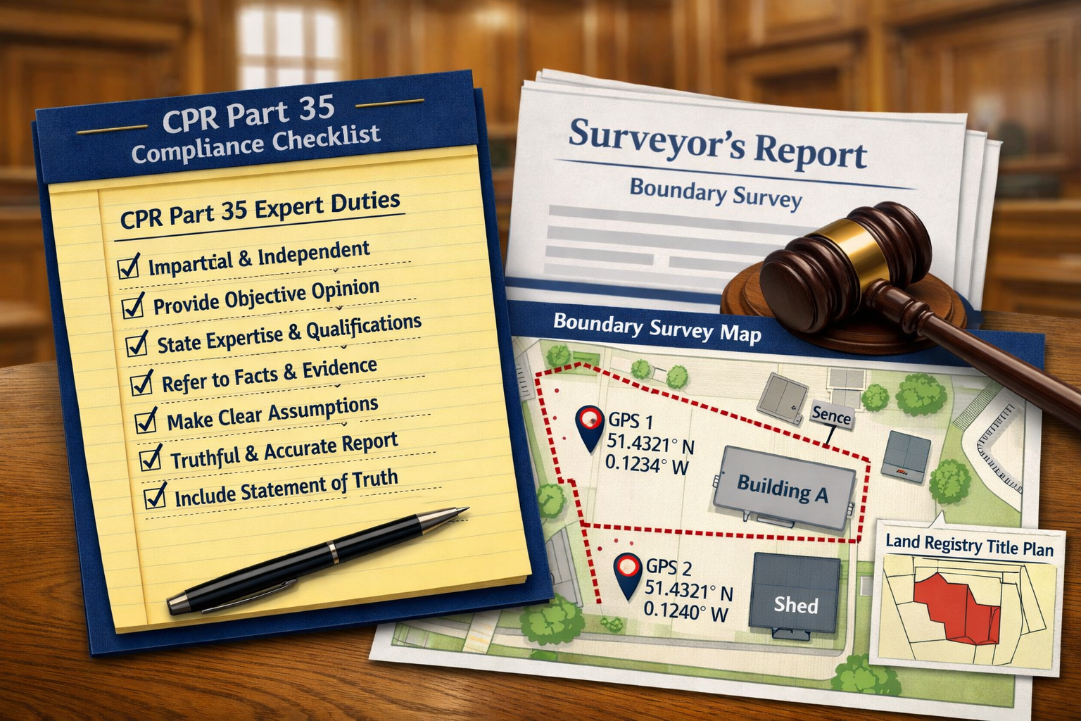
- Expert reports must meet strict formal requirements under CPR 35.10 and the accompanying Practice Direction, including a signed declaration of independence.
- Land Registry title plans are not definitive — drone-derived photogrammetric data can challenge and supplement them when properly authenticated.
- Courts increasingly accept drone evidence, but only when the expert witness can demonstrate methodology, calibration, and impartiality.
Understanding CPR Part 35: The Expert Witness Framework
What CPR Part 35 Actually Requires
The Civil Procedure Rules Part 35 governs the use of expert evidence in civil litigation in England and Wales. Its central principle is unambiguous: an expert witness owes an overriding duty to the court, not to the party who instructs or pays them [1]. This is not merely procedural etiquette — it is a legal obligation that can result in costs sanctions, report exclusion, or worse if violated.
For surveyors acting as expert witnesses in boundary disputes, this means every conclusion drawn from a drone survey must be based on professional judgment and objective analysis, regardless of which side of the fence their client sits on [2].
Key requirements under CPR 35.10 and the Practice Direction include [4]:
| Requirement | Detail |
|---|---|
| Written report | Must be addressed to the court, not the client |
| Declaration of truth | Signed statement that the expert understands their duty |
| Statement of independence | Confirmation the report is not influenced by litigation pressures |
| Disclosure of instructions | Summary of the substance of instructions received |
| Qualifications | Expert must state their relevant expertise |
| Basis of opinion | All material facts and assumptions must be stated |
💬 Pull Quote: "An expert who tailors conclusions to suit their instructing party is not an expert witness — they are an advocate. Courts distinguish between the two, and the consequences of confusion are severe."
The Distinction Between Expert Evidence and Factual Evidence
Drone survey data, in its raw form, is factual evidence — a photogrammetric point cloud, an orthomosaic image, a set of GPS coordinates. The expert witness's role is to interpret that data and offer an opinion grounded in professional expertise [2]. This distinction matters enormously in court. A surveyor who simply presents drone imagery without analytical commentary has not fulfilled the CPR Part 35 function. The expert must explain what the data means in the context of the disputed boundary, how it compares with title deeds and Land Registry records, and what conclusions a reasonable surveyor would draw [5].
For comprehensive guidance on navigating boundary disputes and the surveyor's role, see this guide to boundary dispute and party wall surveyors in London.
Expert Witness Roles in CPR Part 35 Boundary Disputes: Turning Drone Surveys into Courtroom Evidence 2026 — The Technical Foundation
Why Drone Surveys Are Transforming Boundary Evidence
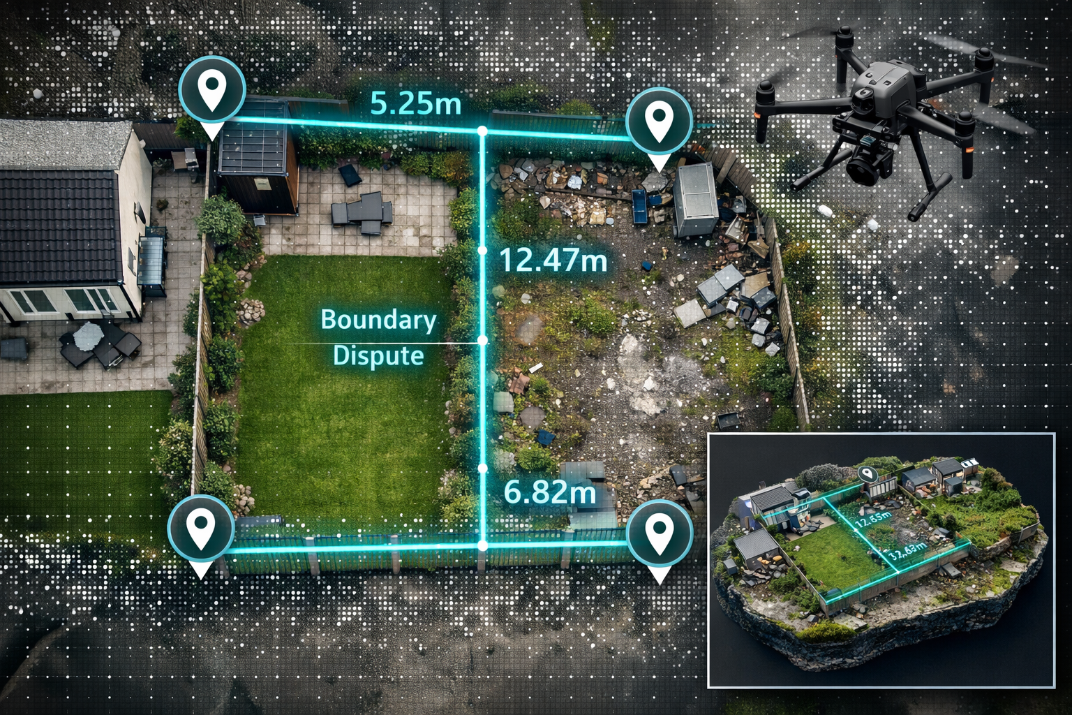
Traditional boundary surveys rely on ground-based total stations, tape measures, and theodolites. These methods are accurate but limited — they capture data from a fixed vantage point, can be obstructed by vegetation or structures, and may miss contextual spatial relationships between features. Drone-based photogrammetry and LiDAR scanning overcome many of these limitations by capturing comprehensive aerial datasets that can be processed into:
- 🗺️ Orthomosaic maps — geometrically corrected aerial images accurate to ±2–5 cm
- 📐 Digital Surface Models (DSMs) — 3D representations of all above-ground features
- 🌿 Point clouds — millions of data points defining the precise position of fences, walls, hedges, and structures
- 📏 Measured drawings — extracted boundary lines with verifiable coordinates
Research published in the Journal of Legal Affairs and Dispute Resolution in Engineering and Construction confirms that UAV-derived photogrammetric data can achieve spatial accuracies sufficient for legal boundary determination when ground control points are properly deployed [6].
Ground Control Points: The Cornerstone of Admissible Drone Evidence
The single most important technical factor in making drone survey data court-admissible is the use of Ground Control Points (GCPs). These are physical markers placed at known OS National Grid coordinates, surveyed using GNSS equipment, and captured within the drone imagery. Without GCPs, drone data floats in relative space — accurate internally but not tied to the national coordinate system that Land Registry title plans reference.
For a boundary dispute expert report, the surveyor must document:
- Number and distribution of GCPs used across the survey area
- GNSS equipment used and its accuracy specification
- Processing software (e.g., Agisoft Metashape, Pix4D) and version
- Residual errors at each GCP after photogrammetric processing
- Final positional accuracy of the derived boundary measurements
This methodology chain is not optional — it is what allows opposing counsel and the court to scrutinise and validate the evidence [4].
Drone Surveys vs. Land Registry Title Plans: Navigating the Gap
One of the most common misconceptions in boundary disputes is that the Land Registry title plan is definitive. It is not. The Land Registry itself states that its general boundary rule means title plans show only the general position of a boundary, not its precise legal line. Drone survey data, properly processed and tied to OS coordinates, can reveal discrepancies between the physical boundary features on the ground and the approximate lines shown on title plans.
This is where the expert witness's role becomes critical — and legally sensitive. The surveyor must present the drone data not as a contradiction of the title plan, but as additional precision evidence that helps the court determine the true boundary in the context of all available documents, including conveyance deeds, historical maps, and witness statements [5].
For expert witness report services in London, Kingston Surveyors' expert witness report service provides professionally structured CPR Part 35-compliant reports.
Structuring a CPR Part 35-Compliant Drone Survey Expert Report
The Anatomy of an Admissible Expert Report
A drone survey expert report for a boundary dispute must follow a precise structure to satisfy CPR 35.10 and Practice Direction 35 [4]. The following framework reflects current best practice in 2026:
Section 1 — Introduction and Instructions
- Identity and qualifications of the expert
- Summary of instructions received
- Documents and data reviewed
Section 2 — Methodology
- Drone equipment specifications (make, model, sensor type)
- Flight parameters (altitude, overlap, GSD)
- GCP deployment and GNSS survey details
- Processing methodology and software
Section 3 — Factual Findings
- Annotated orthomosaic images with boundary features identified
- Measured distances and coordinates
- Comparison with title plan boundaries
- Identification of physical features (fences, walls, hedges, posts)
Section 4 — Expert Opinion
- Analysis of the boundary evidence
- Discussion of any ambiguities or conflicting data
- The expert's reasoned conclusion on the boundary position
Section 5 — Declaration
- Signed CPR Part 35 declaration of truth and independence [1]
💬 Pull Quote: "A drone survey without a CPR Part 35 declaration is just photography. With the declaration, methodology, and professional analysis, it becomes evidence."
Common Pitfalls That Undermine Expert Reports
Even technically excellent drone surveys can be excluded or discredited if the expert report fails on procedural grounds. The most frequent failures include [1][2]:
- ❌ Advocacy language — using phrases like "my client's boundary" rather than "the boundary as surveyed"
- ❌ Incomplete methodology disclosure — failing to state GCP accuracy or processing residuals
- ❌ Missing declaration — omitting or incorrectly wording the CPR 35 statement of truth
- ❌ Selective data presentation — showing only imagery that supports one party's position
- ❌ Overstating certainty — claiming millimetre precision from equipment with centimetre accuracy
Surveyors acting as expert witnesses in party wall and boundary matters should also be familiar with the intersection between boundary disputes and party wall disputes, as these often arise simultaneously.
Expert Witness Roles in CPR Part 35 Boundary Disputes: Turning Drone Surveys into Courtroom Evidence 2026 — Court Presentation and Cross-Examination
Presenting Drone Evidence Effectively in Court
The expert witness's job does not end when the report is filed. In contested boundary cases that proceed to trial, the surveyor will typically be required to give oral evidence and face cross-examination. Presenting drone-derived evidence effectively requires:
Visual clarity 🖼️
Courts are not populated by GIS specialists. Orthomosaic images must be presented with clear annotations, scale bars, north arrows, and legend keys. Overlaying the drone survey boundary line directly onto the Land Registry title plan — with the differences clearly highlighted — is far more persuasive than presenting the datasets separately.
Accessible explanation of methodology 🔬
The expert must be able to explain photogrammetry, GCPs, and positional accuracy in plain language without condescension. A judge who understands why the drone data is reliable is far more likely to give it significant weight.
Handling conflicting evidence ⚖️
Opposing parties will often instruct their own expert. Where two experts disagree, courts may order a without prejudice meeting (a "hot tub" or joint statement process) under CPR 35.12. The expert must be prepared to identify areas of genuine agreement and clearly articulate the basis for any remaining disagreement [2].
The Role of Single Joint Experts in Boundary Disputes
In lower-value boundary disputes, courts may direct that a Single Joint Expert (SJE) be appointed rather than each party instructing their own surveyor. Under this arrangement, the SJE is instructed jointly by both parties and reports to the court alone [1]. For drone surveys, this arrangement has practical advantages — a single comprehensive aerial survey eliminates the risk of competing datasets captured at different times or under different conditions.
However, the SJE role demands exceptional impartiality. The surveyor must be scrupulous in ensuring that the drone survey methodology, data processing, and report conclusions cannot be challenged as favouring either party [4].
For those dealing with party wall matters that intersect with boundary questions, understanding what a party wall dispute involves is essential context for any expert witness engagement.
Drone Survey Regulations and Professional Standards in 2026
CAA Compliance for Survey Drones
Expert witnesses using drone surveys must ensure that all flights comply with UK Civil Aviation Authority (CAA) regulations. In 2026, the relevant framework includes:
- Operator registration with the CAA
- Flyer ID for the remote pilot
- Operational authorisation for flights over residential areas (typically requiring an OSC — Operational Safety Case — for complex operations)
- Insurance covering third-party liability
Any failure to comply with CAA regulations creates a vulnerability in the expert evidence chain — opposing counsel will inevitably ask whether the survey was conducted lawfully [7].
RICS Professional Standards
The Royal Institution of Chartered Surveyors (RICS) publishes guidance on both expert witness practice and geospatial survey methodology. Expert witnesses should ensure their drone survey practice aligns with current RICS guidance on:
- Boundary determination methodology
- Measurement accuracy standards
- Expert witness conduct and reporting
For those needing specialist aerial survey services, drone roof survey services in London demonstrate how drone technology is applied professionally in the UK surveying context.
Practical Steps for Solicitors and Property Owners
When to Commission a Drone Survey Expert
Not every boundary dispute warrants the cost of a drone survey expert witness. The following factors indicate when drone evidence is likely to add decisive value:
| Scenario | Drone Survey Value |
|---|---|
| Disputed fence or wall position | ⭐⭐⭐⭐⭐ High |
| Encroachment by structure or planting | ⭐⭐⭐⭐⭐ High |
| Discrepancy between deeds and physical features | ⭐⭐⭐⭐ High |
| Adverse possession claim | ⭐⭐⭐⭐ High |
| Access rights / right of way disputes | ⭐⭐⭐ Moderate |
| Pure legal interpretation of deeds | ⭐ Low |
Instructing the Expert Correctly
Solicitors instructing a drone survey expert witness should ensure that the letter of instruction:
- Clearly identifies the disputed boundary and the legal issues in question
- Provides all relevant title deeds, conveyance plans, and Land Registry documents
- Requests a CPR Part 35-compliant report explicitly
- Does not suggest a desired outcome or preferred conclusion [1][3]
The last point is critical. Any instruction that implies the expert should reach a particular conclusion — even subtly — risks tainting the report's independence and exposing it to challenge [2].
For party wall matters that frequently accompany boundary disputes, understanding the party wall notice process is an important parallel step for property owners.
Conclusion: Actionable Next Steps for 2026
The convergence of drone survey technology and CPR Part 35 expert witness practice represents one of the most significant developments in boundary dispute litigation in recent years. In 2026, courts are increasingly receptive to drone-derived evidence — but only when it is presented through the disciplined framework of an independent, qualified expert who understands both the technical and legal standards required.
For property owners and solicitors, the key message is this: commission drone survey evidence early, instruct experts correctly, and ensure the report meets CPR 35 requirements before it is filed. Evidence gathered reactively or without proper methodology will be challenged and may be excluded.
For surveyors acting as expert witnesses, the obligation is clear: the duty to the court comes first, the methodology must be documented and defensible, and the report must be structured to withstand cross-examination.
Actionable Next Steps ✅
- Identify the dispute type early — determine whether drone survey evidence will add decisive value before commissioning it
- Instruct a RICS-qualified surveyor with specific experience in both drone photogrammetry and CPR Part 35 expert witness work
- Provide complete documentation — title deeds, historical conveyances, and Land Registry plans must all be available to the expert
- Review the draft report for CPR compliance before filing — check for the declaration, methodology section, and absence of advocacy language
- Consider mediation — drone survey evidence is equally powerful in mediation and settlement negotiations, often resolving disputes without trial
For expert witness surveying services and boundary dispute support, Kingston Surveyors' expert witness report service offers CPR Part 35-compliant reports from qualified chartered surveyors across London and the South East.
References
[1] The Responsibilities Of An Expert Witness Under Civil Procedure Rules Part 35 – https://paramedic-expert.com/the-responsibilities-of-an-expert-witness-under-civil-procedure-rules-part-35/
[2] What Is An Expert Witnesses Part 35 – https://www.jonathanlea.net/blog/what-is-an-expert-witnesses-part-35/
[3] Expert Witness Valuations In Neighbour Dispute Settlements Mediation Evidence And Cpr Part 35 Compliance – https://nottinghillsurveyors.com/blog/expert-witness-valuations-in-neighbour-dispute-settlements-mediation-evidence-and-cpr-part-35-compliance
[4] Pd Part35 – https://www.justice.gov.uk/courts/procedure-rules/civil/rules/part35/pd_part35
[5] Boundary Disputes Expert Witness – https://seakexperts.com/keywords/boundary-disputes-expert-witness
[6] Jladah.ladr 930 – https://ascelibrary.com/doi/10.1061/JLADAH.LADR-930
[7] Regulations – https://www.jspubs.com/expert-witness/si/r/regulations/